Country:
 City:


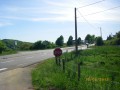
Parking is available at the side of the D142 between Pugey and La Maltournée (1 km from Pugey and 500 m from La Maltournée) at the start of a forest track on the left when coming from Pugey. Yellow-blue signposting. A significant section is unmarked.
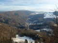
(S/E) Take the stony track before the bend (towards Pugey), which is closed off by a metal gate – please remember to close it behind you. You are now on mountain bike route 114 (marker on the right-hand post). As you enter the pasture, there is a lovely view over the Doubs valley and beyond. Head left towards a clearing – a paragliding launch site – which offers views of Avanne and Besançon. Take care around the unprotected viewpoint.
(1) Continue along the edge of the pasture on your left, then head down the path. You’ll pass between two small rocks whose very straight edges suggest they have been carved over the centuries by the passage of the iron-rimmed wheels of old carts. You’ll emerge onto another pasture, which you’ll cross widthways towards the opposite edge, where you’ll find a narrow path leading into the woods.
(2) Take this path, which, after about twenty steps, veers off into the scree on the right. Do not go to the viewpoint in wet weather or when the ground is soggy. Descend with the utmost caution; the edge of the cliff is not far away. You’ll reach the Chère promontory, with a superb view of the upper part of the valley. Retrace your steps, follow the edge of the woodland on your right for a few steps, and head down the stony forest track on the right to join the D308.
(3) Head up to the left towards the hamlet of La Maltournée, ignoring the departmental road that climbs to the left and continuing for about fifty metres until just past the first house (on your left).
(4) Turn left onto the small Chemin des Combards. Soon, leave the path that climbs to the left and carry on straight ahead, passing some farm sheds. At the nearby crossroads, carry on straight ahead until you come to a stony path on your left that climbs the hill.
(5) Head up this path to the left. At the top, enter the pasture through the gap in the fence next to the gate and cross it to find a small gate opposite, which you must remember to close behind you. Walk along the row of trees on your right for a few steps until you come to a path (marked with a ‘Grand Besançon Métropole’ signpost). Head right into the woods until you come to a path crossing the ridge.
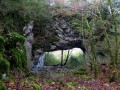
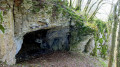
(6) Continue left along this ridge to quickly reach some fields. Walk alongside them, following the track in the grass and keeping the edge of the field on your left. About fifty metres from the right-hand corner of the pasture, look for a small path at the edge of the woodland which soon joins another. Head down to the left for about twenty metres to find the small cave.
(7) Retrace your steps and, at the fork, carry on straight ahead, passing the remains of the fortification. You’ll emerge into a small triangular clearing. Walk along the right-hand edge of it and follow the stony path to reach Pugey Fort. At the signposts, take a short detour to the left and back to the underground casemate (picnic table).
(8) Head back to the entrance of the small clearing (signpost). Look out for another signpost on the right (the direction is indicated by a mountain-bike marker) which marks the start of a lovely ridge path; take this to the left to rejoin the path to the fort a little further on and the car park. (S/E)
 Visorando Member

 Moderate