Country:

 City:
City:


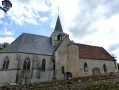
Starting point: the village centre, Rue Principale near the Town Hall.
Blue signposts.
(S/E) With your back to the Town Hall and facing the church, turn left and ignore the road coming in from the right, the Route de Villers Vermont. After walking for nearly 1 km, you’ll reach the junction with the Chemin de l’Obus.
(1) Leave the Chemin de l’Obus on your left – this will be your return route – continue straight ahead, take the path on the right, Rue de Mercatel, and follow it to the first turn-off on the right.
(2) Turn right, heading south-south-east. At the T-junction in the Bois du Fayel, carry on straight ahead until you reach the tarmac road at a place called ‘Le Vieux Moulin’. Ignore the turn-off on the right marked ‘Le Pré Haut’ and head for the next T-junction.
(3) Turn right onto Rue de Villers-Vermont and carry on to the crossroads near the wayside cross.
(4) Carry on straight ahead to the village of Gancourt-Saint-Étienne, along Rue du Haut Gancourt. At the T-junction, turn left towards the church. Then retrace your steps and immediately turn left onto Rue du Bas Gancourt. Walk for about 700 m until you reach a right-hand bend.
(5) At the bend, ignore the first path on the right and take the second path, which is just before the bend ends, between houses nos. 25 and 27. Follow this path, cross the railway line to reach Rue Rachinel, and continue to the T-junction.
(6) Turn right onto Route d’Haussez (D 120), continue for about 200 m and take the first left onto Rue Hyaumet. This then becomes Chemin Hyaumet (tarmac), continue for about 2 km, passing the hamlet known as “La Haute Cloquière”, until you reach a Y-junction. Turn right to reach an X-junction.
(7) Turn right onto Route de Ménerval (D 16), carry on straight ahead at the crossroads with the wayside cross and, a little further on, enter the village of Ménerval until you reach the right-hand bend.
Green signposts.
(8) At the bend, take the second turn-off on the left, Route de la Mer. Pass the wayside cross at the hamlet known as Le Dieu de Pitié and come to a Y-junction.
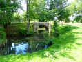
(9) Keep to the right and continue straight on along this path. Ignore a turn-off to the right; at the next Y-junction, turn right until you reach the Pont de Coq bridge over the Epte.
(10) Turn left just before the bridge onto Chemin de Brimbec. At the road, cross over, take the path opposite, slightly to the left, and continue to the tarmac T-junction.
(11) Turn left onto Chemin de Vivière, continue to the T-junction and rejoin the Route de la Mer.
(9) Turn right and, at the T-junction, follow the bend onto the D 16.
Blue signposts.
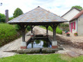
(8) Turn left onto Route de Haussez. Leave this road at the first right onto Chemin du Lavoir and immediately follow the path on the left just after the bend, Chemin de l’Église. Join the street in front of the church.
(12) On Rue de l’Église, first turn right then left to go round the church onto Chemin du Rosay, then continue along the cul-de-sac on the left. Walk for about 1.6 km, passing the hamlet known as ‘La Salmonerie’, to reach the T-junction after Le Rosay.
(13) Turn right onto the D 120 and then immediately take the first left, Impasse du Vieux Rosay. Pass under the railway bridge to reach the hamlet known as “Le Vieux Rosay”. Continue straight on, taking the track that begins just after the tarmac and leads to the road, Rue des Hayes de la Dame.
(14) Cross the road and continue along the path opposite, which becomes Chemin de l’Obus (tarmac), until you reach the T-junction you passed on the way out.
(1) Turn right onto Rue Principale and return to the starting point (S/E).

 Visorando Member
 Moderate
 Easy
Easy