Country:
 City:


Car park behind the post office, in front of the police station (sometimes busy).
(S/E) Leave this car park, heading towards Chemin de Coupet, and walk down towards the Ruisseau de l’Estampon. Cross it via the footbridge and walk back up to Avenue Gaston Lescouzeres.
(1) Turn right twice, then immediately left, between the businesses. Turn right into the cul-de-sac known as Chemin de Couseillat and continue until you reach a Fork in the road.
(2) Take the access path on the left to the “cross parc” and go round it until you reach the crossroads. Turn right and follow this wide track for a long way, until you reach the entrance to the Airial de Garrouzin (private property).
(3) Turn left and follow this track steadily until you reach a junction.
(4) Turn slightly to the right , ignoring the path on the left (which will be your return route), and carry on. Walk past the carpentry workshop buildings until you reach a small road.
(5) At an old railway station, turn right and carry on along the road, following theGRP® markings (yellow and red) until you reach the junction with the Piste de Garrouzin.
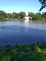
(6) Turn left and follow this wide track to a large picnic area, the perfect spot for a break, overlooking the Grande Lagune de Nabias.
(7) Take the path that starts by a large information board and go round the lagoon on the right. Leave this peaceful spot via a small path on the right and you’ll soon reach theGR® track.
(8) Follow it to the left and continue, running parallel to the old disused railway line, until you reach the small road, then turn right towards the old station.
(5) Turn left and head back along the same path that runs alongside the joinery workshop. Make a detour around a former industrial site (now derelict).
(4) Leave theGR® markings (cross-markings) at this bend and go straight on; stay on this track which leads back towards the old disused railway line and continue to the left until you reach the first buildings. Turn right towards Avenue Gaston Lescouzeres.
(9) Follow it to the left, passing several businesses, then the premises of a leisure centre offering various activities, until you reach the original junction.
(1) Turn left (following the signposts) and head down towards the footbridge over the Estampon, cross it and head back up towards the car park (S/E).
 Visorando Member

 Moderate