Country:
 City:
City:


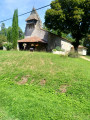
Park at the car park by the old Bourriot-Bergonce railway station. (La Gare neighbourhood on the D24 towards Losse).
(S/E) Head south along the track (former railway line) running above the road until you reach the D24. Turn left onto the D24.
(2) About a hundred metres further on, turn left onto a lovely, sandy, shaded track (heading north). At the bend, keep to the right and continue straight on until you reach a small tarmac road.
(3) Turn right and follow the road. Pass by the Airials de Lamé and Laffargue. Reach the inter-municipal track no. 56 and follow it to the right for just a few metres.
(4) Leave the road and turn left onto a wide, sandy track. Stay on this track and ignore the turn-offs to the right.
(5) At a fork in the road, turn right onto a track with a hard-packed yellow schist surface. Cross the Ruisseau de Comblats and, at the next fork in the road, continue straight on. Walk past the Airials de Comblats and the Petit Comblats. In front of the beautiful Moulin de Pouyhéré estate, continue along the track and cross the Ruisseau de Bergonce.
(6) Turn right after the gentle climb, onto a path through the woodland. Join the D24 and follow it to the right.
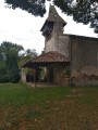
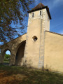
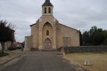
(7) At the Conseil Général information sign, turn right and head towards the church. After the church, turn left to rejoin the D24. Turn right and walk past the water tower.
(8) Turn left (just before the sign for the hamlet of Bergonce). Follow this track for some time, heading south-west and ignoring the side paths. Continue until you reach a junction with a stony track.
(9) Turn right onto this track, known as “inter-municipal track no. 241”, which follows the route of a former railway line. You’ll cross several paths at right angles and cross the Bergonce Stream, then the Nauton Stream. Cross a metal footbridge.
The track curves sharply to the right and joins another railway line just before the D24; continue to the right.
(1) Cross the D24 and continue straight on to the starting car park (S/E).
 Visorando Member
 Moderate
 Tourist office