The banks of the Loire starting from Saint-Julien-en-Concelles

A walk between the banks of the Loire and the market-garden areas.

Details

2766260
Creation:
Last update:
Last review:
  • Walking
    Activity: Walking
  • ↔
    Distance: 5.50 mi
  • ◔
    Average duration: 2h 35 
  • ▲
    Difficulty: Easy

  • ⚐
    Back to start: Yes
  • ↗
    Ascent: + 13 ft
  • ↘
    Descent: - 13 ft

  • ▲
    Highest point: 30 ft
  • ▼
    Lowest point: 13 ft

Description of the walk

Park in the car park near the football pitches.

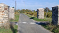
(S/E) Take the path opposite to join the track running alongside a small canal.
Walk past the football pitches on the left, cross the road and continue straight ahead along the canal. Just before the municipal sports centre, turn right onto the path towards Le Mortier.
Cross the D274. Carry on straight ahead to reach another road.

(1) Turn left towards the village of La Rochelle. Before you reach the village, at the junction, take the path on the left.
At the next junction, turn right. Stay on this straight stretch of road, passing under the power lines. You’ll very soon come to another junction.

(2) Cross the road and carry on straight ahead. Pass through the villages of Marais Abraham and Les Galopins.
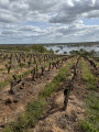
On leaving the village, turn right towards the market gardens and follow a path on the left which joins the Divatte embankment.

(3) Turn left onto it. Follow the Loire along the greenway, passing through the neighbourhoods of Les Violettes, Haut Chaussin and La Chebuette. You’ll reach the neighbourhood of La Praudière.

(4) Before the Praudière slipway – this is the second picnic area – take the steep staircase on the left to cross the D751 again at a place called Les Amourettes.
On leaving the village, take the road on the left, then turn right onto the path that crosses the market gardens. After the power lines, you’ll come to a crossroads by the meadows.

(5) Turn left, then take the path on the right by the orchards. At the end of this path, turn left to reach the canal.
Follow it to the left, cross the RD74 at the roundabout and continue walking along the canal to return to the starting car park (S/E).

Waypoints

  1. S/E : mi 0 - alt. 16 ft - Car park near the football pitches
  2. 1 : mi 0.62 - alt. 20 ft - Junction towards La Rochelle
  3. 2 : mi 1.65 - alt. 20 ft - Marais Abraham crossroads
  4. 3 : mi 2.17 - alt. 23 ft - Divatte canal
  5. 4 : mi 3.54 - alt. 30 ft - La Praudière - La Loire
  6. 5 : mi 4.54 - alt. 16 ft - Meadow crossroads
  7. S/E : mi 5.5 - alt. 16 ft - Car park near the football pitches

Worth a visit

Tenues maraichères: a term used in Nantes to describe plots enclosed by walls.
Divatte canal section.
The Chêne lake.

Reviews and comments

3.6 / 5
Based on 4 reviews

Reliability of the description
4.7 / 5
Ease of following the route
3.8 / 5
Route interest
2.5 / 5
jean luc Bor
jean luc Bor

Overall rating : 3 / 5

Date of your route : Sep 16, 2024
Reliability of the description : ★★★★☆ Good
Ease of following the route : ★★☆☆☆ Disappointing
Route interest : ★★★☆☆ Average
Very busy route : No

an easy route for walking

Machine-translated

surfy
surfy

Overall rating : 2 / 5

Date of your route : Jul 18, 2023
Reliability of the description : Not used / Not applicable
Ease of following the route : ★★★☆☆ Average
Route interest : ★☆☆☆☆ Very disappointing
Very busy route : No

A waste of time – this walk is completely uninteresting. You spend four-fifths of the time on stony paths in the sun, winding your way through market gardens. I was expecting to end up at some spots that would be worth the effort, but not even that. The stretch along the banks of the Loire – the only decent viewpoint on the route – is in full sun and runs alongside the main road, which is quite busy. There are loads of cyclists on the path we’re taking. The view is much better elsewhere along the Loire.
And the return journey is even more unpleasant than the outward one. Don’t waste your time.

Machine-translated

lapjac44
lapjac44

Overall rating : 4.7 / 5

Date of your route : Mar 21, 2022
Reliability of the description : ★★★★★ Very good
Ease of following the route : ★★★★★ Very good
Route interest : ★★★★☆ Good
Very busy route : No

A walking route with absolutely no risks
Nothing negative to report; a pleasant, flat route
Thank you

Machine-translated

Joussemet
Joussemet

Hike not yet completed

Machine-translated

raphysps
raphysps

As the route starts at the car park by the Chêne lake, there’s nothing to stop you adding this loop as a bonus and continuing on to the famous ‘ ’ chapel (allow 3 km, about 45 minutes).

Machine-translated

ght
ght

Overall rating : 4 / 5

Date of your route : Dec 23, 2019
Reliability of the description : ★★★★★ Very good
Ease of following the route : ★★★★★ Very good
Route interest : ★★☆☆☆ Disappointing

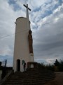
This walk through the market-gardening area of St Julien de Concelles, which was reclaimed from the banks of the Loire in the 19th century, ‘bypasses’ the sites that are currently of greatest interest: the lake and the Chapel of Saint Barthélémy.
Kind regards

Machine-translated

louismireille
louismireille

Sorry… I haven’t done this walk yet… I’m ‘saving it up’ for my future Sunday walks. I’ll be sure to let you know what I think once I’ve done this route. Thank you for your understanding.

Machine-translated

Other walks in the area

For more walks, use our search engine .

The GPS track and description are the property of this route's author. Please do not copy them without permission.