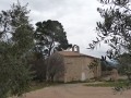
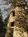
Volx via the six hills, starting from Mont d’Or

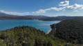
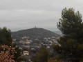
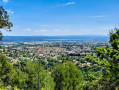
Set off from Mont d’Or towards Volx, taking the paths on the western side, and return via the Chemin du Canal. From Mont d’Or, there is a beautiful panoramic view over the Durance valley.

Details

41216730
Creation:
Last update:
Last review:
  • Walking
    Activity: Walking
  • ↔
    Distance: 9.47 mi
  • ◔
    Average duration: 5h 20 
  • ▲
    Difficulty: Moderate

  • ⚐
    Back to start: Yes
  • ↗
    Ascent: + 1,089 ft
  • ↘
    Descent: - 1,086 ft

  • ▲
    Highest point: 1,732 ft
  • ▼
    Lowest point: 1,204 ft

Photos

Description of the walk

(S/E) Set off from the Mont d’Or car park and head down the tarmac road. At a left-hand bend, carry on straight ahead along the path.

(1) Leave the path and head left after the hedge. Cross a fallow field and a wood to rejoin a path 500 m further on. Turn right onto the road for 100 m.

(2) Follow the road as it winds sharply to the left.

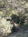
(3) Leave the road and take the path on the right through the woods. Cross a bridge and arrive at the crossroads.

(4) Follow the canal on the left for 250 m until you reach a road.

(5) Follow it to the left.

(6) At the bend in the road to the left, leave the road and walk downhill alongside the vineyards. After 150 m, climb a small embankment on the right so that you can then cross the canal and the valley.

(7) Go under the bridge on the left and follow the path.

(8) At the fork in the road, keep to the right and follow the edge of the olive grove until you reach the next path. Take this to the right.

(9) Take the path on the left as it climbs, going round the hill to reach the canal.

(10) Follow the canal to the right.

(11) Cross the bridge and continue along the canal. You’ll come to a junction you passed on the way out.

(7) Cross the bridge and continue along the canal. You’ll come to a junction you passed on the way there.

(5) Take the road on the left as you go downhill to join a road on the left.

(12) At the junction, turn right and head uphill towards the canal to reach a junction you passed on the way there.

(4) Take the path along the canal on the left.

(13) Cross the canal via the footbridge, then head down to the road. Walk up the hill along the path opposite. Return to the canal and follow it.

(14) Cross the canal via the bridge, then head up the path and continue to the left towards Mont d’Or.

(15) Head back down towards the car park (S/E).

Waypoints

  1. S/E : mi 0 - alt. 1,637 ft - Mont d’Or car park
  2. 1 : mi 0.51 - alt. 1,391 ft - Leave the path
  3. 2 : mi 1.15 - alt. 1,260 ft - Walk back up the road
  4. 3 : mi 1.58 - alt. 1,450 ft - Path on the right
  5. 4 : mi 2.04 - alt. 1,283 ft - Junction no. 1 of the - Canal de Manosque
  6. 5 : mi 2.37 - alt. 1,286 ft - Junction No. 2 on the canal
  7. 6 : mi 2.6 - alt. 1,352 ft - Turn right into the vineyards
  8. 7 : mi 2.85 - alt. 1,289 ft - Under the bridge. Joint A/R junction
  9. 8 : mi 3.34 - alt. 1,417 ft - Walk alongside the olive grove
  10. 9 : mi 3.85 - alt. 1,407 ft - To the left
  11. 10 : mi 4.44 - alt. 1,289 ft - Follow the canal
  12. 11 : mi 4.83 - alt. 1,302 ft - Cross the bridge
  13. 12 : mi 6.53 - alt. 1,224 ft - To the right
  14. 13 : mi 7.49 - alt. 1,280 ft - Head straight down
  15. 14 : mi 8.56 - alt. 1,280 ft - Cross the bridge
  16. 15 : mi 9.36 - alt. 1,706 ft - Descent to the car park
  17. S/E : mi 9.47 - alt. 1,640 ft - Mont d’Or car park

Notes

Free parking for a few cars at the starting point.

Reviews and comments

3.6 / 5
Based on 4 reviews

Reliability of the description
3 / 5
Ease of following the route
3.3 / 5
Route interest
4.5 / 5
phmlgcn
phmlgcn

Overall rating : 3.7 / 5

Date of your route : Jun 10, 2025
Reliability of the description : ★★★☆☆ Average
Ease of following the route : ★★★☆☆ Average
Route interest : ★★★★★ Very good
Very busy route : No

Very beautiful hike but difficult to navigate even with GPS
- Between 1 and 2, impossible on the route described: at 1, there is a field fenced off with a double row of electric wires; we had to go back the way we came
- between 8 and 9, you have to find a path that isn't on the IGN map
- The final climb can only be found with GPS (nothing on IGN).

Machine-translated

chabre05
chabre05
• Edited:

Overall rating : 2.7 / 5

Date of your route : May 28, 2025
Reliability of the description : ★★☆☆☆ Disappointing
Ease of following the route : ★★★☆☆ Average
Route interest : ★★★☆☆ Average
Very busy route : No

The route was very poorly marked, with a lot of uncertainty all the way along.
We’d planned to tackle the six hills via the summits, but ended up walking along the valley floor instead – a shame, as the view isn’t quite the same.
The return journey along the Manosque Canal is quite pleasant, even idyllic. But the worst bit is between points 14 and 15: no path or clear trail, with a stretch through olive groves that haven’t seen a soul in ages – a bit of a gamble😉
There’s a lot of work to be done on this walk.

Machine-translated

mounine
mounine

Overall rating : 4.3 / 5

Date of your route : Apr 08, 2024
Reliability of the description : ★★★★☆ Good
Ease of following the route : ★★★★☆ Good
Route interest : ★★★★★ Very good
Very busy route : No

Beautiful surroundings. A very pleasant route

Machine-translated

Nivalys
Nivalys

Hello, and thank you for your comment
It’s true that the start of the route (when you leave the road) isn’t easy to follow because the plot is fenced off, so you need to take an alternative route (which isn’t very well marked).
As for the distance, I rely on my GPS, which shows just over 15 km.
To avoid ending up with the climb up Mont d’Or (I started the route there because I live nearby), you can always start it from the Volx side (where there’s parking) or at any other point along the route that’s accessible by car.

Machine-translated

Lilyane Dav
Lilyane Dav

Overall rating : 3.7 / 5

Date of your route : Jan 07, 2024
Reliability of the description : ★★★☆☆ Average
Ease of following the route : ★★★☆☆ Average
Route interest : ★★★★★ Very good
Very busy route : No

The start of the walk is tricky, and the instructions are inadequate. The route description lacks detail, so we had to use our GPS on several occasions. The walk is closer to 20 km than 15 km. The final climb is particularly steep. Despite these comments, we really enjoyed this walk; the scenery is varied and, in places, the views are magnificent. The whole section running alongside the canal is particularly pleasant.

Machine-translated

Nivalys
Nivalys

Good evening,
I don’t recall any signposting, but the paths are clearly marked, apart from the start after Stage 1, as the path originally ran alongside a farm field, but this is now surrounded by a game fence. You therefore need to walk along the top of the hedge (about 200 metres along a fallow field), then 200 metres through the woods (an existing path, though poorly marked) to rejoin the original path after the fenced-off plot.
Alternatively, you can continue along the road before Stage 1 and then head back down via the paths running between the apple orchards.

Machine-translated

AUDO13
AUDO13

Hello, is the path signposted? According to the description, does it not cross private property? Thank you

Machine-translated

Other walks in the area

For more walks, use our search engine .

The GPS track and description are the property of this route's author. Please do not copy them without permission.