Pimayon Hill, starting from Manosque

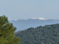
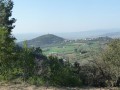
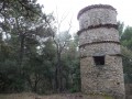
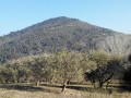
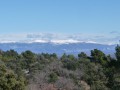
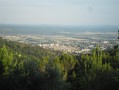
The Pimayon Hill route takes you through oak woods, offering a view of the Montagne de Lure in the distance on one side and a 180° view of the Durance Valley on the other.

Details

n°56652
Creation:
Last update:
Last review:
  • Walking
    Activity: Walking
  • ↔
    Distance: 3.89 mi
  • ◔
    Average duration: 2h 35 
  • ▲
    Difficulty: Easy

  • ⚐
    Back to start: Yes
  • ↗
    Ascent: + 932 ft
  • ↘
    Descent: - 932 ft

  • ▲
    Highest point: 2,375 ft
  • ▼
    Lowest point: 1,434 ft

Photos

Description of the walk

To reach the starting point, follow Chemin Louis Denis de Valvérane to the end. Park on the left-hand side of the road just after the right-angled bend, level with the entrance to the former Gaude mines (look out for a sign).

(S/E) Walk down Chemin Louis de Valvérane and take the small path on your left as you round the bend. Follow a fairly steep climb to reach a track junction.

(1) Continue to the right along the path until you reach another junction, where there is a bench.

(2) Turn right at almost a 180° angle and head for the ridge of the Colline de Pimayon. Follow it to the left and complete the ascent to reach the highest point.

(3) Keep to the right to begin the descent; after a sharp left-hand bend, you’ll reach a crossroads with several routes.

(4) Take the track to the left to return to the original crossroads you passed on the way up.

(2) Take the path on the right and, after several hairpin bends, you’ll come to a crossroads of tracks further down, near a picnic area.

(5) Turn slightly right onto thesecond track to complete the descent and return to the car park at the former Gaude mines (S/E).


Waypoints

  1. S/E : mi 0 - alt. 1,444 ft - Gaude Mines Car Park
  2. 1 : mi 0.32 - alt. 1,752 ft - Trail junction
  3. 2 : mi 0.86 - alt. 2,008 ft - Crossroads at the end of the circular loop
  4. 3 : mi 1.52 - alt. 2,375 ft - Pimayon Hill – highest point
  5. 4 : mi 2.12 - alt. 2,159 ft - Trail junction
  6. 5 : mi 3.15 - alt. 1,637 ft - Developed rest area
  7. S/E : mi 3.89 - alt. 1,444 ft - Gaude Mines car park

Notes

Always wear walking shoes and carry a small first-aid kit for minor injuries.
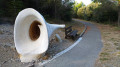
On the way back, on the straight stretch just before the car park, you’ll see Géométhane (an underground natural gas storage facility) on your left and, on your right, the entrance to the former Gaude coal mines.

Worth a visit

You’re near Manosque, the town of Jean Giono.
Don’t leave Manosque without visiting its historic centre.

Reviews and comments

3.7 / 5
Based on 3 reviews

Reliability of the description
3 / 5
Ease of following the route
3.7 / 5
Route interest
4.3 / 5
Gilles Vernier
Gilles Vernier

Overall rating : 4 / 5

Date of your route : Aug 02, 2021
Reliability of the description : ★★★★☆ Good
Ease of following the route : ★★★★☆ Good
Route interest : ★★★★☆ Good
Very busy route : No

I completed part of this walk up to point 3, then took the Bellevue paths via Mont des Spels, returning via Borie du Pain de Sucre to extend the route.
The starting point should be moved to the public car park opposite the designated area (yellow lines on the satellite image). The car park shown is a private Géométhane car park accessible beyond a barrier.
The start of the path is also accessible from the left bank of the canal at the foot of the private car park indicated.

Machine-translated

cedric.h
cedric.h

Overall rating : 4 / 5

Date of your route : Dec 18, 2016
Reliability of the description : ★★★☆☆ Average
Ease of following the route : ★★★★☆ Good
Route interest : ★★★★★ Very good

Good evening,
Some lovely views of the Durance valley, the Valensole plateau, the Montagne de Lure, Mont Ventoux and the Southern Alps. In January and February, the hills must be covered in snow – it must be well worth a look!!!
Just a quick note… the start of the walk is a bit tricky to find because of the roadworks on Géométhane… the sat-nav really came in handy.
Enjoy the walk,
www.sacsadosetcourbatures.fr

Machine-translated

bibi
bibi ★

We’ll wait for a reply from the author as this walk is quite recent.

Machine-translated

annie04
annie04

Overall rating : 3 / 5

Date of your route : May 24, 2015
Reliability of the description : ★★☆☆☆ Disappointing
Ease of following the route : ★★★☆☆ Average
Route interest : ★★★★☆ Good

The description lacks detail:
- the car park is located after the S-bend (left then right), which allows you to find the information sign at the old mine
- between points 1 and 2, the wider path is a forest track and the first bench you come to is not the right one. We took a wrong turn and followed a path that branches off near the bench, which took us on a circular route that brought us back to the bench mentioned in the guide, but shortened the walk.
- At point 5, the widest path is simply a forest firebreak
Apart from that, the walk through the forest is pleasant and shaded

Machine-translated

Other walks in the area

For more walks, use our search engine .

The GPS track and description are the property of this route's author. Please do not copy them without permission.