Les Allumières, starting from La Thieuloye

This walk will take you through two villages in the Ternois region, La Thieuloye and Monchy Breton, exploring their plains and paths as well as the old railway line.

Details

n°2818135
Creation:
Last update:
Last review:
  • Walking
    Activity: Walking
  • ↔
    Distance: 5.77 mi
  • ◔
    Average duration: 2h 45 
  • ▲
    Difficulty: Easy

  • ⚐
    Back to start: Yes
  • ↗
    Ascent: + 135 ft
  • ↘
    Descent: - 131 ft

  • ▲
    Highest point: 525 ft
  • ▼
    Lowest point: 417 ft

Description of the walk

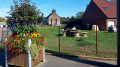
Park in the car park at La Thieuloye church.

(S/E) Head down towards the village, heading south-west, and you’ll soon reach the roundabout.

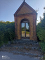
(1) Follow the road to the right, cross at the pedestrian crossing, and at the junction follow the road to the left heading south-west. At the junction, continue south on the tarmac road until you reach the crossroads by the chapel where the path meets the D86.

(2) Take the grassy path on the left. At the end of the path, follow the D86 to the left, passing the town hall and the Café Chez Tartous.

(3) At the junction, turn left onto the D77, cross at the pedestrian crossing just before the water tower and take Rue des Violettes on the right. At the junction, take the path on the left heading north, follow it until you reach the Calvary crossroads.

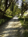
(4) Turn right onto the dirt track on the right heading north-east. In wet weather, this can be quite muddy. At the end of the track, you’ll reach theGR®127; turn left and head towards the crossroads marked by a solitary shrub.

(5) Cross the road and continue along the path opposite. You’ll reach the junction with the old railway line.

(6) Follow it to the left, heading west. At the end of the old railway line, follow the road to the left, heading south, and cross the small woodland of Les Allumières to reach a T-junction.

(7) Follow the road to the right towards the village and its church to return to the car park (S/E).

Waypoints

  1. S/E : mi 0 - alt. 518 ft - La Thieuloye Church
  2. 1 : mi 0.3 - alt. 489 ft - Roundabout
  3. 2 : mi 1.45 - alt. 522 ft - Chapel
  4. 3 : mi 2.19 - alt. 476 ft - D77
  5. 4 : mi 3.23 - alt. 495 ft - Calvary
  6. 5 : mi 4.11 - alt. 476 ft - Isolated shrub
  7. 6 : mi 4.36 - alt. 472 ft - Former railway line
  8. 7 : mi 5.33 - alt. 495 ft - Crossroads
  9. S/E : mi 5.77 - alt. 518 ft - La Thieuloye Church

Notes

At the starting point there is a bus shelter which may be useful for getting kitted out in wet weather.
Walking shoes and walking poles are recommended.

Worth a visit

(3) Café chez Tartous: known for its Marie Grouette festival.

Always be cautious and plan ahead when you're outdoors. Visorando and the author of this route cannot be held responsible for any accidents occurring on this route.

The GR® and PR® markings are the intellectual property of the Fédération Française de Randonnée Pédestre.

Reviews and comments

4.7 / 5
Based on 1 review

Reliability of the description
5 / 5
Ease of following the route
5 / 5
Route interest
4 / 5
Jean-Mi 62550
Jean-Mi 62550
• Edited:

Overall rating : 4.7 / 5

Date of your route : Apr 06, 2021
Reliability of the description : ★★★★★ Very good
Ease of following the route : ★★★★★ Very good
Route interest : ★★★★☆ Good
Very busy route : No

A leisurely two-hour walk!

Machine-translated

Other walks in the area

For more walks, use our search engine .

The GPS track and description are the property of this route's author. Please do not copy them without permission.