Country:
 City:


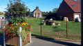
(S/E) From the car park at La Thieuloye church, head north-east for 50 m and turn right onto Rue du Calvaire, heading south-east.
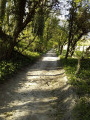
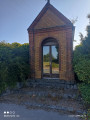
(1) At the Calvary crossroads, take the path on the left heading north-east. This path may be a bit muddy, so watch your step.
(2) At the end of the path, follow theGR®127to the right, heading south-southeast.
(3) At the junction, stay on theGR®127and continue along the path to the left for about 1.5 km.
(4) At the T-junction, leave theGR®127and take the road on the left heading north-west, following it for 150 m.
(5) Turn left onto the stony path heading south-west.
(6) At the junction, leave the track and take the one on the right which leads down towards the village of Bajus.
(7) At the bottom of the track, follow the road on the left heading west.
(8) At the T-junction, take the road that climbs up to the right, heading north, as far as Bajus station.
(9) At the junction of the road and the track (a former railway line), take the track on the left heading west. Walk alongside the Bois de Houdain.
(10) Cross theGR®127and carry on straight ahead. At the end of the track, follow the road to the left for 100 m heading south.
(11) Take the track on the right heading south-west towards La Thieuloye. Follow the track for 1.3 km.
(12) Take the path on the left heading south towards the village.
(13) At the junction with the D77, turn left onto it. At the roundabout, continue along the road to the left and follow it to the finish (S/E).

 Visorando Member
 Easy

 Association / Club / Walk leader