Country:
 City:
City:


Park in the car park on Allée du Brivet, opposite Intermarché, except on Monday mornings (market day). There’s space a little further up.
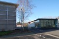
(S/E) Start the walk by crossing the river via the wooden footbridge, then turn right. You’ll pass behind the “Le Carré d’Argent” theatre.
(1) Continue along the wooden footbridge. Just before passing under the bridge, check the water level gauge for the Brivet. If the level is above 1.20 metres, do not go on this walk. Some paths will be under water. Otherwise, go under the bridge and head left onto Place Dominique David.
Walk past the town hall and turn left up Rue Sainte-Catherine. At the end, cross the road and go under the archway at the corner of the restaurant “Le 11”. Follow this path uphill. You’ll pass behind the old flour mill, which has been converted into flats. At the top, keep left and take the left-hand exit at the roundabout. You’ll soon come within sight of the viaduct.
(2). Cross it, keeping to the left. Take a moment to admire the view. As you emerge from the viaduct, head back down to the left. Follow the stream along Rue de Nantes. At the bottom, you’ll find a flight of steps and a ramp leading down to the stream. Don’t go under the bridge, but cross via the footbridge just before it.
Carry on straight ahead, following the railway line on your right. Soon, you’ll pass under the viaduct, walking alongside the marshes.
Further on, go under the railway bridge and turn right at the lift station. You’re still in the marshes. I hope you haven’t forgotten your binoculars. Many different species of birds live in the area.
(3) Carry on along this path and enter the “dead end”, then continue alongside the outer wall of Coët Roz Castle on your right. Carry on uphill until you reach the roundabout before the viaduct.
(2) This time, do not cross it again. Instead, at the roundabout, head back down towards the town centre via the footpath (and cycle path) that runs alongside the road next to the railway line.
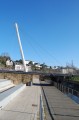
(4) Pass between the station and the post office, and carry on straight ahead, passing between “Cavavin” and the community cinema “La Bobine”. Ahead of you stands a tall white mast on a footbridge. Cross the footbridge. You are back on Place Dominique David.
Carry on straight ahead, passing behind the town hall and then in front of “L’Estaminet”. At the corner of Rue de l’Opticien, turn right.
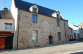
(5) You are now in front of the oldest house in Pontchâteau (1661?), recently converted into a media centre and tourist information office.
Walk up this street for 25 metres and enter the courtyard of the Salle de Spectacle, then exit on the other side onto Rue du Port du Four.
Walk down this street and cross the footbridge. You’ll come back to the car park (S/E).

 Visorando Member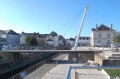
 Moderate
 Difficult