Around the Brivet from Pontchâteau

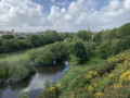
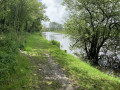
This walk will take you on a journey of discovery around the Pontchâteau area, winding your way along the River Brivet. The route mainly follows easily accessible paths, with a few sections on roads with very little traffic. You’ll encounter plenty of wildlife and a wide variety of vegetation. Please note that after heavy rain, the banks of the Brivet may be flooded.

Details

9312111
Creation:
Last update:
Last review:
  • Walking
    Activity: Walking
  • ↔
    Distance: 16.20 mi
  • ◔
    Average duration: 7h 45 
  • ▲
    Difficulty: Difficult

  • ⚐
    Back to start: Yes
  • ↗
    Ascent: + 328 ft
  • ↘
    Descent: - 328 ft

  • ▲
    Highest point: 102 ft
  • ▼
    Lowest point: 0 ft
  • ⚐ Country: France
  • ⚐ City: Pontchâteau (44160)
  • ⚑
    Start/End: N 47.435324° / W 2.088888°
  • ❏
    IGN map(s): Ref. 1022ET, 1122SB
  • Hour-by-hour weather

Photos

Description of the walk

(S/E) The walk starts from the square opposite Pontchâteau station. With your back to the station, head left onto Boulevard du Belvedère and follow the cycle path on your right until you reach the roundabout at the junction with the Pontchâteau Viaduct.

(1) Then take the path opposite, slightly to the right after the first exit (Route de Crossac). Stay on the path. Pass a few houses (Coët Rozic) on your left and continue straight on towards the electricity pylon. The path leads gently downhill towards the Brivet and comes out opposite an SNCF railway bridge. At the junction of the two paths, turn left, following the yellow markings (painted on a concrete block).

(2) The path takes you under the railway line and runs alongside the Brivet towards the centre of Pontchâteau.
Pass under the Pontchâteau Viaduct and, a few hundred metres further on, re-enter the town at the station quay opposite your starting point.

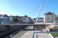
(3) Head straight ahead across the car park and make your way towards the footbridge spanning the Brivet. On the other bank, continue along the footbridge to the left, passing under two bridges and walking alongside Pontchâteau Town Hall.

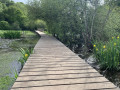
(4) At the end of the path, after passing the media centre, cross the Brivet again via the footbridge on the left and turn immediately right towards the Bois de Coët Roz. Stay on the path that takes you through the woods, following the Brivet. Cross a floating footbridge under a bridge, stay on this bank and pass a footbridge on your right. Continue to follow the yellow markings, which will guide you through the woods.

(5) When you reach a fitness trail station with pull-up bars, turn left and head up the slope (leaving thePR® to your right). Then take the first track on the right and follow the fitness trail. When you reach a bench (an exercise station on the fitness trail), head up to the left along a small path which will take you to the road.

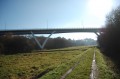
(6) Take the road on the right and cross the bridge over the N165 (Nantes–Vannes–Brest road). Continue to the end of the road through the hamlet of Haut Coët Roz, arriving at the Pontchâteau Equestrian Centre.

(7) At the end of the road, take the path on the left signposted ‘Drefféac 8 km’ cycle route. Follow the path down, skirting the equestrian centre, and cross the stream via the footbridge. The path climbs again after the footbridge. When you reach the junction, turn right, following the cycle route. At the next junction, turn left, then left again, and leave the cycle route, which branches off to the right.

(8) Pass under the railway line once more and turn right at the junction. Follow the road uphill for several hundred metres. Cross a junction and continue along the road straight ahead.

(9) Turn left onto a track. Continue for a few hundred metres, then turn right onto the Landes de Bilais Discovery Trail at a red sign indicating that this is a hunting reserve.

(10) For a full walk, take the path opposite once you’ve entered the Landes de Bilais. Turn right, following the yellow markings, then take the second right at the next junction, following the markings. Turn right to walk round the pond and then follow the path alongside the car park. At the end of the car park, take the path on the left to complete the loop round the pond. At the end of the path, turn right, following the Route du Haut Brivet. Cross a wide avenue and take the path directly in front of you. The path leads you to a meadow. Cross the meadow on the left and rejoin the path at thePR® marker. The path takes you back onto the wide avenue once more.

(11) Head right along it, then, a few dozen metres further on, rejoin the path that branches off to the left. At the end of this path, turn right until you reach a concrete building. Turn right onto the path that starts just after the building. At the crossroads, turn right, following the yellow markings, then, a few dozen metres further on, turn left onto the Route des Landes de Bilais. Stay on the path, which later joins the Route du Haut Brivet.

(12) At the junction with the road, continue along the Circuit du Haut Brivet, which heads left onto the road. Take the second road on the right, which leads into a housing estate, and continue along the path opposite you. The path runs along the back of the estate’s gardens. At the end of the path, return to the road, turn right and cross the railway line.

(13) Immediately after the railway line, take the path on the left (signposted ‘Station d’Épuration’). When you reach an SNCF bridge on your left, take the path on the right alongside a stream. At the junction, continue to the right, then, at the next crossroads, return to the road by turning left. Stay on the road for a few hundred metres. At the next junction, turn right, following the cycle route towards Pontchâteau, cross a small stream and then continue along the path on the left.

(14) Pass a path on your right and, a few dozen metres further on, join the Circuit des Pirogues, which branches off to the left. Head down towards Le Brivet and cross the footbridge to reach the opposite bank. If required, there is a picnic area here. Leave the picnic area on your left and head right along the bank of the Brivet (Route des Pirogues). Stay on the bank for about 2 km and go round the Tinfois racecourse. (Please note: after heavy rain, the banks of the Brivet may be flooded).

(15) Leave the banks of the Brivet and head up the track on the left. At the end of the track, at the crossroads, take the road on the right to the hamlet of Champ Blanc.

(16) Turn right before the bus stop, following the cycle path, and stay on this track for several kilometres (Route des Pirogues). At the end of the track, after passing two paths on your right and three on your left, continue to the left and ignore a path on your right which leads back down towards the Brivet. Follow the track uphill.

(17) At the junction, turn right onto the D33 towards Pontchâteau. (Please note: this is a departmental road with a 70 km/h speed limit and, in places, narrow verges. Take care and walk on the left-hand side of the road.) Cross the bridge over the N165 towards the Leclerc shopping centre in Pontchâteau.

(18) At the roundabout just after the petrol station, cross over to the other side of the road and immediately join the small road that leads back down towards the A-road (Rue du Commandant Charbonnier). The road turns left into La Hirtais (a former farmstead) and becomes a track leading down towards the Bois de Coët Roz. Follow the track all the way down to the bottom, under the N165 bridge.

(19) Once you reach the bridge, take the footbridge on the left (do not cross Le Brivet). Continue along the path which will lead you to a long wooden footbridge.

(20) After this, turn onto the path that climbs to the left, with a few log steps. Turn left at the top of the steps. The path goes round a housing estate with the Pontchâteau swimming pool on the left. At the junction, you’ll come out onto Rue du Commandant Charbonnier. Turn right, then right again at the junction.

(21) At the sign for “Maison de retraite La Châtaigneraie”, turn left onto Boulevard de Villeneuve. Walk down the boulevard to the roundabout. Cross the Pontchâteau Viaduct (2nd exit, towards Saint-Joachim).

(22) At the next roundabout, after crossing the viaduct, take the first exit on the right onto Boulevard du Belvédère and head back down towards the starting point, Pontchâteau railway station (S/E).

Waypoints

  1. S/E : mi 0 - alt. 20 ft - Gare de Pontchâteau
  2. 1 : mi 0.24 - alt. 82 ft - Roundabout at the - Viaduc de Pontchâteau
  3. 2 : mi 0.79 - alt. 7 ft - Passage under the railway line
  4. 3 : mi 1.22 - alt. 13 ft - Car park
  5. 4 : mi 1.49 - alt. 13 ft - Footbridge - Brivet (rivière)
  6. 5 : mi 2.18 - alt. 46 ft - Junction at the Barres de Traction
  7. 6 : mi 2.41 - alt. 85 ft - Bridge over the N165
  8. 7 : mi 3 - alt. 33 ft - Pontchâteau Equestrian Centre
  9. 8 : mi 3.66 - alt. 36 ft - Crossing the railway line
  10. 9 : mi 4.29 - alt. 69 ft - Junction on the tarmac track
  11. 10 : mi 4.57 - alt. 72 ft - Les Landes du Bilais
  12. 11 : mi 5.39 - alt. 59 ft - Wide path
  13. 12 : mi 6.26 - alt. 33 ft - Road junction
  14. 13 : mi 6.91 - alt. 30 ft - Turn left after the railway line
  15. 14 : mi 8.43 - alt. 16 ft - Left – Route des Pirogues
  16. 15 : mi 9.71 - alt. 3 ft - Turn left at the fork
  17. 16 : mi 10.99 - alt. 43 ft - Champ Blanc hamlet
  18. 17 : mi 13.54 - alt. 30 ft - Turn right onto the D33
  19. 18 : mi 14.53 - alt. 79 ft - Roundabout
  20. 19 : mi 14.94 - alt. 7 ft - N165 Bridge
  21. 20 : mi 15.12 - alt. 3 ft - Junction after the wooden footbridge
  22. 21 : mi 15.48 - alt. 98 ft - Signpost for the Maison de la Châtaigneraie
  23. 22 : mi 15.93 - alt. 62 ft - Viaduc de Pontchâteau
  24. S/E : mi 16.2 - alt. 20 ft - Gare de Pontchâteau

Notes

The route does not require any specific technical equipment. However, a pair of walking boots is recommended. Remember to wear high-top boots (ideally waterproof) with deep treads if you plan to walk this route after heavy rain, as you will need to cross areas that may be flooded or muddy.
Towards the end of the route, for a distance of one kilometre, you’ll walk alongside the D33, a road with a speed limit of 70 km/h and a narrow hard shoulder. Please take care on this busy stretch.
The route passes several picnic areas with benches and tables set amidst the countryside. The Bois de Coët Roz also features various sports facilities (a skatepark, table tennis tables and a fitness trail).
Several bus shelters and bridges can provide shelter in the event of heavy rain. As a large part of the route is under the trees, you will also be partially sheltered throughout the walk.

Alternative route: at the point (20), turn right and walk up the riverbank through the Bois de Coët Roz. You will arrive at the floating footbridge you crossed at the start of the route (4).

Worth a visit

You’ll follow the River Brivet, which is the final tributary of the Loire, as it flows into the river at the Pont de Saint-Nazaire after passing through the Brière Marshes (the second-largest marshland in France). You will begin to follow it through the Bois de Coët Roz, a mecca for cyclo-cross. It has, in fact, hosted the World and French Championships on several occasions, as well as a number of World Cup rounds in the discipline. A few kilometres after leaving the woods, you’ll enter the Landes de Bilais nature reserve (in the commune of Dréfféac) and wind your way along the Sentier de Découverte, which offers a rich variety of vegetation in a very peaceful setting. This is a mesophilic heathland (halfway between dry and wet heathland). Further details are available __here__

Always be cautious and plan ahead when you're outdoors. Visorando and the author of this route cannot be held responsible for any accidents occurring on this route.

The GR® and PR® markings are the intellectual property of the Fédération Française de Randonnée Pédestre.

Reviews and comments

4 / 5
Based on 3 reviews

Reliability of the description
5 / 5
Ease of following the route
3.7 / 5
Route interest
3.3 / 5
Doximo
Doximo

Overall rating : 4.3 / 5

Date of your route : Jul 31, 2025
Reliability of the description : ★★★★★ Very good
Ease of following the route : ★★★★☆ Good
Route interest : ★★★★☆ Good
Very busy route : No

Addendum to the previous report: an alternative route to avoid the D33 road without significantly lengthening the hike.
You can plan a more peaceful route by taking the footbridge on the right before going back up to point 17, rather than going up to the left towards the D33 (before point 17) and crossing the Brivet again to reach Branducas (crossed on the way there). From there, you can follow the same route back, which is much more pleasant and takes you back to Pontchâteau.
ADDITION: to avoid extending the route, simply start the walk at point 3 (station on the Vannes - Nantes side). The section between points 1 and 3 is of little interest and will mainly appeal to local walkers.
For a change, on the return journey, around point 5, you can cross the footbridge (point 20) and option 1 follow the route initially described (points 20 to 22) or option 2: continue along the Brivet and just before the footbridge on the right, under the cemetery, climb a large staircase towards the village via the church, returning to the station either by following the route to point 3 along the Brivet or by crossing the shopping street in Pontchâteau.

Machine-translated

Doximo
Doximo
• Edited:

Overall rating : 4.3 / 5

Date of your route : Aug 01, 2025
Reliability of the description : ★★★★★ Very good
Ease of following the route : ★★★★☆ Good
Route interest : ★★★★☆ Good
Very busy route : No

Hike completed on 31/07/2025 in good weather (dry season): a lovely walk (easy to get to by regional train), with no difficulties (mostly flat terrain), requiring a little attention (the route is very well described), as this hike is not directly signposted (some sections are shared with local hiking trails, which tend to increase confusion due to conflicting signs...).
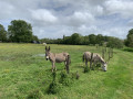
The appeal of this walk lies in its peaceful nature (away from the D33, see below...), the diversity of the landscapes and the variety of animals, both domestic and wild (common ones such as herons, more unexpected ones such as storks, etc.), encountered along the way.
Reduced to approx. 23 km (4½ hours excluding breaks) instead of 26 km because...
(1) at point 15, carried away by the charm of the Brivet..., I missed the large loop on the left passing through the 'Champ blanc' and continued along the river, eventually finding the route again (pirogue circuit), in short, just a shortcut...
(2) After the rough stretch on the departmental road (points 17 to 18: D33 towards Pontchâteau for about 15 minutes. ... At point 20, I preferred to continue along the Brivet (a walking stick is recommended on a path that is uneven in places due to fallen trees), which seemed more picturesque than the route suggested between points 20 and 22 (before the footbridge on the right, under the cemetery, simply climb the stairs towards the village via the church, returning to the station; ideal for lunchtime ;-)).
Add a high-visibility vest (weighs just a few grams) to your equipment for the rough stretch of the D33 departmental road for added safety (heavy traffic between the Pontchâteau exit and the Nantes-Vannes four-lane road).
To avoid this unpleasant stretch of the D33 departmental road, you can plan a slightly longer but more peaceful hike by taking the footbridge on the right rather than going up to the left towards the D33 (before point 17), crossing the Brivet again, reaching Branducas and, from there, retracing your steps along the much more pleasant route you took on the way there, and returning to Pontchâteau (recommended alternative for groups for whom the D33 is unsuitable).

Machine-translated

steph96
steph96

Overall rating : 2.5 / 5

Date of your route : Feb 27, 2022
Reliability of the description : Not used / Not applicable
Ease of following the route : ★★★☆☆ Average
Route interest : ★★☆☆☆ Disappointing
Very busy route : No

A walk that could be quite nice

Definitely not to be attempted in winter or in wet weather; the paths are impassable and you’ll be forced to turn back and extend the route each time, particularly at point 15 and between points 19 and 20.
There are also too many roads, mainly due to the detours, but the stretch between points 17 and 18 is also very busy.

Machine-translated

Other walks in the area

For more walks, use our search engine .

The GPS track and description are the property of this route's author. Please do not copy them without permission.