Country:
 City:


Park at the foot of Saint-Martial Priory. The main signposting is yellow, that of Route No. 53 proposed by the Brenne Regional Nature Park, entitled “Balade de St-Victor”.
(S/E) Take the street to the north, cross the D951 with care and continue straight on towards the old railway station. Turn right, then left.
(1) Turn right, heading east, onto the Voie Verte, a cycle and footpath running along the old railway line (watch out for cyclists).
(2) After crossing a bridge over a road, go down a few steps on the left to join a small road; take this to the right until you reach the hamlet of La Caillauderie.
(3) Once you reach the hamlet, turn right towards Les Clous, then follow the path to the right (GRP® signposted ‘La Brenne’).
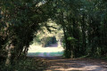
(4) When you reach the first buildings of the Domaine de La Roche, continue along the wide path to the left, heading north-north-east. In some sections, you can still see remains of the ancient Roman road. Ignore the offshoots on either side and continue until you reach a fork in the path.
(5) Continue straight on initially to explore the Étang des Grandes Fourdines.
Retrace your steps, then head down the path on the far right. This then heads south-west and reaches the hamlet of Les Demars. Continue straight on along the small road for 100 metres.
(6) Turn onto the path on the right (GRP® signposted), head down to the Ruisseau de Saint-Victor and then climb back up through the Bois Jachère. Once you reach the D15, follow it to the left as far as the Brousses crossroads.
(7) Turn right onto the track, then left at the next junction.
(8) 100 metres further on, leave theGRP® ahead of you and turn right. Then follow the small road to the left which leads back down to Ruffec.
(9) At the junction, carry on straight ahead to cross the Voie Verte and walk alongside the cemetery. Cross the D951 carefully and continue along Rue de l’Église.
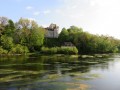
(10) Before reaching the priory, turn into thesecond street on the right, Rue du Gué, and walk down to the River Creuse. Turn left onto a narrow path running alongside a fence, then pass under the bridge on the Route de Bélâbre to reach the old mill on the River Creuse.
Retrace your steps to head north, passing by the post office, and return to the starting car park (S/E).

 Visorando Member

 Easy