Zugarramurdi from the Sare Caves

A beautiful walk starting from the Sare Caves and passing through the Zugarramurdi Caves, the Witch Museum and the village of Zugarramurdi.

Details

3118151
Creation:
Last update:
Last review:
  • Walking
    Activity: Walking
  • ↔
    Distance: 4.27 mi
  • ◔
    Average duration: 2h 35 
  • ▲
    Difficulty: Easy

  • ⚐
    Back to start: Yes
  • ↗
    Ascent: + 666 ft
  • ↘
    Descent: - 666 ft

  • ▲
    Highest point: 787 ft
  • ▼
    Lowest point: 518 ft

Photos

Description of the walk

To get to the starting point, follow the route to the Sare Caves, which are clearly signposted on the various roads. Park in the car park below the caves to leave the spaces near the entrance for visitors.

(S/E) Continue along the road and pass the entrance to the caves, walking along the left side of the quarry using the path that runs alongside the road.

(1) Take the path on the right just after rejoining the road, then follow the first path on the left, which joins another road further up.

(2) Continue left to rejoin the road you left earlier before a right-hand bend.

(3) Take the path that branches off to the left at the end of the bend and runs along the left-hand side of the road. Further on, this path joins another path and then the road to Zugarramurdi.

(4) Turn right and, once in the village, turn right again towards the church.

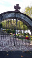
(5) Turn right, then quickly left, and walk along the right side of the church. As you leave the village, don't miss the traditional cemetery.

(6) Continue right on the road, which runs horizontally.

(7) Just before a bridge, turn right onto the road.

(3) Go straight ahead and ignore the road on the right.

(2) Continue along the road, ignoring the path you took on the way up. Then turn right onto another path that joins the road you started on.

(1) Turn left and follow the outward route back to the car park (S/E).

Waypoints

  1. S/E : mi 0 - alt. 591 ft - Car park at the Sare Caves
  2. 1 : mi 0.51 - alt. 551 ft - Path to the right then to the left
  3. 2 : mi 0.87 - alt. 705 ft - Crossroads of the first circular loop
  4. 3 : mi 1.01 - alt. 705 ft - Crossroads of the second circular loop
  5. 4 : mi 1.53 - alt. 597 ft - Zugarramurdi Road
  6. 5 : mi 1.92 - alt. 696 ft - Church, on the right
  7. 6 : mi 2.15 - alt. 722 ft - Road on the right after the cemetery
  8. 7 : mi 2.68 - alt. 696 ft - Road on the right
  9. S/E : mi 4.27 - alt. 591 ft - Car park at the Sare Caves

Notes

You will find water in Zuggaramurdi

Worth a visit

Reviews and comments

3.9 / 5
Based on 10 reviews

Reliability of the description
3.4 / 5
Ease of following the route
4.2 / 5
Route interest
4.1 / 5
Bernardsalsa
Bernardsalsa

Overall rating : 4 / 5

Date of your route : Jan 12, 2025
Reliability of the description : ★★★★☆ Good
Ease of following the route : ★★★★★ Very good
Route interest : ★★★☆☆ Average
Very busy route : No

At point 3, the alternative route (marked with blue pottok signs) is easy to follow but very muddy and slippery at this time of year.
A bit too much road for my liking.

Machine-translated

eric bourdon
eric bourdon

Overall rating : 4.3 / 5

Date of your route : Sep 15, 2024
Reliability of the description : ★★★★☆ Good
Ease of following the route : ★★★★☆ Good
Route interest : ★★★★★ Very good
Very busy route : No

An easy, pleasant route that takes you to the caves of Zugarramurdi, which are well worth the short detour. The little blue pottok is a very reliable marker for following the trail.

Machine-translated

Hervé Bignon
Hervé Bignon

Hello,

I will take note of this during my next visit and rectify what needs to be rectified.

Thank you for your feedback.

Machine-translated

Pascal (Arbonne)
Pascal (Arbonne)

Overall rating : 3.7 / 5

Date of your route : Aug 08, 2024
Reliability of the description : ★★★☆☆ Average
Ease of following the route : ★★★★☆ Good
Route interest : ★★★★☆ Good
Very busy route : No

I confirm that the proposed route is impossible shortly after point 3, as described by Marie240.
In addition to her description of the alternative route, I can add that shortly before reaching the bridge to cross, there is a footbridge on the left that should not be taken. The bridge is a little further on, heading up to the right and then taking a path down to the left before reaching a metal gate that may be locked with a padlock.
Otherwise, it's a very pleasant and easy hike, but make sure you wear sturdy footwear as some sections can be slippery depending on the weather. And the village of Zugarramurdi is well worth spending a little (or a lot) of time in!

Machine-translated

Marie240
Marie240

Overall rating : 3.3 / 5

Date of your route : Mar 17, 2024
Reliability of the description : ★★☆☆☆ Disappointing
Ease of following the route : ★★★★☆ Good
Route interest : ★★★★☆ Good
Very busy route : Yes

Please note that after point 3, the path has been privatised and closed. There is a no entry sign. Take the path that descends to the left and follow the blue pottok markings. Cross through a forest, go over the bridge and turn left. There is a pedestrian crossing. Walk along the fence until you reach the tarmac road again.

Machine-translated

Braguette
Braguette

Sorry, there's been a mistake. I mixed up the routes after doing two on the same day. Kind regards

Machine-translated

Hervé Bignon
Hervé Bignon

It is described in the text and shown on the map, what more could you want?

Machine-translated

Braguette
Braguette

Overall rating : 4.3 / 5

Date of your route : Mar 09, 2024
Reliability of the description : ★★★☆☆ Average
Ease of following the route : ★★★★★ Very good
Route interest : ★★★★★ Very good
Very busy route : Yes

The starting point is not clearly identified.

Machine-translated

Hervé Bignon
Hervé Bignon

Can you explain what is wrong? The map on my phone is accurate compared to the description.

Thank you for your help if there is a problem.

Machine-translated

mpetitjean
mpetitjean

For your information, the map provided does not correspond to the hike.
Thanks to visorando!

Machine-translated

Philou 16
Philou 16

Overall rating : 3.3 / 5

Date of your route : Oct 30, 2023
Reliability of the description : ★★★☆☆ Average
Ease of following the route : ★★★☆☆ Average
Route interest : ★★★★☆ Good
Very busy route : No

Hike done in superb weather. On the way back, there were no signposts. We had to find our own way.
However, we were pleasantly surprised by the restaurant along the walk with its cave-like dining room. Book the restaurant in advance.

Machine-translated

Sylvain Lagarde
Sylvain Lagarde

Overall rating : 4 / 5

Date of your route : Aug 16, 2023
Reliability of the description : ★★★★☆ Good
Ease of following the route : ★★★★☆ Good
Route interest : ★★★★☆ Good
Very busy route : No

Beautiful hike, but two access points are blocked between points 3 and 4! It is possible to go around them or climb over them!!!
Don't hesitate to stop for a bite to eat at the Venta Antonem after landmark 7. It's best to book during the summer so you can eat on the terrace with a magnificent view!!!!! There will be just 800 metres left to complete this beautiful walk!

Machine-translated

arthur34
arthur34

Overall rating : 3.7 / 5

Date of your route : May 29, 2023
Reliability of the description : ★★★★☆ Good
Ease of following the route : ★★★★☆ Good
Route interest : ★★★☆☆ Average
Very busy route : No

It is impossible to reach marker 4, as the path is blocked by wire fencing before the entrance to the Zugarramurdi caves. You have to go back up the road that you would normally take after passing through Zugarramurdi. This makes the hike somewhat disappointing.

Machine-translated

PITWOMIKA
PITWOMIKA

Overall rating : 3.7 / 5

Date of your route : Sep 12, 2021
Reliability of the description : ★★☆☆☆ Disappointing
Ease of following the route : ★★★★☆ Good
Route interest : ★★★★★ Very good
Very busy route : Yes

The description lacks detail for this hike. Several uncertainties
about which direction to take.
Kind regards.
Mr and Mrs MAILLAND

Machine-translated

chantal vander
chantal vander

Overall rating : 4.7 / 5

Date of your route : Aug 17, 2020
Reliability of the description : ★★★★★ Very good
Ease of following the route : ★★★★★ Very good
Route interest : ★★★★☆ Good
Very busy route : Yes

A pleasant walk, but far too crowded on a Sunday in August!

Machine-translated

Other walks in the area

For more walks, use our search engine .

The GPS track and description are the property of this route's author. Please do not copy them without permission.