Col des Trois Bornes

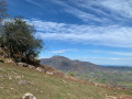
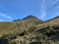
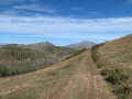
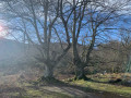
A lovely circular walk starting from the Grottes de Sare and climbing up to the Col des Trois Bornes.

Details

3183088
Creation:
Last update:
Last review:
  • Walking
    Activity: Walking
  • ↔
    Distance: 4.35 mi
  • ◔
    Average duration: 3h 10 
  • ▲
    Difficulty: Moderate

  • ⚐
    Back to start: Yes
  • ↗
    Ascent: + 1,368 ft
  • ↘
    Descent: - 1,371 ft

  • ▲
    Highest point: 1,726 ft
  • ▼
    Lowest point: 581 ft

Photos

Description of the walk

To reach the start, follow the route to the Grottes de Sare, which are very well signposted along the various roads. Park in the car park below the caves; the path starts from the lowest car park.

(S/E) Take the path heading south-west and climbing through the forest. The path turns north before joining another path.

(1) Turn left at the hairpin bend heading south-west. On a flat section, join a path on the left and continue straight ahead until you reach a junction.

(2) Carry on straight ahead, passing the houses at Arrosagaraiko Borda. Then ignore the paths branching off to the right or left. Walk alongside the forest, then enter it to reach a wide track suitable for vehicles. Turn left onto this track and head for the boundary marker.

(3) Stay on this ascending track to reach the pass junction.

(4) Turn right and, following an almost flat path, head towards the Col des Trois Bornes, where there is another boundary marker.

(5) Return to the previous junction via the same route.

(4) Take the path opposite, follow the edge of the forest, and reach the junction of the path leading to Atxuria via the western valley, also marked by the stream ford.

(6) Turn right to head uphill. At a Fork in the road, veer left. You’ll reach the junction with the path leading to the eastern valley.

(7) Take the track straight ahead which leads back down to the car park at the Sare Caves (S/E), ignoring the paths branching off to the left.


Waypoints

  1. S/E : mi 0 - alt. 584 ft - Sare Caves car park
  2. 1 : mi 0.28 - alt. 853 ft - Hairpin bend to the left
  3. 2 : mi 0.5 - alt. 1,076 ft - Arrosagaraiko Borda junction
  4. 3 : mi 1.61 - alt. 1,437 ft - Boundary marker
  5. 4 : mi 1.87 - alt. 1,699 ft - T-junction
  6. 5 : mi 2.26 - alt. 1,709 ft - Boundary Marker 56 - Col des Trois Bornes
  7. 6 : mi 3.16 - alt. 1,352 ft - Three-way junction
  8. 7 : mi 3.47 - alt. 1,348 ft - Three-way junction
  9. S/E : mi 4.35 - alt. 581 ft - Sare Caves car park

Notes

No water source along the way.

Worth a visit

Restaurant.

Reviews and comments

4.6 / 5
Based on 3 reviews

Reliability of the description
4.7 / 5
Ease of following the route
4.7 / 5
Route interest
4.3 / 5
jeanmichelroy
jeanmichelroy

Overall rating : 4.7 / 5

Date of your route : Jul 27, 2026
Reliability of the description : ★★★★★ Very good
Ease of following the route : ★★★★★ Very good
Route interest : ★★★★☆ Good
Very busy route : No

An easy walk.
Make sure you follow the path carefully between point 4 (after returning from the pass) and point 6, as the route starts off through a field.

Machine-translated

Samourai40
Samourai40

Overall rating : 4 / 5

Date of your route : Aug 22, 2025
Reliability of the description : ★★★★☆ Good
Ease of following the route : ★★★★☆ Good
Route interest : ★★★★☆ Good
Very busy route : No

Lovely walk, a bit tricky to park as the car park was full (lots of people were visiting the Sare caves during this busy tourist season...), but once we got a bit higher up, it was much quieter! Thanks again.

Machine-translated

Hervé Bignon
Hervé Bignon

Hello Elisabeth,

I’m delighted that you liked this suggestion.

I can confirm that the return journey is less interesting than the outward one, and your suggestion to return via the same route is a good idea, as you don’t see the same things on the way up as you do on the way down.

Kind regards,
Hervé

Machine-translated

Elisabeth64
Elisabeth64

Overall rating : 5 / 5

Date of your route : Feb 28, 2021
Reliability of the description : ★★★★★ Very good
Ease of following the route : ★★★★★ Very good
Route interest : ★★★★★ Very good
Very busy route : No

A lovely walk with my 6-year-old son, who kept up well. I just changed the route at the end of the walk, as it finished with a descent towards the Sare quarry and I found that rather uninteresting.

We retraced our steps back to where we’d started the walk, looking out over the plain.

Including a short picnic break, the walk took us 3 hours and 15 minutes in total.

Machine-translated

jelebo645
jelebo645

Hi Hervé, I’ve just had a look at the “Col des 3 Bornes” route. I’m a bit familiar with it. I’m up for doing it whenever you like. It’s a half-day hike that can be extended to a full day by heading to Atxuria, for example. See you soon, JL

Machine-translated

Other walks in the area

For more walks, use our search engine .

The GPS track and description are the property of this route's author. Please do not copy them without permission.