Country:

 City:
City:


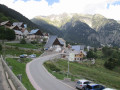
You can park in a relatively spacious car park by the roadside between the restaurant “Le Cabri” and the farmers’ cheese co-operative.
(S/E) Set off south-west along the road leading to Allemont.
(1) After 200 metres, take the road that climbs to the right; at the start of this road you’ll find signposts for walking trails, including ‘York Mallory’, which you should follow to your destination.
(2) We pass through a block of houses, amongst which is the Ibex Museum. We continue along this same road for about 450 metres until we come to the start of a footpath on the right (just after the road crosses a stream).
(3) This path starts to the right of the road, where the tarmac ends. At the start of the path, you’ll see a sign for “York Mallory”, which you should follow. It begins immediately with an uphill climb through the forest.
(4) Still in the woods, the main path turns right; ignore another path on the left.
(5) You gradually leave the woodland behind. Ignore a path branching off to the rear left and continue straight on (following the sign for York Mallory). A little further on, you cross a small stream, then pass a small path on your right.
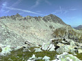
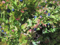
(6) You are now in a very open area of blueberry heathland. Continue along the main path, which turns right, passing another path on your left.
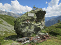
After walking through blueberry heathland strewn with scattered debris from the plane crash, you’ll reach the memorial stone.
(7) After visiting the site, we head back down, retracing the entire route in the opposite direction to return to the car park at the Rivier d’Allemont co-operative (S/E).



 Visorando Member
 Difficult
 Tourism professional
 Very difficult
 Extremely difficult