


 Country:
 City:
City:


Car park at the Merzhausen swimming pool.
(S/E) As you leave the car park towards the main road, look out for the path on the left marked with a Yellow Diamond, which leads up a stony track through the vineyards. Pass a path on your right and, about a hundred metres further on, turn left towards a chapel (Schönstattkapelle).
(1) Walk past the chapel and turn right onto the uphill path marked with a Yellow Diamond. About a hundred metres further on, turn left. At the place known as ‘Bei Der Schönstattkapelle’, turn right towards Gaisberg. Cross the courtyard of the Jesuitenschloss.
(2) After the exit archway, turn left onto a small tarmac road. Ignore a path branching off to the left and continue uphill along the stony track to reach the place known as ‘Am Drescheschopf’.
(3) Ignore the path leading slightly downhill and turn right uphill towards Gaisberg. When you reach the forest at a junction at the place called Gaisberg, take the left-hand path, which is slightly uphill towards Am Kopfacker, following the Yellow Diamond. At the junction in the hamlet of Am Kopfacker, ignore the path on the right leading to Am Felsele and continue along the edge of the forest towards Dürrstein/Wittnau. Ignore a path descending to the left. Follow the Yellow Diamond and arrive at a junction in the hamlet of Dürrstein.
(4) Ignore the steeply ascending path on the right and the path on the left leading down towards Wittnau. Continue straight ahead towards Obere Englematt.
(5) Don’t miss: after 150 m, at a Fork in the road, turn right towards Ebringen (wooden sign), then at the next junction at a place called Ebielibuck, follow the sign for Obere Englematt, leaving the Langhardpfad sign on your right. Cross a meadow on the edge of the forest (views of the Black Forest) and arrive at a junction at a place called Odere Englematt.
(6) Continue following the Yellow Diamond towards Untere Langhard, ignoring a path on the left leading downhill towards Kliebe. Stay on the main path, ignoring a small track to the right by an electricity pole, until you reach the hamlet of Untere Langhard on a tarmac road. Follow the road uphill towards Schlauchweg for about fifty metres to reach a junction at the hamlet of Parkplatz Schlauchweg.
(7) Turn right, following the Yellow Diamond towards Herrenbuck. Stay on the main path (the one going uphill) marked with the Yellow Diamond. At the hamlet of Herrenbuck, join a wide, vehicle-accessible track. Follow it uphill towards Langhardpfad. After 500 metres, you’ll reach a junction at the hamlet of Langhardpfad.
(8) Ignore the wide track heading towards Dürrstein and turn left uphill towards Obere Schonberg, following the Yellow Diamond. After a 400-metre climb, you’ll reach a junction. Turn left along the pasture, ignoring the path leading downhill. 30 metres further on, you’ll reach another junction.
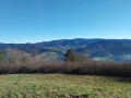
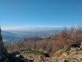
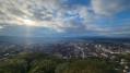
(9) Don’t miss this. Turn right (signposted ‘Schonberggipfe’), leaving the path along the pasture. Stay on the path furthest to the right (there are many paths). After a 150-metre climb, you’ll reach the summit of the Schönberg (alt. 644 m).
(10) After taking in the view, head towards a transmission mast. Go round it on the right and join a small tarmac road, following it downhill. At a junction, at the hamlet of Oberer Schönberg, turn right towards Hedwigsbrunnen, leaving the road and the path on your left. Descend to a junction at the hamlet of Hedwigsbrunnen.
(11) Cross the wide track and head downhill towards Ladhöfle. At the next junction at a place called Ladhöfle, take the first path on the left and, a few metres further down, you’ll reach the Gasthaus Schönberghof.
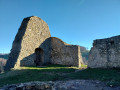
(12) Set off up the tarmac road towards the Schneeburg ruins, which are visible on the right. After a short climb, at a place called An Der Schneeburgruine, turn right towards the Schneeburg ruins.
(13) Important: on the climb, look out for a path marked with a Yellow Diamond on the right. This will be the path you take down. Continue to the castle and enjoy the view.
(14) Begin the descent by retracing your steps along the path you took on the way up until you reach the junction with the path marked with a Yellow Diamond on the left, which you spotted on the way up.
(13) Follow this path until you reach a junction with a tarmac road. Leave the Yellow Diamond path and turn right, heading downhill along the small road (no signpost). 200 metres further on, first ignore a small road joining from the left, then a few metres further on, ignore the small path on the left (Yellow Diamond). Stay on the small road, pass through a gate and arrive at a junction at a place called Mösle.
(15) Turn left towards Mösleschacht, following the Yellow Diamond markings. Pass a first path on your left, then the paths leading to the Grillstelle. Stay on the wide path and, at a crossroads, follow the wide Yellow Diamond path downhill. Ignore the paths to the right and left. Ignore a small path leading off to the right and, a few metres further on, leave the wide Yellow Diamond path heading downhill and take a path veering off to the right. You’ll come to a junction with a path marked ‘Trail’. Continue straight ahead to reach, 200 metres further on, a junction at the place known as Zwiegeracker.
(16) Turn left onto the wide path heading towards the Jesuitenschloss. You’ll pass the buildings you went past on the way out.
(2) Cross the courtyard and follow the path back along the same route as on the way out to reach the car park (S/E).


 Visorando Member
 Difficult
 Easy
Easy 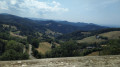
 Association / Club / Walk leader
