


Refine your search for walks in Nécropole nationale (Plaine)
Nécropole nationale (Plaine) walks


 The Flag Trail in Saint-Blaise-la-Roche
 Visorando Member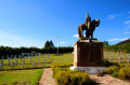
 4.53 mi
 +594 ft
 -620 ft
 2h 35
2h 35
 Easy
Easy
 Departure from Saint-Blaise-la-Roche (Bas-Rhin)
A commemorative walk retracing the Battle of Saint-Blaise-la-Roche during the First World War and the episode of the flag captured from the enemy. Numerous information boards line the route.
Between the Col du Donon, Col du Prayé and Col du Hantz to Saint-Blaise-la-Roche
 14.61 mi
+1,427 ft
-2,444 ft
8h 00
14.61 mi
+1,427 ft
-2,444 ft
8h 00
 Difficult
Departure from Grandfontaine (Bas-Rhin) (Bas-Rhin)
Difficult
Departure from Grandfontaine (Bas-Rhin) (Bas-Rhin)
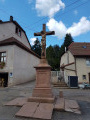
A long hike that will take you from the Col du Donon to Saint-Blaise-la-Roche in the Schirmeck valley, via the Col du Prayé and the Col du Hantz. You’ll follow the old 1871 border between France and Germany along the ridges, which is still marked by several boundary stones. In August, the high moors are dotted with flowering heather, creating a beautiful pink hue that contrasts with the green of the fir trees, the blue of the sky and the white clouds.
Walks near Nécropole nationale (Plaine)
From Salm to the Tête du Coquin
 10.34 mi
+2,963 ft
-2,349 ft
7h 20
Difficult
Departure from La Broque (Bas-Rhin)
10.34 mi
+2,963 ft
-2,349 ft
7h 20
Difficult
Departure from La Broque (Bas-Rhin)
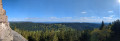
This first stage is probably the hardest day of the route. Beautiful views, pleasant trails and few forest roads. A steep climb at the end of the day explains the "Difficult" rating.
Three days around the Val de Senones with bivouacs
33.33 mi
+5,928 ft
-5,945 ft
3 days
Difficult
Departure from La Broque (Bas-Rhin)
Three days of hiking and camping around the Val de Senones, passing by beautiful viewpoints. Campsites at the Tête du Coquin and the Haute Loge.
 Mountain biking in the Vosges, Day 4: Hohwald - Chatenois (Part 1)
7.84 mi
+840 ft
-1,558 ft
2.5 hrs
 Moderate
Departure from Le Hohwald (Bas-Rhin)
Moderate
Departure from Le Hohwald (Bas-Rhin)
This route is the first part of thefourth stage of a seven-day tour of the Alsatian side of the Vosges mountains. Most of the route is on forest roads in good condition. The signage is excellent, consisting of signs with an orange or red mountain bike logo and the letters TMV (Traversée du Massif Vosgien).