The Raphaël Trail to Mirande

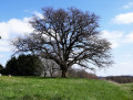
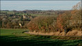
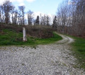
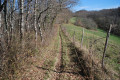
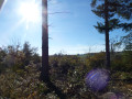
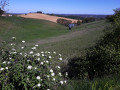
The Raphaël trail is a circular route that winds its way round the hills above Mirande, offering you some lovely views of the town and the surrounding hillsides. An easy walk with a few short, slightly steep ascents and descents. A relatively shaded route, very pleasant to walk during the summer months.

Details

1718065
Creation:
Last update:
Last review:
  • Walking
    Activity: Walking
  • ↔
    Distance: 5.26 mi
  • ◔
    Average duration: 3h 05 
  • ▲
    Difficulty: Easy

  • ⚐
    Back to start: Yes
  • ↗
    Ascent: + 732 ft
  • ↘
    Descent: - 738 ft

  • ▲
    Highest point: 843 ft
  • ▼
    Lowest point: 505 ft

Photos

Description of the walk

Car park at the leisure centre; the start of thePR® is signposted.

(S/E) Turn left towards the junction with the D104. Take care. Follow the departmental road to the right, then take the track branching off to the left (altitude 167m). Continue up this track, which ends in a path winding through a copse to the edge of the departmental road. You’ll reach the junction.

(1) At this junction, take the road on the left for a few metres, then turn onto the track that climbs to the left and leads onto a footpath. Follow this footpath until you reach the junction with a road.

(2) Follow this small road uphill to the right. Then take the dirt track leading downhill to the left (altitude 193m). At the junction with a track suitable for vehicles, continue straight ahead along the track uphill through the forest. Stay on this track, which occasionally becomes a footpath, until you reach a junction with a road.

(3) Take the track straight ahead that runs alongside the solar farm on the left. Follow this track downhill until you reach a crossroads.

(4) Turn right. Directly ahead of you, at the top of the track, you’ll see some houses. Continue to the end of the uphill track, then turn right (altitude 233m).

(5) You’ll reach the start of a microlight runway. Cross the runway, then turn right and follow the microlight runway uphill until you reach a path branching off to the left. Take this path until you reach the road.

(6) Follow the road to the left until you reach the junction with the D104

(1) Continue along the road to the left – take care – until you reach the first track on the right.

(7) Turn onto this small tarmac road and go straight on, passing a track on your right. Continue until you reach the track coming from the right.

(8) Take this track, which quite quickly turns into a footpath; stay on this downhill path, which veers to the left to join a track suitable for vehicles. This track is not shown on the IGN map.

(9) Take the track opposite, which turns into a small tarmac road. Follow this road to the T-junction and turn right until you reach the finish, at the leisure centre car park (S/E)


Waypoints

  1. S/E : mi 0 - alt. 512 ft - Car park at the leisure centre
  2. 1 : mi 0.91 - alt. 814 ft - Junction of the circular loop
  3. 2 : mi 1.8 - alt. 581 ft - Turn right onto the road
  4. 3 : mi 2.39 - alt. 804 ft - Exit the path and cross the road
  5. 4 : mi 2.86 - alt. 702 ft - Turn right at the crossroads
  6. 5 : mi 3.1 - alt. 768 ft - Starting point for a microlight run
  7. 6 : mi 3.46 - alt. 837 ft - Leave the path and return to the road
  8. 7 : mi 3.83 - alt. 781 ft - Turn right at the crossroads
  9. 8 : mi 4.05 - alt. 807 ft - Path on the right
  10. 9 : mi 4.71 - alt. 600 ft - Leave the footpath and return to the road
  11. S/E : mi 5.26 - alt. 512 ft - Car park at the leisure centre

Notes

There are no drinking fountains along the route.
Please take care when walking alongside the county road; keep your children by your side.
You can have a picnic around the lake. The lake is situated behind the hill.

Worth a visit

After the (1) highest point, with a beautiful view over the town of Mirande.
(3) View of a large solar farm.
(5) With a bit of luck, you’ll see microlights in action.
(S/E) A pleasant break at the leisure centre; free entry.

Always be cautious and plan ahead when you're outdoors. Visorando and the author of this route cannot be held responsible for any accidents occurring on this route.

The GR® and PR® markings are the intellectual property of the Fédération Française de Randonnée Pédestre.

Reviews and comments

4.8 / 5
Based on 2 reviews

Reliability of the description
5 / 5
Ease of following the route
5 / 5
Route interest
4.5 / 5
skargo
skargo

Overall rating : 5 / 5

Date of your route : Dec 25, 2022
Reliability of the description : ★★★★★ Very good
Ease of following the route : ★★★★★ Very good
Route interest : ★★★★★ Very good
Very busy route : Yes

A lovely, sunny walk with views of the Pyrenees
Best done in dry weather
We did it in the opposite direction as we’d already done it
Skargomically, G.

Machine-translated

drennek
drennek
• Edited:

Overall rating : 4.7 / 5

Date of your route : Aug 18, 2022
Reliability of the description : ★★★★★ Very good
Ease of following the route : ★★★★★ Very good
Route interest : ★★★★☆ Good
Very busy route : No

A very easy family walk.
A few interesting viewpoints.
Varied route. A few welcome shaded sections.

Machine-translated

Other walks in the area

For more walks, use our search engine .

The GPS track and description are the property of this route's author. Please do not copy them without permission.