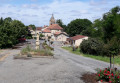
The path from Laredaou to Ponsampère

A route along the western slope of the Baïse via the Armagnac State Forest.
Most of the route follows tarmac roads or tracks suitable for vehicles.

Details

n°7248632
Creation:
Last update:
Last review:
  • Walking
    Activity: Walking
  • ↔
    Distance: 7.44 mi
  • ◔
    Average duration: 3h 45 
  • ▲
    Difficulty: Average

  • ⚐
    Back to start: Yes
  • ↗
    Ascent: + 348 ft
  • ↘
    Descent: - 364 ft

  • ▲
    Highest point: 856 ft
  • ▼
    Lowest point: 564 ft

Photos

Description of the walk

Park near the church at Ponsampère.

(S/E) Take the D279 departmental road northwards. At the three-way junction, Le Manéchal, turn left, pass the hamlet of L’Escalet and continue until you reach the wayside cross at the right-angled bend.

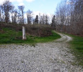
(1) Take the dirt track directly in front of you. Continue and cross the ford, then carry on along the track suitable for vehicles opposite, leaving a dirt track on your left. At the airfield, turn left and carry on straight ahead, leaving a footpath on your right. Pass the hamlet of Farbous and continue to the crossroads.

(2) Head straight on opposite Claudel, cross a first tarmac road then a second, and continue to the hamlet of Le Prince.

(3) Turn right and carry on to the tarmac road. Turn right and head for the junction with Chemin Mirandais.

(4) Turn slightly right and continue along Chemin Mirandais. Carry on straight ahead until you reach the junction with the D279.

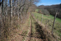
(5) Take the dirt track opposite, enter the Armagnac State Forest (Forêt de Berdoues) and stay on this track to cross the entire forest.
At the junction with a tarmac track, near the Berdoues Forest House (elevation 185), head straight ahead, then pass a track on the left and another, a little further on, on the right. Continue straight on until you reach the right-angled bend in Chemin Mirandais.

(6) Turn right, continue straight on, passing a track on your right, and carry on uphill until you reach the edge of the forest. Stay on this track, pass the hamlet of Le Lin and continue to the hamlet of Estévenet.

(7) At the junction in Estévenet, turn right; then, at the junction in front of Gamotis, turn left and you’ll come to the church at Ponsampère (S/E).


Waypoints

  1. S/E : mi 0 - alt. 856 ft - Ponsampère village square
  2. 1 : mi 0.62 - alt. 751 ft - Le Lavigne crossroads (calvary)
  3. 2 : mi 1.61 - alt. 686 ft - Le Claudel junction
  4. 3 : mi 2.11 - alt. 669 ft - Le Prince junction
  5. 4 : mi 2.79 - alt. 564 ft - Chemin Mirandais junction
  6. 5 : mi 3.81 - alt. 594 ft - D279 junction
  7. 6 : mi 5.61 - alt. 633 ft - Berdoues Forest
  8. 7 : mi 6.91 - alt. 797 ft - Estévenet junction
  9. S/E : mi 7.44 - alt. 853 ft - Ponsampère village square

Worth a visit

- Château Cours (private)
- Berdoues Forest

Reviews and comments

3.7 / 5
Based on 3 reviews

Reliability of the description
3.7 / 5
Ease of following the route
3.7 / 5
Route interest
3.7 / 5
skargo
skargo

Overall rating : 3 / 5

Date of your route : Nov 18, 2024
Reliability of the description : ★★★☆☆ Average
Ease of following the route : ★★★☆☆ Average
Route interest : ★★★☆☆ Average
Very busy route : Yes

Walk taken on 15 November
New route – follow the new signposting.
As I’m from the area and have done this walk several times over the last few years, the route on the website is no longer accurate for certain sections of the path, so please follow the new signposting.
Skargomically, G@

Machine-translated

lecbalcaz
lecbalcaz

Overall rating : 3.3 / 5

Date of your route : Jun 20, 2023
Reliability of the description : ★★★☆☆ Average
Ease of following the route : ★★★☆☆ Average
Route interest : ★★★★☆ Good
Very busy route : No

Hike completed on 18 June 2023. Very cloudy weather and the ground was wet from thunderstorms in the preceding days.
The walk would be very good if it were properly signposted (signposting is almost non-existent). The section between points 3 and 4
was completely covered in muddy slush, forcing us to turn back and take the field running alongside the path.
An alternative route should be found, as even in dry weather there’s bound to be slush there anyway.
It’s a shame, as the route is interesting.

Machine-translated

Dill
Dill

Thank you for your contribution and your valuable advice for the wet season. And here’s to more lovely walks...!!

Machine-translated

framonin
framonin

Overall rating : 4.7 / 5

Date of your route : Feb 06, 2022
Reliability of the description : ★★★★★ Very good
Ease of following the route : ★★★★★ Very good
Route interest : ★★★★☆ Good
Very busy route : No

A varied but easy route; however, the section 100 metres past point 3 is completely impassable in wet weather due to the nature of the path (dirt track), which has been damaged by animals. Tip: take the tarmac path before point 3 and follow it to join the signposted road just after point 4; this shortens the walk slightly, but it will save you from ending up with mud right up to the tops of your shoes!

Machine-translated

Other walks in the area

For more walks, use our search engine .

The GPS track and description are the property of this route's author. Please do not copy them without permission.