Le Quevalon depuis Hulluch

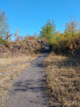
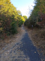
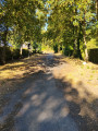
Jolie petite randonnée qui vous fera passer par la base de loisir et la plaine environnante

Details

69246729
Creation:
Last update:
Last review:
  • Walking
    Activity: Walking
  • ↔
    Distance: 5.00 mi
  • ◔
    Average duration: 2h 20 
  • ▲
    Difficulty: Easy

  • ⚐
    Back to start: Yes
  • ↗
    Ascent: + 36 ft
  • ↘
    Descent: - 36 ft

  • ▲
    Highest point: 125 ft
  • ▼
    Lowest point: 79 ft

Description of the walk

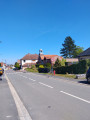
Start at the town hall square.

(S/E) With the town hall behind you, cross the road and take the first left (one-way street) then immediately right, opposite No. 11, to reach a junction at the end of Rue Carlier.

(1) Turn left (Rue du Général Leclerc), then take the first right, towards Résidence du Chemin Vert. Turn left onto the small Chemin de la Bassée, walk past the cemetery on your right and continue to the bend.

(2) Turn left, carry on straight ahead and head for No. 3 (Rue des Éparges). Immediately afterwards, first turn right then left to follow the one-way street (Rue Élisa) and continue to the end of it, at the entrance to the leisure centre opposite.

(3) First turn left then right, then at the end first turn right then left, and stay on the path on the right.

(4) Turn onto the path on the right, then take the first right, and carry on straight ahead through the wooded area.

(5) Turn right and head towards Route de Lens.

(6) Cross it carefully and carry on straight ahead until you reach the next junction.

(7) Turn left, then keep to the right until you reach a multi-way junction at the first houses in Douvrin.

(8) Take the path (Chemin des Cavaliers) on the right and, after 450 m, at the tarmac road, keep to the right (Rue Gustave Delory) and continue to a three-way junction.

(9) Turn slightly right and carry on straight ahead until you reach a junction at No. 10 (Rue Mademoiselle Carpentier).

(10) Turn right and continue straight on until you reach the original junction.

(1) Turn left (Rue du Général Leclerc) then right to return to the town hall square (S/E).

Waypoints

  1. S/E : mi 0 - alt. 89 ft - Town Hall Square
  2. 1 : mi 0.16 - alt. 95 ft - Junction of the circular loop
  3. 2 : mi 0.56 - alt. 115 ft - Turn onto Rue des Éparges
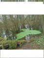
  4. 3 : mi 0.75 - alt. 105 ft - Leisure centre
  5. 4 : mi 1.1 - alt. 125 ft - Turn right
  6. 5 : mi 1.55 - alt. 105 ft - T-junction
  7. 6 : mi 1.96 - alt. 98 ft - Route de Lens
  8. 7 : mi 2.33 - alt. 85 ft - Junction
  9. 8 : mi 3 - alt. 89 ft - Junction towards Chemin des Cavaliers
  10. 9 : mi 3.64 - alt. 79 ft - Y-junction
  11. 10 : mi 4.42 - alt. 85 ft - Rue Mademoiselle Carpentier
  12. S/E : mi 5 - alt. 89 ft - Town Hall Square

Notes

Pas de point d'eau.

Worth a visit

Base de loisir, fosse 13.

Reviews and comments

4.3 / 5
Based on 2 reviews

Reliability of the description
4 / 5
Ease of following the route
4.5 / 5
Route interest
4.5 / 5
souchez rando
souchez rando

Thank you for your feedback. Unfortunately, there is nothing we can do. Our farmers have to work.

Machine-translated

maclemarpa59134
maclemarpa59134

Overall rating : 4 / 5

Date of your route : Nov 03, 2025
Reliability of the description : ★★★★☆ Good
Ease of following the route : ★★★★☆ Good
Route interest : ★★★★☆ Good
Very busy route : No

Followed the app, perfect.
The path from the Armanet farm is damaged by tractors and there is a very muddy, unpleasant crossing. I'm leading the hike this Thursday, but I'm going to avoid this section by taking the GRP Bassin Minier route, which only slightly lengthens the hike.

Machine-translated

souchez rando
souchez rando

Thank you for your feedback. Unfortunately, there’s not much we can do about certain acts of incivility. Have a good day.

Machine-translated

Jaja62
Jaja62

Overall rating : 4.7 / 5

Date of your route : Apr 06, 2025
Reliability of the description : ★★★★☆ Good
Ease of following the route : ★★★★★ Very good
Route interest : ★★★★★ Very good
Very busy route : No

A lovely walk – it’s a shame there was too much litter in places. 🫤
But I’ll do it again with my club

Machine-translated

Other walks in the area

For more walks, use our search engine .

The GPS track and description are the property of this route's author. Please do not copy them without permission.