Country:

 City:
City:


Start from the cemetery car park just behind the Brasserie du Cht’i.
(S/E) Head towards Rue Pasteur and turn right onto it; then, in front of the brasserie entrance, take the path on the left. At the end, first turn right then left and continue along a new path until you reach Rue Victor Hugo, which you follow to the left for about 100 metres.
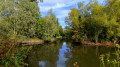
(1) Cross the street carefully, walk past the pub and turn right immediately afterwards. Follow the path and enter the marsh. Continue along this path, which was once ploughed by a farmer, until you reach a crossroads.
(2) Turn right, then carry on straight ahead. At the end, turn right, go under the bridge and continue until you reach the entrance to another marsh.
(3) Carry on straight ahead, then take the first left onto Route de Douvrin.
(4) Cross carefully and turn right, then take the path on the left and follow it alongside the railway line.
(5) Just before the crossroads, go up onto the old railway line and cross it to join the parallel path; follow this to the left until you reach the road you took on the way there.
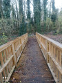
(4) Cross the road, go through the barrier and turn right onto the wooden bridge. Continue straight ahead, then turn left, following the N47, and carry on to the junction you passed on the way there.
(3) Turn right and go under the bridge again. Turn left and carry on straight ahead, in the opposite direction to your outward journey, until you reach the crossroads you passed on the way out.
(2) Carry on straight ahead until you reach the entrance to the village.
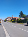
(6) Head straight ahead onto Rue Rayere and cross the road as soon as possible at the pedestrian crossing.
(8) Opposite number 53B, turn left onto the path and carry on straight ahead. Cross a stream and join Rue Pasteur.
(8) Turn left, then right, staying on Rue Pasteur, to return to the car park (S/E).

 Association / Club / Walk leader
 Moderate