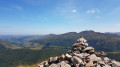
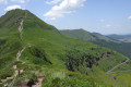
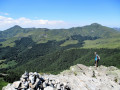
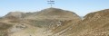
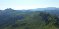
The Puy de Niermont and the Limon Plateau as seen from the Col de Serre

A beautiful walk featuring the Puy de Niermont for its 360° views and the Limon for its lovely cross-plateau stretches. This walk can be shortened (or extended) depending on the circumstances.

Details

3752384
Creation:
Last update:
Last review:
  • Walking
    Activity: Walking
  • ↔
    Distance: 11.33 mi
  • ◔
    Average duration: 6h 50 
  • ▲
    Difficulty: Moderate

  • ⚐
    Back to start: Yes
  • ↗
    Ascent: + 1,857 ft
  • ↘
    Descent: - 1,837 ft

  • ▲
    Highest point: 5,308 ft
  • ▼
    Lowest point: 4,288 ft

Description of the walk

(S/E) From the Col de Serre car park, head north-east along a wide path that follows the ridge. Follow theGR®4 markings

(1) After just under 3 km, carry on straight ahead along the ridge.

(2) Go through the gate and leave theGR® 4, then climb up to the Puy de Niermont. Take in the 360° view and look out for the well-known Puys.

Head north, skirting the boulder field to the left, then join a lovely path heading north towards a paragliding launch site. Go round the embankment on the left. Take in the whole view to the west.

(3) Take a wide right-hand bend to end up facing due east, staying at the same altitude. Cross the stream. This route is an easy one to follow.

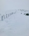
(4) Follow theGR® 4 northwards. In our case, initially to the west of the fence, then to the east afterwards.

(5) Go through the gate (which has been moved and looks a bit out of place) to pass north of the fence, then head east (alternative route in the practical information section).

Alternatively, head north-east along a lovely path that runs across the plateau, then turns south-east and descends towards a well-restored buron. In this area, there are some rather old orange markings.

(6) Go round the back of the buron, then continue eastwards to reach a copse of trees. Go through a gate.

(7) Orange markings. Cross the ford, go through another gate. Red and whiteGR® markings. Follow theGR®; at elevation 1324, turn right, due south, until you reach the Croix du Gendarme, which you can see. Continue along theGR® 4 to the crossroads at elevation 1374.

(8) Leave theGR®4, which heads off to the right, and carry on straight ahead towards the south-west along a well-marked path.

(9) Leave the path heading due south, signposted ‘Dienne’, and turn west-south-west onto a path that is barely marked but signposted in green, either on stones or on small posts.

(10) Follow the markings, which will soon veer south-west and skirt round the Puy de Niermont along a steep south-eastern slope, returning to the junction you passed on the way out.

(1) Continue to the left on theGR® 4, retracing your steps from the outward journey, until you reach the Col de Serre car park (S/E).

Waypoints

  1. S/E : mi 0 - alt. 4,373 ft - Car park - Col de Serre (1331m)
  2. 1 : mi 1.76 - alt. 4,974 ft - Common junction (there and back)
  3. 2 : mi 2.09 - alt. 5,285 ft - Puy de Niermont
  4. 3 : mi 3.04 - alt. 4,961 ft - Altitude: 1,512 m – Paragliding take-off
  5. 4 : mi 3.67 - alt. 4,925 ft - GR4 junction
  6. 5 : mi 4.49 - alt. 4,688 ft - Route
  7. 6 : mi 5.35 - alt. 4,436 ft - Buron
  8. 7 : mi 5.69 - alt. 4,314 ft - Orange markings
  9. 8 : mi 6.77 - alt. 4,508 ft - Leave the GR4 - Sentier des Quiroux
  10. 9 : mi 7.09 - alt. 4,603 ft - Path to Dienne
  11. 10 : mi 7.34 - alt. 4,649 ft - Green signposting
  12. S/E : mi 11.33 - alt. 4,370 ft - Car park - Col de Serre (1331m)

Notes

(5): Alternative route: here, you can shorten the route by continuing due east on theGR®4to reach (8).

The routes are affected by livestock in the pastures and the gates used to enter and exit the enclosures.
Please ensure you close the gates carefully.
For the animals, an open gate is a sign of a visitor and they are very curious.

Standard kit: high-top shoes, walking poles, a cap, sunglasses and long trousers to prevent tick bites.
Make sure you take plenty of water with you; the streams on the plateau are not safe to drink.

Worth a visit

There’s plenty to see with your own eyes during the hike, both in the distance and in the local flora.

Always be cautious and plan ahead when you're outdoors. Visorando and the author of this route cannot be held responsible for any accidents occurring on this route.

The GR® and PR® markings are the intellectual property of the Fédération Française de Randonnée Pédestre.

Reviews and comments

4.5 / 5
Based on 2 reviews

Reliability of the description
4.5 / 5
Ease of following the route
4 / 5
Route interest
5 / 5
Isabelle Cloux
Isabelle Cloux

Overall rating : 4.3 / 5

Date of your route : Dec 09, 2025
Reliability of the description : ★★★★☆ Good
Ease of following the route : ★★★★☆ Good
Route interest : ★★★★★ Very good
Very busy route : No

I tweaked the route a bit to suit myself, as I set off on foot from the Du Puy Marie stopover lodge (which isn’t actually in Le Puy)
So I joined the route at point 3. I skipped points 6 and 7 (too long for me), I didn’t go all the way to the Col de Serre as I’d taken that path the day before, and to get back to the lodge I left the route just after point 1 to rejoin the GR on the other side.
I still managed to do most of this route, which is very beautiful even in December (it was sunny); obviously, the weather needs to be clear, otherwise there’s a risk of getting lost on the plateau... The beauty of the route therefore lies on the plateau, a wild landscape, and at this time of year it’s not dangerous as the cows had been brought in. Magnificent views, and a sense of escape and freedom across these endless expanses; however, the plateau isn’t monotonous thanks to the varied 390° views all around.
I also appreciated, on my organised tour, the diversity between the plateau, the Puy de Niermont and the other, wooded, side.
Going to the Col de Serre is also very beautiful, as you have a view of the Puy Marie and the others to the left.
You’ll need to bring something to cover up in case of a cold wind, or in summer when the sun is beating down; for me in December, there was no problem with water.
And when you follow the ridge towards Puy de Niermont, it’s magnificent too, as the view ahead and down into the valley is spectacular.
I did, however, have to use my phone’s GPS to follow the route, as there are plenty of animal tracks on the way to Puy de Niermont, but you can navigate by sight (hence the need for clear weather on this route, especially in winter when it can get very cold).
It’s a magnificent place, with a very varied landscape.

Machine-translated

Other walks in the area

For more walks, use our search engine .

The GPS track and description are the property of this route's author. Please do not copy them without permission.