The Burons and the Col de Serre, starting from Lavialle

Discover the Burons de la Gardoune and de la Garde, the ridges (GR®4) leading to the Col de Serre with views of the Puy Mary, and a wealth of exceptional landscapes.

Details

44878851
Creation:
Last update:
Last review:
  • Walking
    Activity: Walking
  • ↔
    Distance: 8.05 mi
  • ◔
    Average duration: 5h 05 
  • ▲
    Difficulty: Moderate

  • ⚐
    Back to start: Yes
  • ↗
    Ascent: + 1,575 ft
  • ↘
    Descent: - 1,572 ft

  • ▲
    Highest point: 4,888 ft
  • ▼
    Lowest point: 3,593 ft

Photos

Description of the walk

Parking is available nearby or at the Lodge du Puy Mary car park.

(S/E) On leaving the lodge car park, turn right towards Col de Serre. Then stop following the signs for “Col de Serre” but stay on the road until you reach the three-way junction with the mobile phone masts.

(1) Turn right onto the path that climbs and, at the first junction, continue straight on until you reach a sign for “Le Claux”.

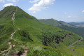
(2) Turn right and follow the path through the forest to the ruins of the Buron de la Gardoune. Enjoy the view over the Claux valley, Puy Mary, Peyre Arse, Puy de la Tourte, etc. You’ll come to a watering trough.

(3) Continue following thePR® markings to the Buron de la Garde. Pass another watering trough and arrive at La Garde. After the Buron de la Garde, follow thePR® for about a hundred metres.

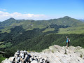
(4) Leave the signposted path and head diagonally uphill towards the ridge, joining theGR®4.

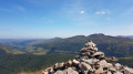
(5) Follow theGR®4to the right towards the Col de Serre until you reach the next junction (400 m before the Col de Serre).

(6) Turn right onto theGR®400. Go through the gate (remember to close it properly) and enter the woods. Follow the path as it winds through the Bois de Nolly Lavialle until you reach the sign for “Lodge du Puy Mary”.

(7) Turn left and carry on straight ahead until you reach the clearing.

(8) Take in the view across the whole of the Cheylade–Le Claux valley as far as the Puy de Sancy. Follow the path on the left, which continues to wind through the woods until you reach the crossing over the Ruisseau de la Blatte.

(9) Cross the stream and return to the lodge car park (S/E).

Waypoints

  1. S/E : mi 0 - alt. 3,642 ft - Gîte du Puy Mary
  2. 1 : mi 0.88 - alt. 4,016 ft - Mobile phone mast
  3. 2 : mi 1.56 - alt. 4,360 ft - PR Le Claux
  4. 3 : mi 2.81 - alt. 4,596 ft - Watering hole
  5. 4 : mi 3.33 - alt. 4,770 ft - La Garde Buron
  6. 5 : mi 3.57 - alt. 4,829 ft - GR4
  7. 6 : mi 4.68 - alt. 4,465 ft - GR400 - Col de Serre (1331m)
  8. 7 : mi 5.86 - alt. 4,452 ft - Follow the sign for Lodge du Puy Mary
  9. 8 : mi 6.32 - alt. 4,203 ft - Clearing
  10. 9 : mi 7.75 - alt. 3,638 ft - La Blatte stream
  11. S/E : mi 8.05 - alt. 3,645 ft - Gîte du Puy Mary

Notes

(6) You can make a return trip to the Col de Serre for a drink.

(8) Option to follow theGR® to the right.

Worth a visit

-(4) Burons de la Garde.

Viewpoints and panoramic views.

Always be cautious and plan ahead when you're outdoors. Visorando and the author of this route cannot be held responsible for any accidents occurring on this route.

The GR® and PR® markings are the intellectual property of the Fédération Française de Randonnée Pédestre.

Reviews and comments

4.3 / 5
Based on 3 reviews

Reliability of the description
4.3 / 5
Ease of following the route
4 / 5
Route interest
4.7 / 5
Tité92
Tité92

Overall rating : 4.3 / 5

Date of your route : Aug 15, 2024
Reliability of the description : ★★★★☆ Good
Ease of following the route : ★★★★☆ Good
Route interest : ★★★★★ Very good
Very busy route : No

A hike in less-than-ideal weather: drizzle and mist at the start. As a result, we weren’t able to fully enjoy the scenery
and we even had a bit of trouble finding our way through the mountain pastures (the path wasn’t always easy to spot amongst the many tracks left by the cows), though we managed to sort it out after a while thanks to the GPS.
Nevertheless, it was a very enjoyable outing thanks to the variety of the route and the beauty of the views.

Machine-translated

Celineetfrederic
Celineetfrederic

Overall rating : 4 / 5

Date of your route : Aug 10, 2024
Reliability of the description : ★★★★☆ Good
Ease of following the route : ★★★★☆ Good
Route interest : ★★★★☆ Good
Very busy route : No

The alpine huts and the magnificent view from the ridge are the highlights of this route. The forests are a bit dull, but they do have the advantage of providing some cool relief during this heatwave weekend.
Thank you very much for sharing

Machine-translated

Sonia V
Sonia V

Overall rating : 4.7 / 5

Date of your route : Mar 30, 2024
Reliability of the description : ★★★★★ Very good
Ease of following the route : ★★★★☆ Good
Route interest : ★★★★★ Very good
Very busy route : No

A lovely surprise. A walk that takes you through all sorts of landscapes (woodland, plains and a ridge with views of several mountains). It’s well suited even to novice walkers, with magnificent views that can be reached quite quickly.

Machine-translated

Other walks in the area

For more walks, use our search engine .

The GPS track and description are the property of this route's author. Please do not copy them without permission.