Country:

 City:


Access to the Col de Serre via the D680 from Le Puy-Mary or from Murat via Dienne. The route starts at this pass.
Red and white markings
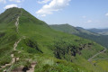
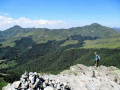
(S/E) Follow theGR® 4 north-east towards the Puy de Niermont. At the first junction, turn right onto theGR® 4to reach the Puy de Niermont (altitude 1,620).
On the ascent, you can admire the view over the village of Le Claux.
(1) From the summit, continue along theGR®4north-eastwards to the Sentier des Quirous (GR®4).
(2) Turn right and follow it (cairns and information sign) east-southeast to the crossroads (elevation 1,374).
(3) Turn right, head generally south and ignore the paths branching off to the right and left. Join a cross-country path.
(4) Turn left and continue the descent south-eastwards, towards Drils. At the entrance to the hamlet, look out for the waterfall on the right and then, a little further on, on the left. Continue the descent to the crossroads in the centre of the hamlet.
(5) Turn right and carry on to the D680.
(6) Cross the road carefully and continue along the road heading west until you reach the D23, which branches off to the left and leads to Lavigerie. Walk past the cemetery and the church on your left until you reach an X-junction.
(7) Turn left towards the hamlet of La Gravière. Cross the bridge over the Impradine, turn left and head for La Gravière. At the first junction (cross), carry on straight ahead to reach the fountain. Carry on straight ahead to La Courbatière after a hairpin bend.
(8) Then take the path on the left, then follow the path on the right, ignoring a turn-off to the right. Ignore two turn-offs to the left. Cross the Impradine via a footbridge and arrive at a T-junction.
(9) Turn left, then cross three streams and, immediately afterwards, reach a Y-junction.
(10) Turn right to head uphill towards some farm buildings, which you’ll walk past on your left. On the way up, you’ll see a beautiful waterfall on your left. Join the D680.
(11) Turn left onto this road and you’ll reach the Col de Serre, where there is a car park (S/E).

 Visorando Member
 Moderate

 Tourism professional