The Puy de Bort

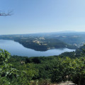
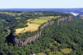
Starting from Bort-les-Orgues, this route will introduce you to the charms of the Bort-Artense region and treat you to panoramic views spanning over 180°. It all begins with a view of the dam, followed by the Monts du Sancy, and then the Bort plateau with its breathtaking vista. On the way back down, you can admire the views of the Cantal and the Sumène. Whilst there is certainly a significant elevation gain, you’ll still enjoy this walk, which is sure to leave a lasting impression. What’s more, much of the route is shaded, ensuring you can enjoy this outing in the best possible conditions.

Details

100970663
Creation:
Last update:
Last review:
  • Walking
    Activity: Walking
  • ↔
    Distance: 8.33 mi
  • ◔
    Average duration: 5h 20 
  • ▲
    Difficulty: Moderate

  • ⚐
    Back to start: Yes
  • ↗
    Ascent: + 1,745 ft
  • ↘
    Descent: - 1,745 ft

  • ▲
    Highest point: 2,664 ft
  • ▼
    Lowest point: 1,417 ft

Photos

Description of the walk

Park on Place Marmontel or nearby in Bort-les-Orgues.

(S/E) Take Boulevard Voltaire (D127) then Avenue du Docteur Lescure, following the red signposts, to reach the stadium.

(1) Continue along Avenue du Docteur Lescure and pass in front of the school.

(2) Turn right then left, and carefully cross Boulevard Jean Jaurès (D979) to follow Chemin du Sacristain.

(3) Join the D127 and follow it to the left, then quickly to the right, still on a track. At the end of the track, in a bend, take the D127 to the left and then head for Chantéry. In the left-hand bend on the D127, stay straight ahead on the track.

(4) Head towards Celut and reach the hamlet of La Colombière.

(5) Continue downhill to the left and reach the hamlet of Celut. Take an uphill track, stay on it and arrive at the village of Puy de Bort and the D127.

(6) After a left-right bend, carry on straight ahead up the slope until you reach a track, then follow it down to the right. At the end of the track, head into the woodland. After the power lines, turn right, heading east, to reach the magnificent panoramic view at Roussillou.

(7) Retrace your steps and continue to the right along the path and the forest track.

(8) At the junction of the tracks, continue down to the right.

(9) At the bottom of the descent, carry on to the left then to the right, skirting the hamlet of La Côte, to reach Tralaroche.

(10) Head down the Chemin de la Vierge on the left to reach the fairground at Bort-les-Orgues. Cross Boulevard Jean-Jaurès (D979) with care and continue downhill via Place du 19 Octobre and the Halle aux Blés, then Rue de Paris, before reaching the car park at Place Marmontel (S/E).

Waypoints

  1. S/E : mi 0 - alt. 1,417 ft - Place Marmontel car park - Dordogne (fleuve)
  2. 1 : mi 0.27 - alt. 1,450 ft - JB Brun Stadium
  3. 2 : mi 0.52 - alt. 1,444 ft - Boulevard Jean Jaurès D979
  4. 3 : mi 0.9 - alt. 1,772 ft - D127
  5. 4 : mi 1.67 - alt. 2,090 ft - Chantéry
  6. 5 : mi 2.1 - alt. 1,965 ft - View of the Monts du Cantal
  7. 6 : mi 3.88 - alt. 2,585 ft - The Puy de Bort
  8. 7 : mi 5 - alt. 2,523 ft - Roussillou
  9. 8 : mi 5.88 - alt. 2,392 ft - Crossroads. Change of direction
  10. 9 : mi 6.4 - alt. 2,277 ft - Junction
  11. 10 : mi 7.69 - alt. 1,877 ft - Côte de la Vierge
  12. S/E : mi 8.33 - alt. 1,417 ft - Place Marmontel car park - Gare de Bort-les-Orgues

Notes

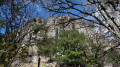
(S/E) A chalet at Les Orgues is regularly open where you can enjoy refreshments and find souvenirs of your visit to the site.
(5) La Colombière: enjoy a lovely view of the Monts du Cantal.
(6) Puy de Bort: you can head a little higher up to admire the panoramic view from the pass.
(7) Roussillou: panoramic views of the lake, the Sancy and the castle.

Worth a visit

Other walks in the area

For more walks, use our search engine .

The GPS track and description are the property of this route's author. Please do not copy them without permission.