Château de Val via the Dordogne route ‘From villages to dams’

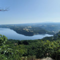
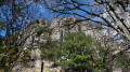
From the centre of Bort-les-Orgues, make your way to Château de Val by following the shores of the lake and the River Dordogne. Admire the dam from its base and then from the promontory on the left bank. Pass by the lovely Siauve beach. You can enjoy magnificent views of Château de Val along the lake.

Details

n°104840291
Creation:
Last update:
Last review:
–
  • Walking
    Activity: Walking
  • ↔
    Distance: 9.84 mi
  • ◔
    Average duration: 5h 15 
  • ▲
    Difficulty: Moderate

  • ⚐
    Back to start: Yes
  • ↗
    Ascent: + 876 ft
  • ↘
    Descent: - 846 ft

  • ▲
    Highest point: 1,955 ft
  • ▼
    Lowest point: 1,407 ft

Description of the walk

Start from Place Marmontel on the banks of the Dordogne. Parking available on site and nearby.

White-and-yellow signposting

(S/E) Take Avenue Victor Hugo to reach Bellevue.

(1) After the barrier, follow the path leading down to the right to the foot of the dam. Turn right to cross the bridge over the Dordogne and head back towards the county road.

(2) Follow this road to the left, then turn left again. Cut across Rue Edison and then Rue Ampère, and reach the viewpoint via a steep climb: a beautiful vantage point from which to admire the dam wall.

(3) Carry on to reach the ridge. Then walk alongside the D683 on the right before crossing over to find a path leading off to the left, which takes you to a narrow road.

(4) Follow this road, turning left.

(5) At the 90° left-hand bend, carry straight on along a path which joins a small road opposite a few isolated houses. Turn right to quickly reach a junction.

(6) Turn left, then follow the path running along the lake on the right. Continue to Siauve beach.

(7) Continue along the beach and the lake to Château de Val.

(8) After taking in the scenery, retrace your steps along the route you took on the way there to return to the car park (S/E).

Waypoints

  1. S/E : mi 0 - alt. 1,407 ft - Place Marmontel
  2. 1 : mi 0.84 - alt. 1,483 ft - Foot of the dam
  3. 2 : mi 1.03 - alt. 1,440 ft - County road
  4. 3 : mi 1.43 - alt. 1,640 ft - Lookout point over the Bort-les-Orgues Dam
  5. 4 : mi 1.8 - alt. 1,791 ft - Junction with a small road
  6. 5 : mi 2.03 - alt. 1,896 ft - Turn, then straight on
  7. 6 : mi 2.3 - alt. 1,955 ft - Mouleyres
  8. 7 : mi 2.95 - alt. 1,785 ft - The Siauve - Dordogne (fleuve)
  9. 8 : mi 4.92 - alt. 1,781 ft - Val Castle
  10. S/E : mi 9.84 - alt. 1,407 ft - Place Marmontel

Notes

Paths through the woodland.

A steep climb to reach the crest of the dam (3).

Worth a visit

Other walks in the area

For more walks, use our search engine .

The GPS track and description are the property of this route's author. Please do not copy them without permission.