


 Country:

 City:
City:


Start at Place Marmontel. Parking available on the square.
(S/E) Cross the bridge and turn left, then right onto the Chemin des Minimes. Continue along the Chemin de la Bastide. You’ll reach the cross
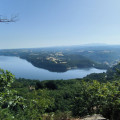
(1) Carry on and then turn left onto the path towards the hamlet of La Bastide (a very lovely, unobstructed view of the Cantal mountains).
(2) At the junction, carry on straight ahead along the road towards Verninières. Keep to the right until you reach the three-way junction at the entrance to the hamlet.
(3) Carry on to the right along the road for a few metres and, at the junction where three roads meet, turn left, heading due south, onto a road (Chemin des Genets) and join the D979.
(3) Cross it and follow it, turning right.
(4) Turn left to reach the car park leading to the Puy Morel path, which you should follow straight on.
(5) Walk past the peat bogs, then head down towards the waterfall. When you reach the foot of the waterfall, turn right towards the ‘Piste verte’.
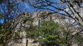
(6) Follow it to the right. Admire the panoramic view of the Orgues site. At the end of the track, head down the access ramp
(7) When you reach the town centre, cross the road, then the park, and cross the bridge again on the left (S/E).
 Local authority
 Visorando Member
 Very difficult
 Easy
Easy 
