Between Rhue and the Dordogne

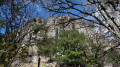
Via the Green Trail, you can admire the Orgues de Bort towering above you and head to the Saut de la Saule on the River Rhue. On the way back, you’ll head to the Ballastière Lake, situated at the confluence of the Rhue and the Dordogne, and walk alongside the Plantade housing estate, built during the construction of the dam. You’ll then return to the town centre, finishing at Place Marmontel.

Details

n°108673097
Creation:
Last update:
Last review:
–
  • Walking
    Activity: Walking
  • ↔
    Distance: 8.01 mi
  • ◔
    Average duration: 3h 55 
  • ▲
    Difficulty: Moderate

  • ⚐
    Back to start: Yes
  • ↗
    Ascent: + 302 ft
  • ↘
    Descent: - 299 ft

  • ▲
    Highest point: 1,493 ft
  • ▼
    Lowest point: 1,365 ft

Description of the walk

Start at Place Marmontel. Parking available on site or nearby.

Red signposting.

(S/E) Cross the bridge over the Dordogne, then first turn right then left. Cross the D922 to join the Green Trail.

(1) Take the Green Trail on the right and follow it all the way to the waterfall.

(2) Admire the view of Les Orgues, then continue along the Green Trail.

(3) Leave the path you’ll take later on your right and carry on straight ahead. Cross the bridge over the Rhue.

(4) Leave the path on the left for now, continue along the track and head towards a picnic area.

(5) Turn round.

(4) Take the path on the right, go under the bridge and head for the Saut de la Saule site.

(6) Retrace your steps and rejoin the Green Trail.

(4) Turn right onto it, heading in the opposite direction to the way out, and cross the bridge over the Rhue again.

(3) At the Cascade level crossing, turn left towards Champ Long.Arrive at Saint-Thomas.

(7) Cross the D922 carefully, follow it to the right, then head down to the left towards La Plantade via Avenue de la Girotte. At the junction, turn left to reach the Ballastière lake.

(8) Walk round the lake on the left-hand side, then, on the way back, first turn left then right to join the path running alongside the Dordogne.

(9) Walk past the Plantade housing estate and head back up towards the D922 road, which you’ll reach at a roundabout.

(10) Go round the roundabout on the left and continue to No. 1150.

(11) Cross the road to join Rue de la Marche. Turn left, then right to rejoin the Piste Verte.

(2) Turn left and return, following the same route as on the way out, to Place Marmontel (S/E).

Waypoints

  1. S/E : mi 0 - alt. 1,414 ft - Place Marmontel
  2. 1 : mi 0.21 - alt. 1,473 ft - Green Trail
  3. 2 : mi 0.97 - alt. 1,453 ft - Junction for the out-and-back route. Lovely view of the Orgues
  4. 3 : mi 1.51 - alt. 1,450 ft - Junction for the out-and-back route. Level crossing
  5. 4 : mi 1.92 - alt. 1,404 ft - Junction for the out-and-back route. Access to the site - Rhue (rivière) - Affluent de la Dordogne
  6. 5 : mi 2.34 - alt. 1,493 ft - Picnic area
  7. 6 : mi 3.11 - alt. 1,467 ft - The Saut de la Saule - Rhue (rivière) - Affluent de la Dordogne
  8. 7 : mi 4.7 - alt. 1,421 ft - Road - Rhue (rivière) - Affluent de la Dordogne
  9. 8 : mi 5.18 - alt. 1,375 ft - Ballastière Lake
  10. 9 : mi 6.19 - alt. 1,378 ft - La Plantade housing estate - Dordogne (fleuve)
  11. 10 : mi 6.58 - alt. 1,414 ft
  12. S/E : mi 8.01 - alt. 1,414 ft - Place Marmontel

Notes

Water point at the start of the Green Trail.

Secured section on the trail.

Path on the right after the bridge below the trail leading to the Saut de la Saule.

Worth a visit

The Green Trail and its superb view of the Orgues de Bort.

(6) The Saut de la Saule.

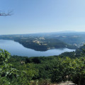
(8) The Ballastière lake.

(9) The Plantade estate.

Other walks in the area

For more walks, use our search engine .

The GPS track and description are the property of this route's author. Please do not copy them without permission.