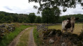
Bort takes its magnificent landscapes from the Auvergne
The town lies on a coal seam dating back to the Palaeozoic era. The upheavals of the Alpine orogeny fractured the Massif Central and created the tectonic fault which, running through the area, led to the formation of the volcanoes or ‘puys’.
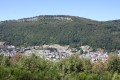
The Puy de Bort stands at an altitude of 860 metres and is a trigonometric point on the Méridienne route.
The Orgues de Bort stretch for two kilometres in length and rise to a height of 80 metres. The Orgues, formed from a phonolite flow originating in the Cantal, majestically overlook the town nestled at their foot at an altitude of 430 metres.
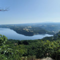
From the top of the Orgues, visitors marvel at the exceptional view they offer over the Auvergne and Limousin regions.
The view takes in a vast panorama: the imposing Sancy Massif, the Cantal Mountains, the Artense Plateau (or ‘land of stones’), and the splendid glacial valleys with their wide, flat bottoms and steep slopes.
(Extract from the Bort-les-Orgues town hall website).
Origins
The village was originally called Bort and took the name Bort-les-Orgues in 1919. In the time of Julius Caesar, the region was inhabited by the Lemovices tribe, whose name is the origin of the names Limousin and Limoges. After coming under the control of the Visigoths, the Limousin region was reclaimed by the Frankish kings in the 7th century. In the 12th century, the Limousin briefly came under English rule. In 1889, the town of Bourganeuf became the first in France to have electricity. The Limousin region was officially established in 1972.
In the Auvergne, Bort is renowned for its magnificent landscapes. The town lies on a coal seam dating from the Palaeozoic era. At an altitude of 860 metres, stretching two kilometres in length and rising 80 metres high, the ‘orgues’ – formations of uncertain age resulting from a phonolite flow originating in the Cantal – majestically overlook the town nestled at their foot (430 m). The view takes in a vast panorama: the imposing Sancy massif, the gigantic mass of the Cantal, the Artense plateau or ‘land of stones’, and the splendid glacial valleys with their wide, flat bottoms and steep slopes.
Bort’s motto is: ‘Extremis finibus Lemovicensium et Arvernorum’ (at the borders of the Limousin and Arverni territories). The Romans, having defeated the Gauls, built a road between Clermont-Ferrand and Limoges which passed through Bort.
Christian rule replaced Roman rule and left a string of superb Romanesque churches along the Dordogne. The Benedictines founded a priory in the 10th century. The most famous of them, Pierre de Balzac (late 15th century), extended the church at Bort, had a bridge built over the Dordogne and installed a clock. Consequently, the church at Bort, built between the 12th and 15th centuries, combines Romanesque and Gothic styles. It is dedicated to the twin patron saints Saint Germain, Patriarch of Constantinople, and Saint Remède, Bishop of Gap. The relics of these two prelates are said to have been brought back from Constantinople during the Fourth Crusade (1204). Among the Crusaders were undoubtedly two knights from the illustrious Bort/Lestrange family, who, in 1370, abandoned their Château de Ribeyrolle in favour of that of Pierrefitte.
Bort gained its independence from the authority of its priors rather late: the consular institutions were not established until the end of the Middle Ages. The inhabitants obtained from Charles VII the right to build fortifications, a project which was undertaken in 1438. With the return of peace, activity resumed; castles were built, such as Pierrefitte, which still retained a medieval appearance, and Val, heralding the Renaissance. The Wars of Religion ravaged the region in the 16th century; Bort was visited by the Huguenots and no doubt paid a ransom to avoid being pillaged (1569).
Modern era
In Year XI, Bort merged with Saint-Thomas, which until then had been part of the department of Cantal.
Bort, which had been part of the Diocese of Limoges until 1801, benefited from the generosity of Intendant Turgot, which saw it connected directly by road to the capital of Limousin (late 18th century).
At that time, the markets flourished. Traditionally a trading town, Bort transformed itself into a manufacturing town in the 19th century. Admittedly, manufacturing was not a new activity. As early as the 14th century, clog-makers took advantage of the abundance of forests to produce clogs. In the 13th century, wine-producing regions – which were major consumers of casks and barrels – sourced their timber from Haute Corrèze; the River Dordogne carried numerous convoys of logs. Three industries in particular employed a large workforce: hat-making (the Mègemond brothers’ firm employed 400 people around 1890), silk reeling at the waterfall (where 700 women worked at the end of the Second Empire) and leatherworking. For centuries, the small-scale tanners of Bort soaked their hides in the River Dordogne. They subsequently fell victim to industrial consolidation, which fuelled the growth of the Tanneries de Bort in the 20th century. In 1932, a leather goods manufacturer, S.O.C.O., completed the transformation of Bort into ‘a city of leather’. A textile manufacturing firm, established in the 1970s, also provided numerous jobs until recent years (the Bidermann Group had a production site in the town). This flourishing industrial activity led to an increase in Bort’s population, who settled along the main transport routes (the station district, for example).
A major effort was made at the end of the 20th century to develop a tourist hub around the reservoir (campsite, lodges, swimming pool, jetties), in conjunction with the commune of Lanobre in the Cantal, whose population and economic activity had grown due to its proximity to Bort.
At the start of the 21st century, Bort had not found a sufficient economic driver to counteract its deindustrialisation.
Economy
The town derives its income from the nearby dam and from tourism linked to the reservoir.
Tanneries, of which the ‘Le Tanneur’ brand is the last remaining example, were once the town’s main source of prosperity.
The town is home to a production site belonging to the Plastic Omnium Group’s environmental division.
Places and monuments
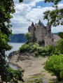
Val Castle.
The former 19th-century market halls. They have been listed as historic monuments since 25 March 1965.
The Bort-les-Orgues dam, a concrete arch-gravity dam.
Val Castle, rising from one of the banks of the reservoir created by the dam, is situated in the municipality of Lanobre in the Cantal department, but has been owned by the municipality of Bort-les-Orgues since the dam’s construction.
The volcanic phonolite massif shaped like organ pipes, similar to basaltic columns.
The Saut de la Saule: impressive canyons on the River Rhue, upstream of the railway bridge spanning the river.



 Country:

 City:
City:






 Visorando Member
 Very difficult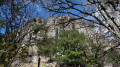
 Easy
Easy