Country:

 City:
City:


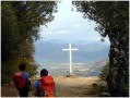
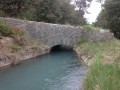
Park in Peyruis, Avenue Saint-Roch at the exit of the village towards Manosque. Leave your vehicle in the small square.
(S/E) Take theGR® opposite, continue to the signpost: Vallon de Beuvon.
(1) Turn left and cross the stream, continue to the next signpost: La Repentance.
(2) Turn right towards the Col de Bane, a little further on, turn right onto thePR®, marked in yellow, and follow it until you reach the Col de Bane.
(3) Turn left and follow the signs for Ganagobie Village. Begin the descent to reach a new crossroads at a place called l'Étang.
(4) Continue left and follow a path that is initially flat and then climbs slightly to reach the multi-way junction with Chemin de Monticelli. You will see this sign here.
(5) Turn right onto theGR®655Dand you will soon see another signpost for the Ganagobie Plateau.
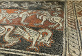
(6) Continue left on theGR® and at the next crossroads, turn left to reach the Ganobie Monastery.
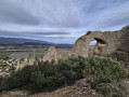
(7) Walk alongside the monastery, then turn north-east and then north to reach the ruined village of Villevielle. Turn left to return to the Plateau de Ganagobie sign.
(6) Turn right to retrace your steps along theGR® and then reach the crossroads with the Chemin de Monticelli signpost.
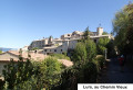
(5) Keep right on theGR®655Dmarked in white and red and follow an easy descent to the village of Ganagobie.
(8) Here you have two options:
- turn right and continue on theGR®, descend and reach the canal,
- take the road on the left, which is the route shown on the map, and also reach the canal.
(9) Take theGR® again and walk uphill to return to the Repentance signpost.
(2) Take the path you came on to return to the car park at Placette Avenue Saint-Roch in Peyruis (S/E).

 . Mainly forest tracks, so no difficulty. The route around the monastery is unclear. Turn left as soon as you cross the cobbled path called "Chemin de Forcalquier" which leads to the monastery. 5½ hours' walk.
 Visorando Member
 Easy
Easy