


A few water sources are indicated in the stage descriptions (after marker 89 (3) on the first stage, when crossing the Ravin de la Lavanche stream on the ascent to the Col de Crousette, or after the hamlet of La Colle on the second stage).
This two-day hike requires you to bring all the necessary equipment for a high-altitude bivouac.
This hike should be avoided in the event of uncertain weather conditions.
Ascent of Mont Mounier from the Aygue Blanche bridge


This two-day hike takes you up to Mont Mounier, a major and isolated peak in the Mercantour, via a circular route.
After a fairly short first stage, an early morning ascent to the summit will allow you to enjoy clearer weather and perhaps spot a few chamois and marmots.
The descent to the Pont d’Aygue Blanche will be very long (a 1,800-metre descent). Don’t hesitate to set off the day before from the Altifsurface to balance out the route.
Details
Creation:
Last update:
Last review:
-
 Activity: Walking
 -
 Distance: 14.36 mi
 -
 Average duration: 2 days
 -
 Difficulty: Difficult
 -
-
 Back to start: Yes
 -
 Ascent: + 5,935 ft
 -
 Descent: - 5,919 ft
 -
-
 Highest point: 9,226 ft
 -
 Lowest point: 4,127 ft
-
 Country:
France
Country:
France
-
 Areas: Alps, Mercantour
 -
 City:
Péone (06470)
City:
Péone (06470) -
 Start/End: N 44.114885° / E 6.922294°
 -


 Hour-by-hour weather
Photos
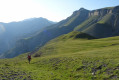
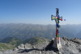
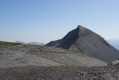
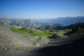
Stages of the route
This route needs several days, find the details below:
Notes
This route passes through a protected area, which may be subject to special regulations:
Worth a visit
The main attraction of this hike lies in the numerous viewpoints stretching from the Col de Crousette to Mont Mounier, which offers a 360° panorama of the Mercantour massif.
Reviews and comments
4.8 / 5
Based on 3 reviews
Reliability of the description
5 / 5
5 / 5
Ease of following the route
4.3 / 5
4.3 / 5
Route interest
5 / 5
5 / 5

Bastigraine
Overall rating : 4.7 / 5
Date of your route : Jul 27, 2026
Reliability of the description : ★★★★★ Very good
Ease of following the route : ★★★★☆ Good
Route interest : ★★★★★ Very good
Very busy route : No
A hike completed in late July 2026, in one go, starting from Valberg. I was looking for an alternative route up Mont Mounier via a side I wasn’t familiar with and with a greater elevation gain. So this was exactly what I was looking for (even though I didn’t get to enjoy the bivouac experience).
The ascent to the Col de Crousette was completely deserted; I didn’t come across a single hiker (unlike on the Petit Mounier/Mounier section and the descent towards La Colle). There were herds of sheep and mountain dogs above marker 89.
The path was quite faint, often non-existent above marker 89. I should have taken the route map and description with me so I could navigate more accurately than I could with just my IGN map.
Beautiful scenery and varied landscapes, the chance to spot chamois below the Col de Crousette, the panoramic view from the Mounier… it was a real pleasure. Thank you for introducing me to this route.
Machine-translated

User 3987306
Overall rating : 4.7 / 5
Date of your route : Jul 01, 2025
Reliability of the description : ★★★★★ Very good
Ease of following the route : ★★★★☆ Good
Route interest : ★★★★★ Very good
Very busy route : No
A wonderful tour. The landscapes are very varied, alternating between grasslands and carpets of broom on the south-facing slopes, high mountains, alpine pastures and cool forests on the north-facing slopes. There are several water sources, although they were dry at the start of the route when I was there (29 June). Fortunately, there is a watering hole fed by a spring near the hut close to the bivouac. The view at dusk from the end of the Montagne de l'Estrop is one of the most beautiful and unobstructed views you can get from a sheltered bivouac.
It's a good idea to start from Valberg, or more precisely from the altiport, to get your bearings. Having started the hike late on the first day (3.30 p.m.), the suggested route was ideal for me.
The travel times indicated are fairly reliable.
One thing to note, however: the passage from Petit Mounier to the summit requires sure footing, as the path runs along a narrow ridge.
Machine-translated
Potman
Overall rating : 5 / 5
Date of your route : Aug 22, 2020
Reliability of the description : ★★★★★ Very good
Ease of following the route : ★★★★★ Very good
Route interest : ★★★★★ Very good
Very busy route : No
Thank you very much for this superb hike; the campsite is in an ideal location, and the route description is very comprehensive. We cut the return leg short as it seemed less interesting to us from point 7, La Colle.
Kind regards
Machine-translated
Other walks in the area
From the Aygue Blanche bridge to Montagne de l’Estrop
 Visorando Member
3.69 mi
+3,209 ft
-0 ft
4h 30
Difficult
Visorando Member
3.69 mi
+3,209 ft
-0 ft
4h 30
Difficult
 Departure from Péone (Alpes-Maritimes)
This hike is the first stage of a two-day circular route leading to the ascent of Mont Mounier.
Starting from the Pont d’Aygue Blanche near Péone, you’ll climb gradually towards the small plateau of the Montagne de l’Estrop, where you can camp in sheltered conditions. A stage through deciduous woodland and mountain pastures at the foot of the rocky ridge of the Montagne de l’Alp.
Tête de Méric
 7.66 mi
+2,858 ft
-2,861 ft
6h 00
7.66 mi
+2,858 ft
-2,861 ft
6h 00
 Moderate
Departure from Péone (Alpes-Maritimes)
Moderate
Departure from Péone (Alpes-Maritimes)
A lesser-known and less-frequented secondary summit of the Mercantour, located above the pretty village of Péone, the Tête de Méric nevertheless offers a magnificent panorama stretching from the Tours du Lac d'Allos to the peaks of the Vallée des Merveilles, via the Val d'Entraunes and the Gorges de Daluis. The final ridge allows you to gradually discover this panorama.
The Tour de Roya via the Green Trail in Valberg
 Local authority3.36 mi
+768 ft
-761 ft
2h 15
Local authority3.36 mi
+768 ft
-761 ft
2h 15
 Easy
Departure from Péone (Alpes-Maritimes)
Easy
Departure from Péone (Alpes-Maritimes)
Starting from the Valberg Golf Club car park, a short (1h40) but intense trail marked as a Green Trail. Lac de Beuil invites you to take a break; you’ll enjoy the return via the Sentier Yoga on the balcony path.
Tour du Chastellan
3.22 mi
+623 ft
-614 ft
2h 00
Easy
Departure from Péone (Alpes-Maritimes)
The walk takes place largely through woodland. Personally, I prefer to do it in the morning in spring, as it isn’t too hot yet.
Dôme de Barrot, Cime du Pra and Tête de la Colombière
 14.22 mi
+3,041 ft
-3,018 ft
9h 10
Difficult
Departure from Péone (Alpes-Maritimes)
14.22 mi
+3,041 ft
-3,018 ft
9h 10
Difficult
Departure from Péone (Alpes-Maritimes)
A walk starting from Valberg that crosses the resort’s ski area and a wilder section towards the end. From the top of these peaks, a remarkably colourful landscape unfolds below, featuring the characteristic red rocks of the Cians and Daluis. You can also admire the 360° views of the peaks (Mont Saint-Honorat on one side, Le Mounier and the Cime Nègre above Valberg on the other, etc.)
Walk to see marmots from Col de l'Espaul
 3.23 mi
+702 ft
-709 ft
2h 05
Easy
Departure from Péone (Alpes-Maritimes)
3.23 mi
+702 ft
-709 ft
2h 05
Easy
Departure from Péone (Alpes-Maritimes)
A short, very easy trail, ideal for a family walk, in an area frequented by marmots.
Mont Mounier from the Col de l'Espaul
 10.80 mi
+3,681 ft
-3,668 ft
8h 10
Difficult
Departure from Péone (Alpes-Maritimes)
10.80 mi
+3,681 ft
-3,668 ft
8h 10
Difficult
Departure from Péone (Alpes-Maritimes)
Mont Mounier (2,817m) is one of the must-see peaks in the Alpes Maritimes: magnificent panoramas, 360° views from the summit, a beautiful ridge at the end, a fairly steady and easy 1,100m climb with views of the summit almost all the way.
Mont Mounier as seen from the Montagne de l’Estrop
10.63 mi
+2,703 ft
-5,919 ft
7 hrs
 Very difficult
Departure from Péone (Alpes-Maritimes)
Very difficult
Departure from Péone (Alpes-Maritimes)
This hike forms thesecond stage of the ascent of Mont Mounier.
Starting from the Montagne de l’Estrop, you’ll climb to the Col de Crousette for a beautiful view over the valley of the same name and the Haute-Tinée. You’ll then reach the Mont Mounier ridge, which you’ll follow to the summit.
The descent takes you through the hamlet of La Colle before climbing back up towards the Tête de Charnaye, then down again towards the altisurface, and finally the final descent to the Pont d’Aygue Blanche.
For more walks, use our search engine .
The GPS track and description are the property of this route's author. Please do not copy them without permission.

