Le Pichaley via the Aulon Valley

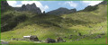
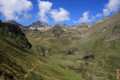
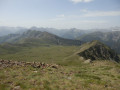
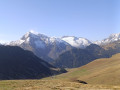
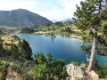
The Aulon Valley is a vast area of mountain pastures fed by the River Lavedan, which you’ll follow for much of the walk. Once you reach the summit, you’ll be treated to a magnificent view of the Néouvielle massif, its lakes and fir trees. Far less busy than the trails in Néouvielle, you’ll be able to enjoy this wild valley and a magnificent panorama of the Arbizon.

Details

3549782
Creation:
Last update:
Last review:
  • Walking
    Activity: Walking
  • ↔
    Distance: 7.83 mi
  • ◔
    Average duration: 7h 10 
  • ▲
    Difficulty: Difficult

  • ⚐
    Back to start: Yes
  • ↗
    Ascent: + 4,065 ft
  • ↘
    Descent: - 4,035 ft

  • ▲
    Highest point: 8,609 ft
  • ▼
    Lowest point: 4,619 ft

Photos

Description of the walk

Park in the hikers’ car park (around ten spaces), situated 50 metres before you reach the Granges de Lurgues (above Aulon). It is also possible to park a little further up, but the car park is usually occupied by residents. There is a spring of very fresh drinking water at the upper car park (you’ll no doubt appreciate it on your return).

(S/E) From the car park, take the path on the left which leads gently uphill away from the barns, heading north-west, through the hazel trees. Ten minutes later, the slope becomes steeper and then, in open country, the path crosses a stream to reach a fork (elevation 1553).

(1) At the fork, ignore the path on the right leading towards Arbizon (signposted). Continue down the valley and cross the torrent.

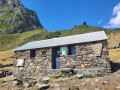
(2) After crossing the torrent, follow the path along the left bank of the Lavedan to reach the Cabane d’Auloueilh (1,857 m).

(3) From the hut, rejoin the path which climbs through the mountain pastures and heads deeper into the valley towards the north-west. Continue along the left bank of the Lavedan.

(4) From the spring, head straight south-west; the final slope then steepens as you reach the Col de Bastan (2,481 m).

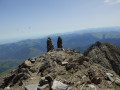
(5) From this pass, if your legs are up to it, you can climb the Pichaley (2,626 m), heading due south. Allow 30 minutes to reach it via a path that runs along the ridge. Although never vertiginous, this path does require some care as the stones are loose and the ground is slippery.

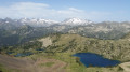
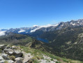
(6) The summit is flat and spacious. Enjoy the view of the Bastan Lakes below, directly to the west.
The descent follows the same path in the opposite direction back to (S/E).

Waypoints

  1. S/E : mi 0 - alt. 4,619 ft - Granges de Lurgues car park
  2. 1 : mi 0.67 - alt. 5,095 ft - Junction
  3. 2 : mi 0.99 - alt. 5,272 ft - Torrent
  4. 3 : mi 1.8 - alt. 6,089 ft - Cabane d'Auloueilh
  5. 4 : mi 2.9 - alt. 7,300 ft - Source: - Lavedan (rivière)
  6. 5 : mi 3.52 - alt. 8,133 ft - Col de Bastan (2440m)
  7. 6 : mi 3.83 - alt. 8,606 ft - Pichaley
  8. S/E : mi 7.83 - alt. 4,619 ft - Granges de Lurgues car park

Notes

Water can be obtained from the spring (4) and at the car park (E)

Shelter is available at the Cabane d’Aloueih, which is open to hikers (3)

Allow 7 hours for the round trip to Le Pichaley (6); 6 hours if you stop at the Col de Bastan (5)

The ascent, early in the season, from the starting point (4) can be tricky if there are snowfields. That said, when I checked the route in early July, there were none left.

Worth a visit

(3) The Aloueih Hut is occupied in summer by a shepherd, but part of it is open to hikers and properly equipped to provide shelter if needed (wood-burning stove, mattress, blanket). The stone enclosures, known as ‘courtaous’, are used to pen in livestock and feature a milking corridor.

It is possible to spend the night at the charming Refuge de Bastan.

In the Bigourdan dialect:
Cuyéu, cuyela, coeyla, courtau: a sheep pen in the high mountains.
Estibe, estive: high-altitude pasture.

Reviews and comments

4.7 / 5
Based on 2 reviews

Reliability of the description
5 / 5
Ease of following the route
5 / 5
Route interest
4 / 5
Loserkids64
Loserkids64

Overall rating : 4.7 / 5

Date of your route : Sep 16, 2023
Reliability of the description : ★★★★★ Very good
Ease of following the route : ★★★★★ Very good
Route interest : ★★★★☆ Good
Very busy route : Yes

You do indeed need to park 50 metres further down so as not to inconvenience local residents.

A very pleasant walk, not too strenuous, although you do need to be careful on the section between the pass and the summit of Pichaley.

Thanks for the route.

Machine-translated

danielfr40
danielfr40

Overall rating : 4.7 / 5

Date of your route : Jun 05, 2022
Reliability of the description : ★★★★★ Very good
Ease of following the route : ★★★★★ Very good
Route interest : ★★★★☆ Good
Very busy route : Yes

The Les Granges car park is reserved exclusively for local residents; there is a car park 50 metres further back for walkers
A lovely walk with superb views from the summit, snow-capped mountain ranges in early June, and the Lacs de l’Oule and de Bastan. There are lovely streams all along the way.
The path is easy and well-marked, with yellow markings up to the pass and a few cairns.
The climb to the summit isn’t difficult; you simply cross from one slope to the other to find sections of the path.
Thank you for mapping this route

Machine-translated

Other walks in the area

For more walks, use our search engine .

The GPS track and description are the property of this route's author. Please do not copy them without permission.