Circular routes between Col du Portet, Pichaley, Pic de Bastan and Port Bielh

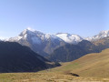
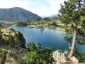
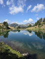
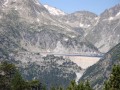
A superb figure-of-eight hike from the Col du Portet to Port Bielh via the Pic de Bastan. Outward journey along the ridges to the summit of Pichaley; return via theGR®10path running along the rim of Lac de l’Oule, passing a large number of lakes: Bastan, Bastanet, Port Vielh, l’Oule, etc.
This is an extension of the Portet–Bastan–Port Bielh–Portet circular walk, with the addition of a route along the ridges and up to Pichaley on the outward leg.

Details

n°22850793
Creation:
Last update:
Last review:
  • Walking
    Activity: Walking
  • ↔
    Distance: 11.26 mi
  • ◔
    Average duration: 8h 45 
  • ▲
    Difficulty: Very difficult

  • ⚐
    Back to start: Yes
  • ↗
    Ascent: + 4,134 ft
  • ↘
    Descent: - 4,124 ft

  • ▲
    Highest point: 8,839 ft
  • ▼
    Lowest point: 6,909 ft

Photos

Description of the walk

Park at Col de Portet.

(S/E) Set off along a steep track climbing north-west, then veering right at the top station of the Col ski lift. Follow it to its summit near the top station of the Aulon chairlift.

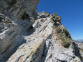
(1) Leave the track at a hairpin bend and take a path opposite. Climb straight up onto the ridge, where you’ll need to use your hands a little. You’ll reach a somewhat vertiginous viewpoint, then descend an easy scree slope. The path often follows the ridge, sometimes running along the left-hand side, passing directly below the Pic de Montarrouyes and then the Montarrouyet. Reach the Col de Jétas.

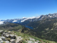
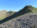
(2) Continue along the ridge to reach the summit of Pichaley without difficulty: there is a magnificent view of the many lakes from this summit.

(3) Continue along the ridge to descend to the Col de Bastan: this descent can be made via various routes, some of which are very steep if you choose your path unwisely.

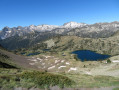
(4) Descend to the left towards the Upper Bastan Lake.

(5) Turn right to head towards the lake’s shores and reach the outlet.

(6) Turn right onto theGR®10C(red and white markings) and head back up to the junction marking the start of the circular loop you are about to complete.

(7) Turn right and head straight north. You’ll reach the Col de Bastanet.

(8) Climb the ridge to the left on a path that is easy at the start.

(9) The going gets trickier. You have the choice between sections of path along the edge – which are exposed – and small rocky chimneys: I preferred the latter. Reach the summit of the Pic de Bastan.

(10) Enjoy the magnificent 360° view, then begin the descent back to the Col de Bastanet.

(8) Turn left towards Lac de la Hourquette, rejoining the GR®.

(11) Leave theGR®10C, head left towards the west and climb up to the Hourquette de Caderolles.

(12) Descend on the other side towards Lac de Bastan or Port Bielh and reach a junction before arriving there.

(13) Follow the path on the left which descends to a hut situated near several small lakes.

(14) Carry on to the left to climb back up towards the Lacs de Bastanet. Pass the second and smaller of the two lakes and return to the junction where the circular route begins, rejoining the GR®.

(7) Turn right and walk along the Lac Supérieur.

(6) Head right, due south, and reach the Refuge de Bastan.

(15) Continue downhill alongside Lac du Milieu. Pass two small lakes and reach a junction where a rock on the ground is marked ‘Col du Portet’ to the left.

(16) Leave theGR®10C, turn left and continue the descent, following the path which heads first due south then south-east , offering stunning views of Lac de l’Oule.

(17) Join theGR®10and continue due south.

(18) Leave theGR®10, keep to the left, and join a track which you follow to the left as far as the Col de Portet (S/E).

Waypoints

  1. S/E : mi 0 - alt. 7,251 ft
  2. 1 : mi 0.65 - alt. 7,657 ft - Start of the ridge trail
  3. 2 : mi 1.79 - alt. 7,963 ft - Jétas Pass
  4. 3 : mi 2.11 - alt. 8,609 ft - Pichaley
  5. 4 : mi 2.39 - alt. 8,143 ft - Bastan Pass (2,475 m)
  6. 5 : mi 2.74 - alt. 7,533 ft - Towards the Upper Lake of Bastan
  7. 6 : mi 2.96 - alt. 7,415 ft - Outlet
  8. 7 : mi 3.16 - alt. 7,533 ft - Junction of the circular loop
  9. 8 : mi 3.9 - alt. 8,202 ft - Bastanet Pass (2,509 m)
  10. 9 : mi 4.13 - alt. 8,629 ft - Start of a difficult section
  11. 10 : mi 4.26 - alt. 8,825 ft - Pic de Bastan
  12. 11 : mi 5.02 - alt. 7,900 ft - Lac de la Hourquette
  13. 12 : mi 5.28 - alt. 8,104 ft - Hourquette de Caderolles
  14. 13 : mi 5.8 - alt. 7,592 ft - Lake Bastan or Lake Port Biehl
  15. 14 : mi 6.27 - alt. 7,274 ft - Port Bielh lakes. Mountain hut
  16. 15 : mi 7.95 - alt. 7,365 ft - Lac du Milieu – Bastan Refuge
  17. 16 : mi 8.45 - alt. 7,215 ft - Junction
  18. 17 : mi 9.12 - alt. 7,021 ft - Junction with the GR10
  19. 18 : mi 10.77 - alt. 7,136 ft - Ascent towards the track
  20. S/E : mi 11.26 - alt. 7,254 ft - Portet Pass

Notes

Water refill at the Bastan Refuge during the summer season and at the Oule Refuge (off the route).
Water must be purified or filtered from mountain streams outside the summer grazing season.
Shelters: Lude hut (14), Bastan Refuge (15) (summer season or part of the winter), Lude hut off the route from (17) via theGR®10. Walk alongside Lake Oule and the Oule Refuge (if open), Port Bielh shelter from (14).

This route passes through a protected area, which may be subject to special regulations:

Always be cautious and plan ahead when you're outdoors. Visorando and the author of this route cannot be held responsible for any accidents occurring on this route.

The GR® and PR® markings are the intellectual property of the Fédération Française de Randonnée Pédestre.

Reviews and comments

4.5 / 5
Based on 2 reviews

Reliability of the description
4.5 / 5
Ease of following the route
4 / 5
Route interest
5 / 5
manu33870
manu33870

Overall rating : 4.7 / 5

Date of your route : Sep 19, 2026
Reliability of the description : ★★★★★ Very good
Ease of following the route : ★★★★☆ Good
Route interest : ★★★★★ Very good
Very busy route : No

A lovely hike, with magnificent scenery amongst mountain passes, peaks and lakes.
A relatively physically demanding route if you want to complete it within the time indicated on the app. This time excludes breaks; allow an extra hour and a half if you take a few short breaks. According to the GPS on a watch from a very well-known brand..., the distance is 19.5 km.
We chose this route for the first day of our GR20 preparation, completing the circular route with a 14 kg rucksack.
Thanks for the route!

Machine-translated

danielfr40
danielfr40

Thank you for your review
The walk is classified as very difficult because of the distance and the elevation gain, but the trail itself isn’t particularly difficult; like the Carlit, the slippery sections are mostly of moderate difficulty.
But it depends on each person’s fitness level.

Machine-translated

Jimmy32
Jimmy32

Overall rating : 4.3 / 5

Date of your route : Aug 08, 2024
Reliability of the description : ★★★★☆ Good
Ease of following the route : ★★★★☆ Good
Route interest : ★★★★★ Very good
Very busy route : No

This walk certainly lives up to its ‘very difficult’ rating.
Please note: you’ll need to set off very early to start from the Col du Portet (closed from 8.30 am in summer)
Beautiful panoramic views but challenging descents, particularly the one down from Pichaley (risk of falls due to slippery, stony and dusty terrain).
We didn’t climb the Pic du Bastan.
Well worth doing for the panoramic views and vistas over the lakes and the Neouvielle massif. However, be prepared for a very difficult hike, except for the final section (from the Bastan refuge to the Col du Portet on the return journey: almost entirely flat).
The only source of drinking water on the route is at the Bastan refuge, which is 1 hour 50 minutes from the finish.

Machine-translated

Other walks in the area

For more walks, use our search engine .

The GPS track and description are the property of this route's author. Please do not copy them without permission.