Cap de Pède

A short hike for an afternoon in the forest before reaching the summit with excellent views.

Details

45548329
Creation:
Last update:
Last review:
  • Walking
    Activity: Walking
  • ↔
    Distance: 2.98 mi
  • ◔
    Average duration: 2h 25 
  • ▲
    Difficulty: Moderate

  • ⚐
    Back to start: Yes
  • ↗
    Ascent: + 1,194 ft
  • ↘
    Descent: - 1,194 ft

  • ▲
    Highest point: 5,295 ft
  • ▼
    Lowest point: 4,101 ft

Description of the walk

Park in the small car park by the side of the road.

(S/E) Set off along the forest track, pass the mast by about a hundred metres and reach the bottom of the valley.

(1) Leave the track and follow a small path on the right which leads up to another track further on. Turn right until you reach a path branching off to the left.

(2) Take a sharp left-hand bend to follow a track and reach a multi-way junction in the forest.

(3) Take the second path on the right, which quickly emerges from the forest and climbs straight up towards a small pass on the ridge.

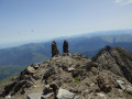
(4) Turn left and you’ll soon reach the summit of Cap de Pède.

(5) Enjoy the view, then retrace your steps along the ascent route to return to the car park (S/E).


Waypoints

  1. S/E : mi 0 - alt. 4,101 ft - Car park
  2. 1 : mi 0.46 - alt. 4,337 ft - Exit via the forest track
  3. 2 : mi 0.87 - alt. 4,692 ft - Path on the left
  4. 3 : mi 1.09 - alt. 4,865 ft - Crossroads
  5. 4 : mi 1.33 - alt. 5,259 ft - Pass
  6. 5 : mi 1.49 - alt. 5,295 ft - Cap de Pède
  7. S/E : mi 2.98 - alt. 4,101 ft - Summit of Cap de Pède

Reviews and comments

4.1 / 5
Based on 4 reviews

Reliability of the description
4.3 / 5
Ease of following the route
3.8 / 5
Route interest
4.3 / 5
User 26069768

Overall rating : 4 / 5

Date of your route : Jul 01, 2025
Reliability of the description : ★★★★☆ Good
Ease of following the route : ★★★★☆ Good
Route interest : ★★★★☆ Good
Very busy route : No

A great app for discovering new routes

Machine-translated

flegall33
flegall33

Overall rating : 4.3 / 5

Date of your route : Jan 19, 2025
Reliability of the description : ★★★★★ Very good
Ease of following the route : ★★★★☆ Good
Route interest : ★★★★☆ Good
Very busy route : No

Hike completed on 19/01/25 with my son.
The climb starts straight away (but gently) and gradually gets steeper. The route is lovely and offers magnificent views of the Pyrenees. Watch out for patches of black ice on the path!
The reward at the summit is the superb view over the Pla d’Adet.
The round trip takes around 2 hours.

Machine-translated

roche laurent
roche laurent

Overall rating : 4.7 / 5

Date of your route : Aug 12, 2024
Reliability of the description : ★★★★★ Very good
Ease of following the route : ★★★★☆ Good
Route interest : ★★★★★ Very good
Very busy route : No

We went on this walk on 12 August 2024. We particularly enjoyed this walk as three-quarters of the route is shaded. Furthermore, it’s very quiet; we only came across one family. The signposting isn’t always very clear at the start, but it’s much better in the middle and towards the end of the route. However, we had no problems using the Visiorando app. Finally, this walk offers some magnificent scenery!

Machine-translated

Amaria
Amaria

Overall rating : 3.3 / 5

Date of your route : Mar 06, 2024
Reliability of the description : ★★★☆☆ Average
Ease of following the route : ★★★☆☆ Average
Route interest : ★★★★☆ Good
Very busy route : No

The route was hard to follow in winter; a compass was essential. The only bright spot was that, with the snow, the teenagers had a brilliant time on snowshoes. The ridge climb was difficult with no marked path. The GPS coordinates weren’t much use.
But we still had a brilliant time thanks to the snow
We’ll do it again in summer to see the difference

Machine-translated

Other walks in the area

For more walks, use our search engine .

The GPS track and description are the property of this route's author. Please do not copy them without permission.