The Vosges version of the Pain de Sucre, and the Balcon du Mettey

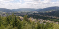
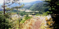
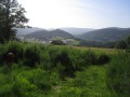
In a little-known part of the Vosges mountains, you can take in views of the Bouchot valley over a relatively short distance, thanks to the three viewing points, two of which are fully secured. The paths are shaded and well maintained by the Club Vosgien.

Details

101095616
Creation:
Last update:
Last review:
  • Walking
    Activity: Walking
  • ↔
    Distance: 1.35 mi
  • ◔
    Average duration: 0h 55 
  • ▲
    Difficulty: Easy

  • ⚐
    Back to start: Yes
  • ↗
    Ascent: + 312 ft
  • ↘
    Descent: - 312 ft

  • ▲
    Highest point: 2,031 ft
  • ▼
    Lowest point: 1,781 ft

Photos

Description of the walk

From the D23f towards Sapois, head up the Route du Mettey past the honey farm and continue to the end of the tarmac road, where parking spaces are available.

Red Disc signposting

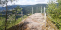
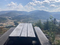
(S/E) Take the path that continues from the road, following the markings towards La Roche du Mettey and its viewpoint over the Bouchot Valley (river). There is a picnic table on this secure terrace.

(1) Walk back a short way to the crossroads. Ignore the path leading uphill to the right and head straight on towards the Pain de Sucre. You’ll come to a wooden bench; continue to the secure viewing point about ten metres further on.

(2) Continue along the path to the Balcon du Mettey, the third viewpoint overlooking the Bouchot Valley.

(3) Take care with children as this viewpoint is not fenced off. There is a picnic table here. Continue along the path and climb up to the left through the rocks to reach, deep in the forest, the summit of the Mettey at an altitude of 622 metres.

(4) Begin the descent along a stony path until you reach a footpath.

(5) Turn right onto this path, which leads directly back to the car park (S/E).

Waypoints

  1. S/E : mi 0 - alt. 1,791 ft - Car park at the end of the tarmac road
  2. 1 : mi 0.43 - alt. 1,844 ft - Picnic table and viewpoint - Roche du Mettey
  3. 2 : mi 0.6 - alt. 1,883 ft - Bench - Le Pain de Sucre (Bugey)
  4. 3 : mi 0.9 - alt. 1,939 ft - Picnic table and viewpoint - Balcon du Mettey
  5. 4 : mi 0.98 - alt. 2,031 ft - High point in the forest - Le Mettey (622 m)
  6. 5 : mi 1.2 - alt. 1,791 ft - Path junction
  7. S/E : mi 1.35 - alt. 1,795 ft - Car park at the end of the tarmac road

Notes

Wear suitable footwear as the paths are treacherous.

There is no water along the route.

Please take care with children when approaching the viewing points.

Worth a visit

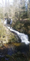
Saut du Bouchot Waterfall.

Other walks in the area

For more walks, use our search engine .

The GPS track and description are the property of this route's author. Please do not copy them without permission.