Country:

 City:
City:


Start the walk at the Saut du Bouchot car park.
Red Disc markings
(S/E) Follow the road towards the bend and take the second track on the right towards Les Roches Saint-Jacques. At the junction, by a meadow, keep to the right until you reach a farm.
Red Triangle markings
(1) Turn right and follow the road. Cross the Ruisseau de Peute Goutte to reach a junction.
Green Triangle Signpost
Turn left twice as you head uphill. Keep left and, after passing L’Ormété, you’ll reach a crossroads. Take the track leading uphill and follow it to the Faing Berrey farm.
(2) Follow the path to the right, then take the road opposite until you reach the house. Then go up the wide track to the right. Next, veer off in that direction to follow a level path, cross a stream and reach a road at Haut des Kerrieux.
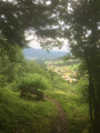
(3) Head straight ahead along a gently ascending track. After the houses, turn left and continue straight on until you reach a pass, with a bench a few metres before it where you can enjoy the view.
(4) Head down to the right along a path that becomes a small road leading to the Col de Fouchure.
(5) Head straight ahead towards La Piquante Pierre until you reach the next junction.
Blue Saltire signpost
(6) Turn left towards the stream and cross it. Then take a right-hand bend, followed by two left-hand bends, to reach a viewpoint.
(7) Continue uphill to reach a fork in the road. The signposting has changed compared to the IGN maps. Follow the Blue Saltire/Red Diamond trail to the right towards La Piquante Pierre. Then ignore two paths leading down to the left to stay at the edge of the forest and reach a track.
(8) Carry on straight ahead. At the next crossroads, turn right and enter the forest. Then follow the path to the right towards the summit (marked on the ground but not on IGN maps).
(9) Enjoy the view, then follow the wide ridge path as it continues. You’ll come to a three-way Fork in the road.
(10) Follow the path to the right until you reach the Col de Menufosse car park.
(11) Carry on straight ahead, skirting the forest, then keep to the right until you reach the second junction.
Blue Ring markings
(12) Head downhill and carry on straight ahead to the houses at Les Moinats. Follow the access road and, at its end, turn right towards the Col de la Croix des Moinats: there is a memorial in honour of the Moroccan goums.
Red Diamond signpost
(13) Cross the D34 very carefully to take the path to the right of the monument. Pass the first house, take a right-hand bend and arrive at a second house. Continue straight on along the path to Le Spechey.
(14) Head up to the left towards the Col des Hayes. When you reach the road, follow it to the left until you reach the pass.
(15) Follow the wide track to the right towards Haut du Roc. Ignore a track on the right and walk along a tarmac section until you reach a picnic table and the forest.
(16) Stay on the track and continue to the Tongoutte junction.
Blue Cross signposting
(17) Turn left then right onto a steeply sloping path towards the Haut du Roc. Join the track again and follow it to the right as far as the cross, the mast and the viewpoint.
(18) Then return to the track and turn right towards the Tables de Charlemagne. Pass these on your left, then take a path on the right.
Red Ring markings
Then keep to the right until you reach a holiday camp.
(19) Turn left, ignoring a path that descends to the right, and continue along the track. After a section on tarmac, take a left-hand bend and follow the track to the hairpin bend.
Yellow Saltire signpost
(20) Turn right onto a level path until you reach a viewpoint with a bench.
(21) Carry on, ignoring a path leading down to the left, until you reach another Fork in the road.
Green Ring signpost
Climb up, then keep to the left until you reach a viewpoint and an orientation board.
(22) Continue along the path. At the stream, head down to the left until you reach the path marked with a Yellow Cross.
Yellow Cross signposting
Keep level to the right until you reach the next junction.
(23) Head down to the end of the path.
Red Triangle markings
Turn left, go round a bend, then take the second path on the left. Turn left again and go round another bend. There is a slight difference in the signposting compared to the IGN maps. You’ll come to a rock and a viewpoint.
(24) Continue the descent. When you reach the road, turn right. Cross the stream and continue to the departmental road.
Blue Saltire Signpost
(25) Turn right, then immediately left, and right again to reach a Fork in the road.
No signposting
Carry on straight ahead.
Yellow Ring signpost
Turn left towards La Roche Plate and its panoramic views.
(26) Enjoy the view, then head back up towards the road, following the path.
Blue Diamond markings
Follow it down to the crossroads.
No markings
Keep to the right and round the bend. Then carry on straight ahead until you reach the ridge in the forest, on a track.
Red Diamond markings
(27) Head down to the left until you reach the crossroads.
Red Triangle markings
(28) Climb slightly to the right before the path levels out again. Ignore a junction. Then keep left until you reach a road.
(29) Head downhill. The shortcut shown on IGN maps is closed. Follow the red markings, then take the shortcut on the left. Cross the road once, then follow it to the right. After the hairpin bend, keep to the right, then take the path on the left. Continue downhill straight ahead until you reach the school and the sports ground. Carry on to the right towards the Chapelle Saint-Del.
(30) Return to the sports ground.
Unmarked
Follow the road and turn right. Cross the D23f carefully to take the path on the other side to the left. Continue to the end.
Red Disc markings
(31) Follow the track.
Yellow Ring signpost
Then head up to the right towards the Roche du Mettey. Then keep left towards this rock and its viewpoint.
Red Disc signpost
(32) Return to the junction and carry on straight ahead to the Pain de Sucre viewpoint.
(33) Carry on, then cut across a track towards the Balcon du Mettey.
(34) Take in this final view and climb a little further to reach the summit. Head back down, continue straight ahead and keep left three times towards the Saut du Bouchot. You’ll come to a picnic table.
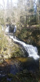
(35) Carry on to the right, then turn left onto a steeper path towards the waterfall. Take in the view of the waterfall, then head back up to the right towards the car park (S/E).

 Visorando Member
 Moderate
 Easy
Easy