


MI.L

 Visorando Member
 Premium user
 - Location: Cognin (73160)
- Gender: man
Sign up:
Published route(s)
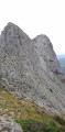
 The Pech de Bugarach via the shortest route
 4.22 mi
 +1,985 ft
 -1,959 ft
 3h 40
3h 40
 Moderate
 Departure from Bugarach (Aude)
It's not the most interesting route in the massif, but it's the shortest way to quickly reach the summit of the famous site that became legendary in 2012, the Pech de Bugarach, the mysterious highest point of the Corbières massif, a foothill of the Pyrenees and a landmark for griffon vultures, which you're sure to spot.
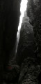
The Golet de l'Agneau via Plainpalais
 2.89 mi
+2,165 ft
-2,165 ft
3h 15
2.89 mi
+2,165 ft
-2,165 ft
3h 15
 Difficult
Departure from Les Déserts (Savoie)
Difficult
Departure from Les Déserts (Savoie)
A short but very interesting hike featuring a continuous steep slope and no easy sections. Undertaken in late October: ice and light snow in the chimney and freezing fog at the summit. Exit the forest to the foot of the cliff and walk up an unstable scree slope. Passage across the cliff is well-cabled and sheathed in plastic (slippery grip with gloves but very comfortable bare-handed in summer). Hike not recommended for young children.
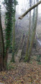
Col du Crucifix and Col Saint-Michel from Cognin
 10.25 mi
+2,638 ft
-2,657 ft
7h 00
Moderate
Departure from Cognin (Savoie)
10.25 mi
+2,638 ft
-2,657 ft
7h 00
Moderate
Departure from Cognin (Savoie)
From the town to the mountains without a car. A long but gently sloping walk.
After leaving the last houses of Cognin, the first part takes you through fields, streams, cows, horses and apple trees; it is only after Saint-Sulpice that you will enter the forest via the ancient Sardinian Way, which, in the 16th century, replaced the Roman road from Vienne to Milan (50 BC) – a route you will follow in part on your return from the Col Saint-Michel.
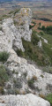
Roque Sestière and Saint-Siméon from Boutenac
 5.17 mi
+669 ft
-666 ft
3h 00
5.17 mi
+669 ft
-666 ft
3h 00
 Easy
Departure from Boutenac (Aude)
Easy
Departure from Boutenac (Aude)
This sunny and windy trip will take you to the heart of the Boutenac National Forest, better known for its wine than for its hikes. In a setting that smells of pine and rosemary, discover the cave and the Chapel of Saint-Siméon, with a fresco depicting its history, its life and its work. Then head to the rocky barrier of Roque Sestière, the highest point of the Boutenac massif, a landmark for birds of prey and an area where the Cers wind has left no chance for vegetation.
Montpenery and La Roche Trouée
 3.57 mi
+367 ft
-361 ft
2h 00
Easy
Departure from Boutenac (Aude)
3.57 mi
+367 ft
-361 ft
2h 00
Easy
Departure from Boutenac (Aude)
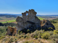
A lovely walk with the scent of the heath in the air. The walk starts at the recently rebuilt Boutenac washhouse, takes you past the church – which has also been renovated – and the remains of the tower. After a visit to the old village, head towards Mount Penery to enjoy a 360° view very close to the Roche Trouée, but be careful not to take any unnecessary risks: if you ask locals for directions, say ‘le Trou de la Lunette’.
Le Grand Charnier via the shortest route
 7.01 mi
+3,622 ft
-3,602 ft
6h 25
Difficult
Departure from La Chapelle-du-Bard (Isère)
7.01 mi
+3,622 ft
-3,602 ft
6h 25
Difficult
Departure from La Chapelle-du-Bard (Isère)
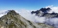
On the Allevard side, the Grand Charnier is the Belledones peak that must absolutely be added to your list of conquests. At 2,561 metres, it offers 360° views of all the peaks of the two Savoie departments and Isère. Here I suggest the shortest route to reach it, but ‘shorter’ means steeper, and is best suited to experienced hikers. A pleasant hike with a significant elevation gain that becomes technical over the final 300 metres; this summit sometimes remains snow-covered until the end of June.
Mont Grelle on the Chambéry side
 4.95 mi
+2,664 ft
-2,664 ft
4h 35
Moderate
Departure from Vimines (Savoie)
4.95 mi
+2,664 ft
-2,664 ft
4h 35
Moderate
Departure from Vimines (Savoie)
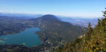
The Mont Grelle viewpoint offers breathtaking views of Lakes Aiguebelette and Bourget, Chambéry Airport and the Massif de l’Épine. A short walk with a respectable elevation gain, mostly in the shade. A steady climb with no easy stretches. This slope of Mont Grelle is a maze of forest tracks, EDF service roads and footpaths: please follow the directions in the on-site guide carefully.
From Bout du Monde to Trou de l’Enfer via the shortest route
 4.55 mi
+1,093 ft
-1,079 ft
3h 05
Moderate
Departure from Saint-Alban-Leysse (Savoie)
4.55 mi
+1,093 ft
-1,079 ft
3h 05
Moderate
Departure from Saint-Alban-Leysse (Savoie)
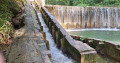
A rather daunting name for a gentle stroll. Le Bout du Monde is the remote, secluded corner of a Savoyard village, whilst the Trou de l’Enfer marks the source of a mid-mountain torrent, the Leysse. In this heatwave, stay in the shade and walk alongside the torrent. Enjoy the cool, damp microclimate. To avoid getting lost, follow the riverbed.