Mont Grèle via the Voie Sarde and the Rocher du Corbeau

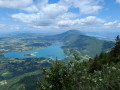
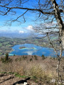
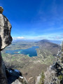
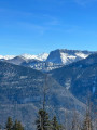
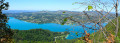
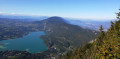
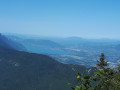
This is a ‘leisurely’ route I’m suggesting to reach Mont Grèle. This path will take you via the Voie Sarde, the Rocher du Cordeau, the Col du Crucifix and the Col Saint-Michel, before you reach Mont Grèle and then head back down to explore the François I cave. Beautiful scenery, a bucolic atmosphere, and a magical final view of the lakes, the Granier and the Belledonnes – a superb route!

Details

20836392
Creation:
Last update:
Last review:
  • Walking
    Activity: Walking
  • ↔
    Distance: 10.98 mi
  • ◔
    Average duration: 8h 10 
  • ▲
    Difficulty: Difficult

  • ⚐
    Back to start: Yes
  • ↗
    Ascent: + 3,615 ft
  • ↘
    Descent: - 3,596 ft

  • ▲
    Highest point: 4,649 ft
  • ▼
    Lowest point: 1,335 ft

Photos

Description of the walk

Park in the car park near the church in Aiguebelette-le-Lac (toilets).

(S/E) From the car park, head towards the church and, as you leave, follow the road to the right. After about a hundred metres, turn left onto a path. Then ignore the paths branching off to the left and pass between the houses.

(1) Carry on along a footpath and continue uphill. Cross a small road and continue along the footpath opposite. Join a road and follow it to the right until you reach the ‘Allemands’ car park.

(2) Leave the road and carry on straight ahead (north) along a forest track.

(3) At the junction, turn left. Follow a shaded track (beautiful views of the lake).

(4) Let the track curve sharply to the right and continue straight on (north-east) along a path. This will take you to the Rocher du Corbeau viewpoint.

(5) Head off again towards the south-east and continue climbing.

(6) Join the track again and follow it to the left. Take a hairpin bend to the left, then one to the right, and continue the ascent towards the south-east.

(7) At a sort of plateau, turn left (north) onto a path. After a straight climb, the path winds its way up a few bends to reach the Col du Crucifix.

(8) Take the path that leads diagonally to the right opposite you. Climb along this path heading south. Go round a hilltop (elevation 962) to the right (the purple line on the 1:25,000 map is inaccurate here). This will take you to the Col Saint-Michel.

(9) Continue straight ahead (east) along the path that climbs towards Mont Grêle. Walk for a long time in a south-south-westerly direction.

(10) At the junction, turn right and climb steeply along a few hairpin bends.

(11) At the next junction, turn right and continue climbing. Pass under the high-voltage power lines.

(12) Shortly afterwards, turn right again and pass under the high-voltage power lines once more to climb up to a viewpoint overlooking Lac du Bourget and Lac d’Aiguebelette (watch out for sheer drops).

(13) Head back down and pass under the high-voltage power lines once more.

(12) Continue south. After about 200 m, turn right to reach the official viewpoint.

(14) Turn back.

(12) Turn right and pass under the high-voltage power lines one last time. Return to the Col Saint-Michel via the outward route in the opposite direction.

(9) Turn left onto a path that winds down along the shaded cliffs. Ignore the paths branching off to the left and take a hairpin bend to the right. Continue northwards to the François I Caves.

(15) Carry on northwards and you’ll very quickly reach a junction.

(16) Then turn left. Head down the path, which winds several times, and ignore the side paths.

(3) Turn left and you’ll soon reach the ‘Parking des Allemands’.

(2) Follow the route you took on the way there in the opposite direction to return to the church (S/E).

Waypoints

  1. S/E : mi 0 - alt. 1,342 ft - Car park - Église Saint-André (Aiguebelette-le-Lac)
  2. 1 : mi 0.33 - alt. 1,463 ft - Le Pilliot
  3. 2 : mi 0.91 - alt. 1,870 ft - Parking des Allemands
  4. 3 : mi 1.04 - alt. 1,932 ft - Junction of the western circular loop
  5. 4 : mi 1.42 - alt. 2,123 ft - Junction
  6. 5 : mi 1.64 - alt. 2,365 ft - Rocher du Rorbeau
  7. 6 : mi 1.82 - alt. 2,500 ft - Junction
  8. 7 : mi 2.51 - alt. 2,789 ft - Junction
  9. 8 : mi 2.82 - alt. 2,986 ft - Col du Crucifix (915m)
  10. 9 : mi 3.4 - alt. 2,959 ft - Col Saint-Michel (903m)
  11. 10 : mi 4.89 - alt. 3,832 ft - Crossroads
  12. 11 : mi 5.44 - alt. 4,275 ft - Junction
  13. 12 : mi 5.77 - alt. 4,554 ft - Junction leading to the viewpoints
  14. 13 : mi 5.87 - alt. 4,606 ft - Viewpoint over the - Lac d'Aiguebelette
  15. 14 : mi 6.17 - alt. 4,649 ft - Mont Grelle (1425m)
  16. 15 : mi 9.3 - alt. 2,769 ft - François I Cave
  17. 16 : mi 9.38 - alt. 2,785 ft - Crossroads
  18. S/E : mi 10.98 - alt. 1,342 ft - Car park - Église Saint-André (Aiguebelette-le-Lac)

Notes

There’s not much water along the route.
The path is mostly shaded.
No technical difficulties; the challenge lies in the combination of a long distance and a significant elevation gain.

Worth a visit

The best spot for photos is at the end of the electricity pylons! You’ll have a view of both lakes, and a sunnier setting!

Reviews and comments

4.7 / 5
Based on 2 reviews

Reliability of the description
5 / 5
Ease of following the route
4.5 / 5
Route interest
4.5 / 5
Toine
Toine

Overall rating : 4.7 / 5

Date of your route : Jul 30, 2026
Reliability of the description : ★★★★★ Very good
Ease of following the route : ★★★★★ Very good
Route interest : ★★★★☆ Good
Very busy route : No

We set off from the Parking des Allemands to minimise the elevation gain and the distance on this sweltering day!
Fortunately, most of the route runs through the forest! As a result, you don’t get to see much of the scenery apart from at the viewpoints and the summit!
The return path from the Grotte de François I is steep and a bit slippery, so you need to be careful, especially as your legs are already quite tired by this point in the walk!

Machine-translated

brubru25
brubru25

Overall rating : 4.7 / 5

Date of your route : Jun 09, 2025
Reliability of the description : ★★★★★ Very good
Ease of following the route : ★★★★☆ Good
Route interest : ★★★★★ Very good
Very busy route : Yes

A brilliant hike with a magnificent view of both lakes. 👍

Machine-translated

titikumkum
titikumkum
• Edited:

Hello,
The problem with Visorando is that the starting points aren’t very clear; they need to be more precise, as we’re always having to find our way round, which is becoming a bit of a nuisance and a shame. Thank you, have a good day

Machine-translated

Other walks in the area

For more walks, use our search engine .

The GPS track and description are the property of this route's author. Please do not copy them without permission.