Country:

 City:
City:


The starting point for the walk is at the Bulatxiki Pass near the village of Arantza (or Aranaz in Basque). To get there, see the ‘Practical Information’ section.
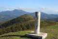
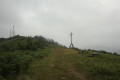
(S/E) From where you’ve parked, choose the path that runs past the foot of the watering trough from among the clearly visible trails. You’ll reach the summit of Zipuru at an altitude of 725 metres, marked by a stone cross. Just before you reach it, look out for the standing stone, which has a hole in it and is streaked.
(1) Carry on straight ahead, following a gentle descent.
(2) Carry on straight ahead, following the sign for “Mendaur”.
(3) Head towards the red and white post on the right.
(4) Walk alongside the fence on the right. The path, which isn’t very well marked, leads to the summit of Mairubaratzeta at 850 m.
(5) Head back down to rejoin the path you left at (4).
(6) Take a small path on the right and climb, keeping to the ridge. Further on, you’ll come across a drinking trough. It’s a long climb to the summit of Mendieder, at an altitude of 1,071 metres.
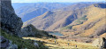
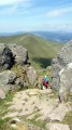
(7) Head left (as seen from the summit) across a nearly flat area, then begin the descent through the grass, heading towards the large menhir visible below. On the descent, enjoy the views over the Mendaur Dam lake. Reach the Bustiztza Zutarria menhir. This is a megalith dating from the Neolithic period, between 6000 and 2500 BC, and is approximately 2 metres high.
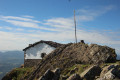
(8) From here, you can clearly see the path to follow for the round trip up to Mendaur. The ascent is quite steep, running fairly straight at first before winding leftwards. Note the arrangement of stones forming steps as you approach the top. You’ll reach the summit of Mendaur at an altitude of 1,131 metres.A hermitage was built here in 1692 and comprises a chapel dedicated to the Trinity and a refuge. A pilgrimage is organised here every year.
(9) Head back down the same path and, towards the end, head towards a signpost, leaving the menhir on your left.
(10) At the signpost, head towards Lesaka. Keeping an eye out for small white and red signposts, follow the path marked GR®11 and GR®12. It is a narrow path along the mountainside where you’ll need to walk in single file, but it is almost entirely flat.
(6) Avoid the climb to the summit by going round it to the right, whilst following the red and white markings. You will then rejoin the path you took on the way up.
(4) Follow the ascent route in the opposite direction to return to the pass (S/E).

 Visorando Member
 Difficult