


Easy access by car from Bera.
The Arantza ridges and cirque


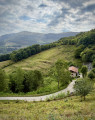
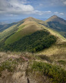
The pretty village of Arantza lies at the foot of a cirque of medium-height mountains, rising to over 1,000 metres in altitude, which you can walk around along the ridges, enjoying magnificent views. Domizko Gaïna (1,038 m), Ekaïtza (1,048 m) and Mendieder (1,071 m) are the main peaks offering magnificent views of the Mendaur (1,131 m). It’s a lovely walk.
Details
Creation:
Last update:
Last review:
–
–
-
 Activity: Walking
 -
 Distance: 9.61 mi
 -
 Average duration: 7h 35
 -
 Difficulty: Difficult
 -
-
 Back to start: Yes
 -
 Ascent: + 3,648 ft
 -
 Descent: - 3,632 ft
 -
-
 Highest point: 3,455 ft
 -
 Lowest point: 577 ft
-
 Country:
Spain
Country:
Spain
-
 Areas: Pyrenees, Basque Country
 -
 City:
Arantza
City:
Arantza -
 Start/End: N 43.194852° / W 1.721999°
 -


 Hour-by-hour weather
Photos
Description of the walk
Waypoints
- S/E : mi 0 - alt. 1,119 ft - Cemetery
- 1 : mi 0.24 - alt. 906 ft - Arantza
- 2 : mi 0.7 - alt. 584 ft - Muriedo Erreka
- 3 : mi 2.3 - alt. 1,991 ft - Etxeberriko borda
- 4 : mi 4.98 - alt. 3,373 ft - Ecaitza
- S/E : mi 9.61 - alt. 1,122 ft - Return via the cemetery
Notes
There are two restaurants and a grocery shop in the village; there are no water points or places to buy provisions along the walk
Worth a visit
Magnificent 360° views, particularly of the Mendaur
Other walks in the area
Mendieder and Mendaur from Arantza
 Visorando Member
 8.36 mi
+3,520 ft
-3,514 ft
6h 55
Difficult
8.36 mi
+3,520 ft
-3,514 ft
6h 55
Difficult
 Departure from Arantza (Navarre)
Mendaur rises to an altitude of 1,130 metres. It is an iconic peak with its chapel built in 1692 and restored in 1963. This is essentially a round trip hike following the ridge line to the south-east of the Navarrese village of Arantza and climbing the nearby Mendieder.
The Putzubeltz waterfall in Arantza
 6.70 mi
+1,385 ft
-1,355 ft
4h 15
6.70 mi
+1,385 ft
-1,355 ft
4h 15
 Moderate
Departure from Arantza (Navarre)
Moderate
Departure from Arantza (Navarre)
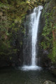
There are numerous waterfalls around the village of Arantza, though some are difficult to reach. The most famous and easiest to access is the Putzubeltz waterfall. The Arantza local council has also created a lovely, fairly easy path leading to it. You start by walking across meadows, then quickly find yourself in the middle of the forest, with the only sound being the trickling of small streams.
Urdiki, Apaola and Oianberri from Arantza
 7.27 mi
+2,313 ft
-2,280 ft
5h 20
Moderate
Departure from Arantza (Navarre)
7.27 mi
+2,313 ft
-2,280 ft
5h 20
Moderate
Departure from Arantza (Navarre)
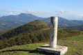
A very lovely walk in the heart of nature, with only the sounds of wildlife. For almost the entire route, there are impressive views of the surrounding peaks, including Mendaur, the Trois Couronnes, La Rhune, etc.
A path to the Putzubeltz Waterfall from Arantza
 7.18 mi
+1,919 ft
-1,886 ft
5h 00
Moderate
Departure from Arantza (Navarre)
7.18 mi
+1,919 ft
-1,886 ft
5h 00
Moderate
Departure from Arantza (Navarre)
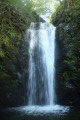
A lovely walk to discover numerous waterfalls, the most famous of which is Putzubeltz. The path, which often runs through the forest, follows several rivers, and you’re constantly accompanied by the sound of running water.
However, part of the route follows a very narrow path along the mountainside, which may be daunting for those with a fear of heights. Furthermore, you’ll have to wade across numerous rivers, which can be difficult after periods of rain.
The Mendaur as seen from the Bulatxiki Pass
 6.28 mi
+2,234 ft
-2,238 ft
4h 50
Moderate
Departure from Facería 87 (Navarre)
6.28 mi
+2,234 ft
-2,238 ft
4h 50
Moderate
Departure from Facería 87 (Navarre)
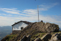
A superb route leading to the area’s most famous peak, with stunning views all along the way.
Unanu and San Juan Xar from Igantzi
 6.72 mi
+1,857 ft
-1,860 ft
4h 40
Moderate
Departure from Igantzi (Navarre)
6.72 mi
+1,857 ft
-1,860 ft
4h 40
Moderate
Departure from Igantzi (Navarre)
A Roman road, a summit offering 360-degree views, wooden vultures, a superb cave, miraculous waters, all in a forest offering a fabulous setting: follow the guide!
Igantzi – Arantza
 Association / Club / Walk leader5.90 mi
+965 ft
-942 ft
3h 35
Moderate
Departure from Igantzi (Navarre)
Association / Club / Walk leader5.90 mi
+965 ft
-942 ft
3h 35
Moderate
Departure from Igantzi (Navarre)
This route is known as SL-NA-001 San Juan Xar. It runs between the villages of Igantzi and Arantza and passes by the site dedicated to San Juan Xar, from whom it takes its name.
Frain from Lesaka
 7.22 mi
+1,677 ft
-1,673 ft
4h 45
Moderate
Departure from Lesaka (Navarre)
7.22 mi
+1,677 ft
-1,673 ft
4h 45
Moderate
Departure from Lesaka (Navarre)
A beautiful route leading to the summit of Frain, known as the Cinco-Villas viewpoint, as it offers the best possible panoramic view of this area. The Cinco-Villas is an area of Navarre along the Bidasoa River comprising the five municipalities of Aranaz, Yanci, Lesaca, Echalar and Vera de la Bidasoa.
For more walks, use our search engine .
The GPS track and description are the property of this route's author. Please do not copy them without permission.

