A path to the Putzubeltz Waterfall from Arantza

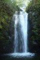
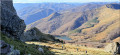
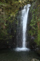
A lovely walk to discover numerous waterfalls, the most famous of which is Putzubeltz. The path, which often runs through the forest, follows several rivers, and you’re constantly accompanied by the sound of running water.
However, part of the route follows a very narrow path along the mountainside, which may be daunting for those with a fear of heights. Furthermore, you’ll have to wade across numerous rivers, which can be difficult after periods of rain.

Details

40061904
Creation:
Last update:
Last review:
  • Walking
    Activity: Walking
  • ↔
    Distance: 7.18 mi
  • ◔
    Average duration: 5h 00 
  • ▲
    Difficulty: Moderate

  • ⚐
    Back to start: Yes
  • ↗
    Ascent: + 1,919 ft
  • ↘
    Descent: - 1,886 ft

  • ▲
    Highest point: 1,604 ft
  • ▼
    Lowest point: 581 ft

Photos

Description of the walk

The starting point for the walk is at the car park, at the entrance to the village of Arantza (or Aranaz in Basque), on Beheko Street. To get there, see the ‘Practical Information’ section below.

(S/E) From the car park, continue along Rue Beheko towards the school. You’ll come to the first sign: follow the direction ‘autres’.

(1) At the sign, follow the sign for “Putzubeltza”. Walk behind the church (where there is a ‘no through road’ sign), then take the path that descends steeply.

(2) You’ll come out onto a very beautiful stone path and the descent continues. Take care as the stones can be slippery, and bear in mind that you’ll have to climb back up everything you’ve gone down on the return journey.

(3) After crossing the bridge, turn left. Follow the white and yellow markings. Follow thePR®-NA 10 Arantzako Zirkoa.

(4) Carry on straight ahead, then walk past the house.

(5) At the tarmac road, turn left.

(6) Turn right. Then follow some white and blue markings.
This point also marks the end of the shared path, which is used for both the outward and return journeys.

(7) Leave thePR® and take the path on the left. You’ll then begin a fairly long stretch of the route on almost level ground.

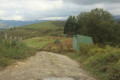
(8) Walk past the hut. The wide path you have been following so far narrows into a very, very narrow track where, if there are several of you, you will need to walk in single file.
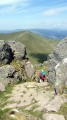
From this point onwards, you should walk carefully as the path runs along the mountainside and, in some places, the drop-off may be daunting for some people, particularly those prone to vertigo.
This warning applies up to the fifth waterfall and a little beyond.

(9) First waterfall and a river crossing – normally easy.

(10) Second waterfall, smaller, and a river crossing, which is normally easy.

(11) Third waterfall and river crossing, normally easy.

(12) Change of direction: turn left.

(13) A beautiful waterfall.

(14) Large waterfall and a tricky river crossing. Take great care not to slip.
The path remains as narrow and tricky as ever. However, a few hundred metres past the waterfall, the path widens and leads out of the dangerous area. This long section can be classified as ‘difficult’.

(15) Just after the sheepfold, take the small path on the left.

(16) Finally, you’ll reach the Putzubeltz waterfall. Then retrace your steps a little and take the path on the right. It’s a wide path marked in white and blue.

(17) At the house, turn left (ignore the direction indicated on the signs). Follow this wide path.

(18) Note: if you look at the map, there are numerous dotted lines showing paths that allow you to avoid walking on the tarmac road. In particular, these paths used to allow you to walk along a disused canal. These paths are currently closed for safety reasons. So there’s no point in tempting fate and asking for trouble.
Reach the tarmac road (fortunately with little traffic) and follow it to the left until you rejoin a section of the route taken on the way out.

(6) Take the reverse route of the outward journey to return to (S/E).
Waypoints

  1. S/E : mi 0 - alt. 843 ft - Car park at the entrance to Arantza
  2. 1 : mi 0.17 - alt. 902 ft - Sign
  3. 2 : mi 0.28 - alt. 843 ft - Stony path
  4. 3 : mi 0.58 - alt. 584 ft - Bridge
  5. 4 : mi 0.81 - alt. 801 ft - Junction
  6. 5 : mi 1.15 - alt. 1,033 ft - Concrete road
  7. 6 : mi 1.25 - alt. 1,040 ft - Junction
  8. 7 : mi 1.33 - alt. 1,102 ft - Change of direction
  9. 8 : mi 2.81 - alt. 1,365 ft - Hut
  10. 9 : mi 2.92 - alt. 1,453 ft - Waterfalls
  11. 10 : mi 3.23 - alt. 1,604 ft - Second waterfall
  12. 11 : mi 3.45 - alt. 1,601 ft - Waterfall
  13. 12 : mi 3.57 - alt. 1,575 ft - Junction
  14. 13 : mi 3.71 - alt. 1,398 ft - Waterfall
  15. 14 : mi 3.73 - alt. 1,401 ft - Waterfall 5
  16. 15 : mi 4.15 - alt. 1,165 ft - Sheepfold
  17. 16 : mi 4.39 - alt. 948 ft - Putzubeltz Waterfall
  18. 17 : mi 4.77 - alt. 837 ft - T-junction. House
  19. 18 : mi 5.21 - alt. 715 ft - Route
  20. S/E : mi 7.18 - alt. 850 ft - Car park at the entrance to Arantza

Notes

To get to the starting point by car.
From Saint-Jean-de-Luz, head to Béhobie to cross the border.
After crossing the bridge, turn left at the roundabout onto the N121A towards Pamplona.
On the N121A, at kilometre 58, take the NA-4020 exit for Igantzi / Arantza.
At the roundabout, take the second exit for the NA-4020 Igantzi / Arantza. Then follow the NA-4020.
At the roundabout, take the second exit towards the NA-4020 Arantza (so do not take the right-hand exit for the NA-4052 Igantzi).
Continue along the NA-4020 for quite some time (you’ll pass the Yanci and San Juan Xar quarries).
You’ll enter Arantza, pass a few blocks of flats, and the car park is immediately on the right-hand side of the road (opposite a large bus park): you’re now on Rue Beheko (Beheko Karrika).

For your information: by car from Saint-Jean-de-Luz, the journey is approximately 35 km and takes around 50 minutes.

Always be cautious and plan ahead when you're outdoors. Visorando and the author of this route cannot be held responsible for any accidents occurring on this route.

The GR® and PR® markings are the intellectual property of the Fédération Française de Randonnée Pédestre.

Reviews and comments

4.9 / 5
Based on 3 reviews

Reliability of the description
5 / 5
Ease of following the route
5 / 5
Route interest
4.7 / 5
VL2
VL2

Overall rating : 5 / 5

Date of your route : Jul 27, 2026
Reliability of the description : ★★★★★ Very good
Ease of following the route : ★★★★★ Very good
Route interest : ★★★★★ Very good
Very busy route : No

After a bit of trouble finding a parking space in Arantza (the car park was full), the walk begins on a stony path that goes downhill and then uphill: it’s lovely, though not so good for your ankles – you need to be very careful for about 2 km. After a short stretch of road, the lovely walk really begins… with pleasant paths and beautiful scenery. The drought is in full swing and the waterfalls are dry, except for the last two: the one at Putzubeltz is well worth the effort it takes to reach it.
The return journey takes us along a long stretch of road before we reach the challenging stony path from the start again.
Please note: due to numerous uprooted trees, the path disappears before you reach Pubebeltz and the section can be described as difficult.
A lovely, undulating walk for keen walkers. Nothing insurmountable, however.

Machine-translated

Izard
Izard

Overall rating : 4.7 / 5

Date of your route : Sep 08, 2025
Reliability of the description : ★★★★★ Very good
Ease of following the route : ★★★★★ Very good
Route interest : ★★★★☆ Good
Very busy route : No

A different return route from the one indicated is possible to avoid returning by road, following a shorter loop back to Arantza

Machine-translated

dominique texier
dominique texier

Overall rating : 5 / 5

Date of your route : Oct 30, 2023
Reliability of the description : ★★★★★ Very good
Ease of following the route : ★★★★★ Very good
Route interest : ★★★★★ Very good
Very busy route : No

A lovely walk with some stunning waterfalls. The only slight downside is that the flat section in the middle is very long and not particularly interesting.

Machine-translated

Other walks in the area

For more walks, use our search engine .

The GPS track and description are the property of this route's author. Please do not copy them without permission.