


LaGauth

 Visorando Member
 Premium user
 - Location: Nice (06100|06300|06200|06000)
- Gender: man
Sign up:
Published route(s)
 From Castérino to the Refuge des Merveilles
 8.31 mi
 +3,058 ft
 -1,736 ft
 6h 30
6h 30
 Difficult
 Departure from Tende (Alpes-Maritimes)
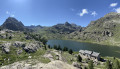
The first part of the magnificent circular walk starting from Castérino to explore the Vallée des Merveilles, passing by the Refuge de Fontanalba, the rock carvings in the Nature Reserve and the Voie Sacrée, and finishing at the Refuge des Merveilles.
Notre-Dame della Serra from the Citadel of Calvi
 5.38 mi
+755 ft
-764 ft
3h 10
5.38 mi
+755 ft
-764 ft
3h 10
 Easy
Departure from Haute-Corse
Easy
Departure from Haute-Corse
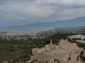
Magnificent views from the Chapel of Notre-Dame della Serra, offering a bird’s-eye view of the town of Calvi and its gulf. An easy circular route starting from the Citadel of Calvi in the town centre.
Allos - Mont Pelat
 10.09 mi
+5,577 ft
-328 ft
9h 30
Difficult
Departure from Allos (Alpes-de-Haute-Provence)
10.09 mi
+5,577 ft
-328 ft
9h 30
Difficult
Departure from Allos (Alpes-de-Haute-Provence)
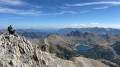
The first part of this two-day circular is challenging and breathtaking, taking you through the heart of Mercantour National Park from the village of Allos, via Lac d'Allos and its refuge, Mont Pelat, Lac du Trou de l'Aigle, Le Cimet and its many waterfalls, including Cascade du Pich and Les Bois de Vacheresse.
Two-day circular to Mont Pelat and Le Cimet
 23.72 mi
+7,982 ft
-7,989 ft
2 days
Difficult
Departure from Allos (Alpes-de-Haute-Provence)
23.72 mi
+7,982 ft
-7,989 ft
2 days
Difficult
Departure from Allos (Alpes-de-Haute-Provence)
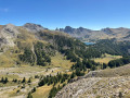
A magnificent, challenging and breathtaking two-day circular route in the heart of the Mercantour National Park, starting from the village of Allos. The route passes by Lac d'Allos and its refuge, Mont Pelat, Lac du Trou de l'Aigle, Le Cimet and its many waterfalls, including Cascade du Pich, and the Bois de Vacheresse. You will set out to climb two peaks over 3,000 metres high: Mont Pelat (3,051 metres) and Le Cimet (3,020 metres), from which you will enjoy 360° panoramic views of the national park.
Mont Pelat - Allos via Le Cimet
 13.63 mi
+2,405 ft
-7,661 ft
8h 20
13.63 mi
+2,405 ft
-7,661 ft
8h 20
 Very difficult
Departure from Allos (Alpes-de-Haute-Provence)
Very difficult
Departure from Allos (Alpes-de-Haute-Provence)
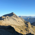
Second part of the circular. This second stage will take you to the village of Allos, starting from Mont Pelat, via the Trou de l'Aigle, the Cimet and its many waterfalls, including the Cascade du Pich and the Bois de Vacheresse.
Circular route to Roc de l'Orméa and Col de Restaud
 5.35 mi
+2,766 ft
-2,769 ft
4h 50
5.35 mi
+2,766 ft
-2,769 ft
4h 50
 Moderate
Departure from Alpes-Maritimes
Moderate
Departure from Alpes-Maritimes
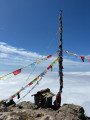
A beautiful, easy circular walk starting from the hilltop village of Castellar, taking you up Roc de l'Orméa (1,132 m) via Cime de Restaud (1,148 m). Enjoy panoramic views of the French Riviera, from Roquebrune-Cap-Martin to Menton, and of the Italian coast. The 360° panorama also offers breathtaking views of the snow-capped peaks of the Mercantour.
The ghost village of Rocca Sparvièra, starting from Duranus
 7.86 mi
+3,133 ft
-3,127 ft
6h 20
Moderate
Departure from Duranus (Alpes-Maritimes)
7.86 mi
+3,133 ft
-3,127 ft
6h 20
Moderate
Departure from Duranus (Alpes-Maritimes)
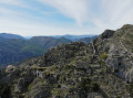
Starting from the charming village of Duranus, this walk takes you on a journey of discovery to a site steeped in history and atmosphere. You will reach the spectacular ruins of Rocca Sparvièra, a veritable hilltop ghost village overlooking the valley.
Along the way, you’ll pass the pretty Saint-Michel Chapel and walk alongside the Éguisse Mines, former arsenic mines now overgrown with vegetation.
An accessible circular route rich in heritage, combining wild nature, medieval ruins and mining history. Perfect for lovers of authentic, atmospheric hikes!
From Blieux to the Mont Chiran Observatory via the Mourre de Chanier
 10.30 mi
+4,626 ft
-1,542 ft
8h 45
Very difficult
Departure from Blieux (Alpes-de-Haute-Provence)
10.30 mi
+4,626 ft
-1,542 ft
8h 45
Very difficult
Departure from Blieux (Alpes-de-Haute-Provence)
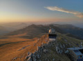
First stage of the circular route from the village of Blieux to the Mont Chiran Observatory. You’ll climb gradually towards the ridges to tackle the day’s peaks: the Mourre de Chanier (1,930 m), the highest point of the stage, the Petit Mourre (1,873 m) and the Grand Mourre (1,898 m), before reaching the Mont Chiran Observatory (1,905 m). The panoramic views stretch out over Lake Sainte-Croix, the Verdon and the surrounding mountain ranges, including the Mercantour. Arrival at the observatory marks the end of this first day, with a welcome water source for the campsite.
Circular walk from Blieux to the Mont Chiran Observatory
18.58 mi
+5,262 ft
-5,253 ft
2 days
Difficult
Departure from Blieux (Alpes-de-Haute-Provence)
A magnificent, challenging and scenic two-day circular route in the heart of the Verdon Regional Nature Park, starting from the village of Blieux.
The route takes you along the ridges and iconic summits of the massif: the Mourre de Chanier (1,930 m), the Petit Mourre (1,873 m), the Grand Mourre (1,898 m), the Mont Chiran Observatory (1,905 m), then the Hauteur (1,777 m) and the Col de Reibert (1,464 m).
You’ll enjoy 360° views of Lake Sainte-Croix, the Verdon, the Mercantour peaks and the vast expanses of the Verdon. An ideal hike for a wild camp in the heart of nature, amongst airy ridges, scree slopes and pastoral trails.
From the Mont Chiran Observatory to Blieux
 8.28 mi
+636 ft
-3,711 ft
4h 20
Moderate
Departure from Blieux (Alpes-de-Haute-Provence)
8.28 mi
+636 ft
-3,711 ft
4h 20
Moderate
Departure from Blieux (Alpes-de-Haute-Provence)
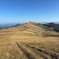
Second stage of the circular route from Blieux to Mont Chiran. You leave the Mont Chiran Observatory and follow the ridges northwards towards L’Hauteur (1,777 m), the day’s highest point. After taking in the views of the Mercantour and the Observatory, you’ll gradually descend towards the Col de Reibert (1,464 m) and then follow the long stony track back to the village of Blieux. A day with a gentler elevation gain, but still very open and offering a change of scenery, which brings this tour of the Verdon peaks to a magnificent close.
Le Mangiabo from Sospel
 12.74 mi
+5,420 ft
-5,413 ft
10h 35
Very difficult
Departure from Sospel (Alpes-Maritimes)
12.74 mi
+5,420 ft
-5,413 ft
10h 35
Very difficult
Departure from Sospel (Alpes-Maritimes)
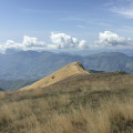
This long and beautiful circular walk takes you along the grassy ridges overlooking the Bévéra valley up to the summit of Mangiabo (1,821 m). At the summit, you’ll be treated to an exceptional 360° panorama: the Mediterranean from San Remo to Antibes and the Estérel to the south, and the high ridges of the Mercantour to the north. The route, which partly follows the GR®52, alternates between forests, mountain pastures and ridges.