


 Country:
 City:
City:


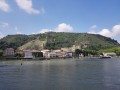
Head to the Leclerc shopping centre in Bourg-les-Valence, situated on the banks of the Rhône on the D2007N. Then head towards La Roche-de-Glun (towards the dam), then turn right towards Les Combeaux and you’ll immediately find a car park reserved for the Via Rhôna on your left.
(S/E) From the car park, facing the dam, head towards an information board about the Via Rhôna.
Take the cycle path on the right (IGN map is slightly misaligned), pass through a green barrier and, shortly afterwards, you’ll come across signs for the dam and, further on, an insect protection zone. Continue along the path, passing a first access point to the Combeaux River Site, then a second.
The Via Rhôna descends, then turns left to reach the bank of the Isère Feed Canal.
(1) Turn right and follow the canal until you reach a T-junction on the Via Rhôna.
(2) Turn left onto the bridge. At the end, turn left then right to continue along the canal.
(3) Go under a bridge and carry on to finish the stretch alongside the canal. The tarmac gives way to a gravel surface. Shortly afterwards, the track runs alongside the Rhône and leads to a car park by the D758.
(4) Carry on straight ahead along the track running parallel to the road until you reach the entrance to Tain-l’Hermitage.
(5) The tarmac returns as you enter the town. Ride past the campsite, go under the bridge and carry on straight ahead along Quai Arthur Rostaing to No. 1, where the cycle path ends in this direction.
(6) Turn right at the pedestrian crossing to cross the quai and join Rue de Scoly, which leads to the church.
Turn left onto Grande Rue and continue to No. 21. Turn right onto Rue de la Voûte, then left onto Rue des Herbes and immediately left onto Rue Joseph Péala.
Cross via the Marc Seguin footbridge, which connects to the Ardèche.
(7) Turn left and follow the cycle path along Quai Charles de Gaulle as far as the bridge. Cross at the pedestrian crossing and continue straight on along Quai Gambetta (note: there is no cycle path here).
(8) At the pumping station, leave the tarmac and continue straight on along a gravel path beside the Rhône until the next junction (sewage treatment plant on your right).
(9) Carry on straight ahead along the track (let the cycle path branch off to the right over a small bridge). Stay on this slightly stony track at all times. Pass Glun and come out onto the D222a.
(10) Cross with care – there is no pedestrian crossing here – then turn left onto the road to cross the dam. On the opposite bank, you’ll reach a roundabout; go round it and continue straight ahead onto Quai des Marettes (towards the lake).
(11) At the entrance to the lake, head for the embankment, slightly to the left, and follow the river. After going round the lake, leave the tarmac and carry on straight ahead along a stony path beside the canal. When the canal joins the Isère, the path becomes more pleasant and then joins the D268 at the Valence Karting track.
(12) Cross the road carefully and turn left to cross the dam. Immediately afterwards, turn right onto a path leading down to a car park at the confluence of the Isère and the Rhône.
At the far end of the car park, go through the barrier and follow the path. Further on, ignore a path on the left (not visible on the map depending on the zoom level). The path bends to the left and then joins a path coming from the left.
(13) Turn right and follow the path, which becomes a little wilder and shadier. Head up towards the power station. Turn left to cross the bridge. At the end, turn right onto a cycle path, then 100 metres further on, turn left to cross the D268 with care and you’ll find the car park opposite (S/E).

 Visorando Member
 Easy
Easy 
 Local authority
 Difficult
 Very difficult
