A round trip to Lac des Pisses from Prapic

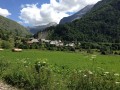
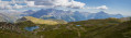
A magnificent hike starting from the pretty village of Prapic to Lac des Pisses, a small, secluded lake in the Écrins National Park, in the heart of the Champsaur. The ascent is pleasant and wild.

Details

49017805
Creation:
Last update:
Last review:
  • Walking
    Activity: Walking
  • ↔
    Distance: 8.38 mi
  • ◔
    Average duration: 6h 35 
  • ▲
    Difficulty: Difficult

  • ⚐
    Back to start: Yes
  • ↗
    Ascent: + 3,169 ft
  • ↘
    Descent: - 3,169 ft

  • ▲
    Highest point: 8,196 ft
  • ▼
    Lowest point: 5,026 ft

Description of the walk

Take the D944 to the village of Orcières, then follow the signs for Prapic. Park in the car park just before the village, next to the campsite.
There is also a shuttle bus to the village of Prapic from Orcières. Check with the Orcières Tourist Office for timetables.

(S/E) From the car park, head towards the village of Prapic along the tarmac road. At the tourist information office, keep right twice to reach a junction marked by a sign pointing towards “Lac des Pisses”.

(1) Turn left onto the Chemin du Poète, as indicated by the sign, heading north. On leaving the village, the road remains relatively flat. Ignore the paths branching off to the right and left and head towards the Torrent de Blaisil.

(2) Turn right onto the path which crosses the Torrent des Sariesses, then follows the Torrent de Blaisil along the left bank before climbing into the forest. You’ll come to a Fork in the road.

(3) Take the path on the left to continue following the sign for “Lac des Pisses”. Cross the Torrent de Blaisil via a small bridge. The path is clearly marked; it is impossible to go wrong. You will come to a hairpin bend.

(4) Turn onto the path that climbs to the left. After a clear stretch on the mountainside, continue climbing in tight hairpin bends through the forest.

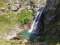
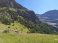
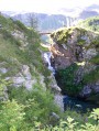
(5) At this hairpin bend, take the path on the right towards Lac des Pisses to cross the small torrent, leaving the path on the left which winds its way up into the Diolon valley. The climb continues north-eastwards, through the forest and then across the mountain pastures. You’ll cross several torrents and waterfalls.
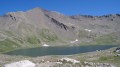
The path becomes rocky. Pass by a shepherd’s hut and, after a long climb in switchbacks, cross two small lakes. You will then reach Lac des Pisses: the setting is barren but peaceful – the ideal spot for a picnic!

(6) Head back along the same path through the Drac State Forest.

(5) Turn onto the path that winds down to the left.

(4) Take the path leading down to the right, heading south.

(3) Continue the descent along a wide path, heading south.

(2) Turn left towards the village, heading south-east. Ignore the side paths and head for the village of Prapic.

(1) Turn right to reach the car park at the start (S/E).

Waypoints

  1. S/E : mi 0 - alt. 5,026 ft - Car park near the Prapic campsite - Arrêt navette Prapic
  2. 1 : mi 0.23 - alt. 5,121 ft - Prapic village centre - Arrêt navette Prapic
  3. 2 : mi 0.54 - alt. 5,102 ft - Crossing the Torrent des Sariesses
  4. 3 : mi 0.94 - alt. 5,253 ft - Fork in the road, towards Lac des Pisses
  5. 4 : mi 1.12 - alt. 5,351 ft - Varaire junction – bend at 1,638 metres
  6. 5 : mi 1.91 - alt. 5,958 ft - Junction with the Diolon valley
  7. 6 : mi 4.19 - alt. 8,192 ft - Lac des Pisses (Alps, Ecrins, Champsaur, Dauphiné) - Lac des Pisses
  8. S/E : mi 8.38 - alt. 5,026 ft - Car park near the Prapic campsite - Drac (rivière) - Drac Noir-Drac

Notes

Water point in the village of Prapic.

N.B. At the start of the season (or after a thunderstorm), crossing the numerous streams can be tricky when the water level is too high.

Worth a visit

The village of Prapic has retained its authentic character; the houses and streets are very pretty.

You can take a short detour (300 m) to reach the Poet’s Tomb: take the path on the right at (3).
The schoolteacher Joseph Reymond (1847–1918) refused to undergo compulsory retraining in Paris after the war of 1878. Dismissed from his post, he became a shepherd in his home village. A poet and storyteller, he built his own tomb beneath a large rock on his summer property by the Torrent du Blaizil. He even wanted to stage a rehearsal of his own funeral with his friends. And it was in January 1918 that the real and only performance took place.

At the northern edge of the village, a mission cross is adorned with tools and a ladder. These are symbols of the Passion of Christ: hammer, nails and pincers (crucifixion); spear (piercing of Jesus’ side); whip (flagellation); cockerel (Saint Peter’s denial); dice (the Roman soldiers casting lots for Christ’s tunic); ladder (descent from the cross), etc.

The Orcières leisure centre, situated at the bottom of the valley below the village, offers activities for children.
The Rocher d’Arthouse via ferrata is recommended, despite the difficulty of the first section.

Reviews and comments

4.6 / 5
Based on 4 reviews

Reliability of the description
4.8 / 5
Ease of following the route
4.3 / 5
Route interest
4.8 / 5
83Isa
83Isa

Overall rating : 5 / 5

Date of your route : Jul 06, 2026
Reliability of the description : ★★★★★ Very good
Ease of following the route : ★★★★★ Very good
Route interest : ★★★★★ Very good
Very busy route : Yes

This is the third time I’ve done it, and it’s still just as magical!
In early July, there are still lovely flowers and the water flows in abundance. The waterfalls dotted along the route are magnificent.
The climb is steady. The final third seems tough, but the reward is waiting at the end!

Machine-translated

Yoyot
Yoyot

Overall rating : 4.3 / 5

Date of your route : May 25, 2026
Reliability of the description : ★★★★★ Very good
Ease of following the route : ★★★☆☆ Average
Route interest : ★★★★★ Very good
Very busy route : No

Hello,
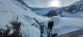
There were two of us on this hike, which the Prapic tourist office had advised against because there were still snowfields and the path was hidden by snow 150 to 200 metres before Lac des Pisses. We stopped at the tourist office after the hike, as it was closed when we set off.
In the end, it was a very beautiful hike, best suited to experienced hikers as there were snowfields to cross which formed snow bridges over the streams and torrents of melting ice from around 2,100m.
We also had to cross a torrent on the way there by positioning a wooden footbridge over some rocks; it hadn’t been put there to prevent it from being swept away by the torrent. On our return in the afternoon, the flow had increased due to the melting snow and the wooden footbridge was thoroughly soaked, so caution is advised.
We put everything back exactly as we found it, of course.
We were alone on this hike.
At the lake, the tranquillity and the sweeping view over the Prapic valley were well worth the fairly steep climb, with hardly any flat sections.
I think it will be perfectly passable in early June.
Thank you, Visorando, for this route. Magnificent.

Machine-translated

john31200
john31200

Overall rating : 4.7 / 5

Date of your route : Aug 18, 2025
Reliability of the description : ★★★★★ Very good
Ease of following the route : ★★★★★ Very good
Route interest : ★★★★☆ Good
Very busy route : No

Thanks for the hiking tip: the lake was full of water and the site is very beautiful with its rocky landscape. The route wasn't difficult, but walking sticks are useful on the way back.

Machine-translated

diggi
diggi

Thank you for your feedback; I’ve added the warning about crossing the streams!

Machine-translated

crisdumoulin
crisdumoulin

Overall rating : 4.5 / 5

Date of your route : Jun 19, 2024
Reliability of the description : ★★★★☆ Good
Ease of following the route : Not used / Not applicable
Route interest : ★★★★★ Very good
Very busy route : No

Hello, I’ve done this magnificent walk several times. But it’s worth noting that at the start of the season or after a storm, crossing the numerous streams can be tricky. I remember having to turn back… right at the first one.
Otherwise, I’d highly recommend it!

Machine-translated

Other walks in the area

For more walks, use our search engine .

The GPS track and description are the property of this route's author. Please do not copy them without permission.