Around La Chaudière

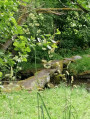
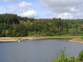
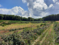
A short, easy walk that completes the circuit around Lake Chamboux. You’ll be able to discover the Morvan’s landscapes, with their fir trees, forests and beautiful rocks.

Details

n°26820234
Creation:
Last update:
Last review:
  • Walking
    Activity: Walking
  • ↔
    Distance: 2.55 mi
  • ◔
    Average duration: 1h 20 
  • ▲
    Difficulty: Easy

  • ⚐
    Back to start: Yes
  • ↗
    Ascent: + 207 ft
  • ↘
    Descent: - 207 ft

  • ▲
    Highest point: 1,873 ft
  • ▼
    Lowest point: 1,667 ft

Photos

Description of the walk

Park in the car park beside Lac de Chamboux, where you’ll find the wooden signposts.

(S/E) Cross the road, turn left towards the south-west and take the first path on the right.

(1) Follow this path through the woodland, then go round a field on the left. Ignore a path branching off to the left atthe first bendand continue to the next fork atthe second bend.

(2) Turn right, head into the woodland, pass the corner of thefirst field and then skirt asecond field a few metres further on. At the end of this second field, you’ll come to a path branching off to the left, the Chemin de la Chaudière.

(3) Turn onto this path and follow it to the edge of the woodland without changing direction. The path runs between two fields and reaches a fork.

(4) Turn sharply left onto the path that starts between the two fields. Then enter the woods and return to the fork you have already passed.

(2) Turn right and follow the path back the way you came to reach the car park on the shores of Lac de Chamboux (S/E).

Waypoints

  1. S/E : mi 0 - alt. 1,667 ft - Car park with signposts - Lac de Chamboux
  2. 1 : mi 0.08 - alt. 1,680 ft - Path on the right
  3. 2 : mi 0.51 - alt. 1,732 ft - A/R junction
  4. 3 : mi 0.92 - alt. 1,775 ft - Chemin de la Chaudière
  5. 4 : mi 1.62 - alt. 1,870 ft - Junction between the fields
  6. S/E : mi 2.55 - alt. 1,667 ft - Car park with signposts - Ternin (rivière) - Affluent de l'Arroux

Notes

On most of the paths in the Morvan, you may encounter muddy or tricky sections, so please wear suitable footwear.

You are hiking in the Morvan Natural Park; please respect the guidelines for responsible hikers regarding the natural environment.

Not recommended during the hunting season.

Reviews and comments

4.7 / 5
Based on 2 reviews

Reliability of the description
5 / 5
Ease of following the route
5 / 5
Route interest
4 / 5
User 28749416

Overall rating : 5 / 5

Date of your route : Sep 03, 2026
Reliability of the description : ★★★★★ Very good
Ease of following the route : ★★★★★ Very good
Route interest : ★★★★★ Very good
Very busy route : No

A pleasant, shaded walk along lovely paths, often lined with moss-covered stones.
The climb to La Chaudière is very gradual, right up to just past point {4}. After that, it’s all downhill.

Machine-translated

Nova’s team
Nova’s team

Overall rating : 4 / 5

Date of your route : Sep 07, 2023
Reliability of the description : Not used / Not applicable
Ease of following the route : ★★★★★ Very good
Route interest : ★★★☆☆ Average
Very busy route : No

A short, fairly shaded walk – lovely in this hot weather. Not much to it, in my view, apart from being out in nature

Machine-translated

Other walks in the area

For more walks, use our search engine .

The GPS track and description are the property of this route's author. Please do not copy them without permission.