


Refine your search for walks in Gare de Saales
Gare de Saales walks


 The Saâles ridges
 Tourist office
 6.67 mi
 +1,063 ft
 -1,063 ft
 4h 00
4h 00
 Moderate
 Departure from Saales (Bas-Rhin)
Set in the centre of a two-kilometre-long plateau, surrounded by mountains, the village of Saâles was built on the Via Salinaria at a convenient crossing point over the Vosges. The village has maintained its role as a market town throughout history. As early as 1743, it was granted the privilege of holding a fair and a market. In 1924, the rebuilt town hall housed the market halls on its ground floor.
The Climont and the Voyemont from Saales
 Visorando Member11.83 mi
+2,139 ft
-2,133 ft
7h 20
Moderate
Departure from Saales (Bas-Rhin)
Visorando Member11.83 mi
+2,139 ft
-2,133 ft
7h 20
Moderate
Departure from Saales (Bas-Rhin)
Climont rises to an altitude of 965 metres. The Julius Tower stands atop its summit, offering a 360-degree view of Alsace and the Black Forest. This walk takes you to the summit starting from Saales. Half of the walk is on flat ground. A further quarter is uphill, and another quarter is downhill. The climbs aren’t very long, but they are quite steep, technical and stony. Most of the walk takes place in the forest. The return route takes you past the Voyemont and the Roche des Fées, offering views of the Bruche Valley and the Bas-Rhin on one side, and the Vosges department on the other.
Walks near Gare de Saales
From Salm to the Tête du Coquin
 10.34 mi
+2,963 ft
-2,349 ft
7h 20
10.34 mi
+2,963 ft
-2,349 ft
7h 20
 Difficult
Departure from La Broque (Bas-Rhin)
Difficult
Departure from La Broque (Bas-Rhin)
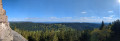
This first stage is probably the hardest day of the route. Beautiful views, pleasant trails and few forest roads. A steep climb at the end of the day explains the "Difficult" rating.
Three days around the Val de Senones with bivouacs
33.33 mi
+5,928 ft
-5,945 ft
3 days
Difficult
Departure from La Broque (Bas-Rhin)
Three days of hiking and camping around the Val de Senones, passing by beautiful viewpoints. Campsites at the Tête du Coquin and the Haute Loge.
Col de Bagenelles – Schupferen
 10.77 mi
+2,694 ft
-1,847 ft
7h 20
Moderate
Departure from Le Bonhomme (Haut-Rhin)
10.77 mi
+2,694 ft
-1,847 ft
7h 20
Moderate
Departure from Le Bonhomme (Haut-Rhin)
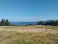
This third day follows the Sentier des Crêtes for the most part, passing through the burnt-out fields with beautiful panoramic views. A walk of moderate difficulty with several opportunities to stop and enjoy a blueberry tart
 Mountain biking in the Vosges, Day 4: Hohwald - Chatenois (Part 1)
7.84 mi
+840 ft
-1,558 ft
2.5 hrs
Moderate
Departure from Le Hohwald (Bas-Rhin)
This route is the first part of thefourth stage of a seven-day tour of the Alsatian side of the Vosges mountains. Most of the route is on forest roads in good condition. The signage is excellent, consisting of signs with an orange or red mountain bike logo and the letters TMV (Traversée du Massif Vosgien).
Schelmenkopf – Col des Bagenelles
 10.60 mi
+1,818 ft
-1,289 ft
6h 25
Moderate
Departure from Ribeauvillé (Haut-Rhin) (Haut-Rhin)
10.60 mi
+1,818 ft
-1,289 ft
6h 25
Moderate
Departure from Ribeauvillé (Haut-Rhin) (Haut-Rhin)
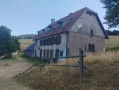
A leisurely second stage, apart perhaps from the total distance. It takes place mainly in the shade on mostly flat paths. You’ll pass beneath the Petit Brézouard and give the Grand Brézouard a wide berth – as it is a wildlife sanctuary – before heading directly to Le Haïcot and then on to the Col des Bagenelles.