The ‘Chevreuil Prune’ route in Lamure-sur-Azergues

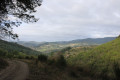
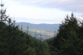
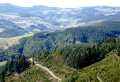
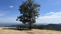
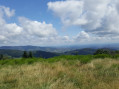
Head to the Ronzière viewing platform, then descend via the Tire Cul forest track and cross La Fay Romagnan.

Details

n°10026025
Creation:
Last update:
Last review:
  • Walking
    Activity: Walking
  • ↔
    Distance: 5.83 mi
  • ◔
    Average duration: 3h 25 
  • ▲
    Difficulty: Easy

  • ⚐
    Back to start: Yes
  • ↗
    Ascent: + 804 ft
  • ↘
    Descent: - 810 ft

  • ▲
    Highest point: 2,064 ft
  • ▼
    Lowest point: 1,217 ft

Photos

Description of the walk

Park near the level crossing above the War Memorial in Lamure-sur-Azergues.

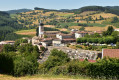
(S/E) Follow the arrows featuring a ‘Prune Deer’, passing the church, the cemetery and the hamlet of Biconne. The start of this route is shared with the ‘Blue Deer’ route (additional signposting).
Walk past the hamlet of Biconne to reach the junction of the paths

(1) Leave the ‘Chevreuil Bleu’ path, which runs alongside the Biconne stream, and keep to the right onto the tarmac road towards the motocross track.
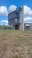
On the climb, take a path on the left which ascends, then descends to the Ronzière viewing platform.

(2) Set off straight ahead along the wide track – this is the Route Forestière de Tire Cul – and head back down to the hamlet of Le Berger.
On leaving the hamlet, you’ll come to a tarmac road. Follow it down to the local road linking Lamure-sur-Azergues to Saint-Cyr-le-Chatoux.

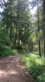
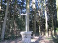
(3) Turn right here and walk a few metres into the Vallon de la Chèvre Pendue, then turn immediately left onto the path. You will then enter the forest, pass through La Fay Romagnan and eventually reach the hamlet of Meyrol. On this section, the signposting is shared with the ‘Chevreuil Rouge’ route and then, before the hamlet of Meyrolles, with the ‘Chevreuil Jaune’ route as well.

(4) When you reach a tarmac road, turn right onto it and follow it. Walk alongside the railway line until you reach a level crossing.

(5) Cross the railway line at this level crossing, then follow the Green Route back to the car park near the War Memorial (S/E).
Waypoints

  1. S/E : mi 0 - alt. 1,273 ft - Car park near the War Memorial - Gare de Lamure-sur-Azergues
  2. 1 : mi 0.95 - alt. 1,545 ft - Junction for the Blue and Prune routes
  3. 2 : mi 1.66 - alt. 2,057 ft - Ronzière Viewpoint
  4. 3 : mi 3.21 - alt. 1,627 ft - Trail to La Fay Romagnan
  5. 4 : mi 4.36 - alt. 1,280 ft - Hamlet of Meyrol
  6. 5 : mi 4.83 - alt. 1,240 ft - Level crossing
  7. S/E : mi 5.83 - alt. 1,270 ft - Car park near the War Memorial

Notes

Reviews and comments

4.2 / 5
Based on 2 reviews

Reliability of the description
4 / 5
Ease of following the route
4.5 / 5
Route interest
4 / 5
molirose4
molirose4

Overall rating : 4 / 5

Date of your route : Sep 30, 2023
Reliability of the description : ★★★★☆ Good
Ease of following the route : ★★★★☆ Good
Route interest : ★★★★☆ Good
Very busy route : No

Hello,
This walk was very enjoyable. We appreciated the signposting.
A few comments:
- Shortly after the cemetery, there is a farm cut off by the road, where three dogs greeted us. They were tied up. I’m pointing this out because, as I have a phobia of dogs, I would have liked to have known this
- After point (3), a signpost is broken and lying on the ground.
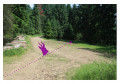
- At the junction just ahead of point (4), a signpost featuring a purple roe deer indicates to take the path on the right, but the route actually tells you to carry on straight ahead. Perhaps a waypoint could be added here.
Thank you very much for this route – we’ll be back to do the others

Machine-translated

MARTDomi
MARTDomi

Overall rating : 4.3 / 5

Date of your route : Sep 05, 2023
Reliability of the description : ★★★★☆ Good
Ease of following the route : ★★★★★ Very good
Route interest : ★★★★☆ Good
Very busy route : No

A lovely route. The descent through the forest is very pleasant

Machine-translated

Other walks in the area

For more walks, use our search engine .

The GPS track and description are the property of this route's author. Please do not copy them without permission.