Country:

 City:
City:


Park at the Claveisolles cemetery. If this is not possible, there is a large car park opposite, below, at the start of the trail routes.
(S/E) With your back to the cemetery, head right towards the village and take the Route de la Casse Froide on the right. After the tennis court, turn right onto the Chemin de Valchevrière, cross the Ruisseau de Valtorte and continue, ignoring the paths on the right and left. The path climbs more steeply further on and reaches an elevation of 562 metres at a stream.
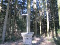
(1) Cross the stream and continue along the path, which curves sharply to the right. When you reach a fork, take the path on the right that climbs uphill and continue straight ahead until you reach Croix Rochaud.
(2) Continue straight ahead along the road, then at the first bend, keep to the right on the path. Quickly take the first path on the right and continue straight ahead. Enter the forest and then turn left. At the fork, take the path on the left downhill and continue for a few dozen metres.
(3) Turn right onto a grassy path that is barely visible along the edge of the forest. Continue along this path, which quickly turns into a forest track where the trail is easily lost. You will find it again at times. Navigate either by following the GPX track or with a compass pointing south, regularly gaining altitude. This section is about 600 m long. Join an ascending path.
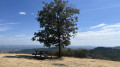
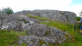
(4) Continue to the summit of Mont Soubran at an altitude of 894 metres.
(5) Turn back 50 m and begin the descent by taking the carriage road that winds downhill. Continue to the barrier that can close the road if necessary.
(6) Take the road on the left (D659). Pass in front of Creux de Soubran and continue to Croix des Essarlets.
(7) Leave the road and turn right onto the path on the hillside and follow it to La Douzette, ignoring the paths branching off to the right or left. You will come to a junction of several tarmac roads.
(8) Turn right onto a well-marked path to Combignon.
(9) Cross the road and turn right onto the path leading to the road (D23).
(10) Turn right onto the road and follow it along the wide grassy verge on the left to reach the starting point safely (S/E).

 Visorando Member
 Easy
Easy