The Chemin de Morte Île from Breuilpont to Hécourt

There are very few published walking routes in the Breuilpont area, so I’d like to share my experience of the paths around Breuilpont with you.

Details

21559596
Creation:
Last update:
Last review:
  • Walking
    Activity: Walking
  • ↔
    Distance: 6.21 mi
  • ◔
    Average duration: 3h 05 
  • ▲
    Difficulty: Easy

  • ⚐
    Back to start: Yes
  • ↗
    Ascent: + 236 ft
  • ↘
    Descent: - 236 ft

  • ▲
    Highest point: 397 ft
  • ▼
    Lowest point: 151 ft
  • ⚐ Country: France
  • ⚐ City: Breuilpont (27640)
  • ⚑
    Start/End: N 48.96062° / E 1.425604°
  • ❏
    IGN map(s): Ref. 2013E, 2113O
  • Hour-by-hour weather

Description of the walk

Park in the Tourist Train station car park on Rue Saint-Exupéry.

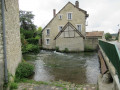
(S/E) On leaving the car park, head right and turn right onto Rue Alfred de Vigny. Turn left shortly afterwards onto Allée de la Planchette, just before the old mill. Cross the railway line and, about a hundred metres further on, you’ll reach the junction with Chemin de Morte Île.

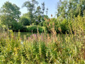
(1) Turn right onto this path and you’ll soon reach Lac Chauvet. Continue along the path on the right, skirting the lake, until you reach its far end.

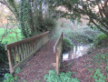
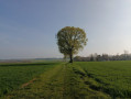
(2) Carry on along the edge of the woods and then through the fields. Cross the small bridge over a tributary of the Eure before reaching the entrance to Hécourt.

(3) Turn left onto Rue des Prés until you reach Rue Saint-Taurin. Cross it before the junction.

(4) Turn right onto Rue de la Forêt, continue straight on and you will then reach a crossroads.

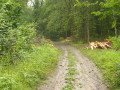
(5) Turn right onto this path, passing the pumping station building. At the next crossroads, take the middle path, then keep to the right-hand branch at the following junction. Continue on to reach the edge of this woodland.

(6) Carry on along the edge of the fields until you come out onto a road near the village of Saint-Chéron.

(7) Turn right onto the road, then immediately turn left off it to join the Chemin de la Queue Quetran. Continue along this path beside the woodland. You’ll reach the Allée des Quatre Arpents.

(8) Carry on straight ahead, skirting the edge of the woodland. Keep left along the edge of the woodland at the Totem crossroads.
Head downhill and arrive at Breuilpont at the junction with the D836 or Rue Victor Hugo.

(9) Cross the road, walk down Rue du Mont Vallet and turn right onto Rue de la Planchette, then left onto Allée de la Planchette until you reach Rue Alfred de Vigny. Turn right to return to the Tourist Train car park (S/E).

Waypoints

  1. S/E : mi 0 - alt. 161 ft - Tourist Train car park
  2. 1 : mi 0.48 - alt. 157 ft - Chemin de Morte île
  3. 2 : mi 1.03 - alt. 154 ft - End of the lake
  4. 3 : mi 1.78 - alt. 164 ft - Hécourt
  5. 4 : mi 2.06 - alt. 184 ft - Rue de la Forêt
  6. 5 : mi 2.77 - alt. 220 ft - Junction before the pumping station
  7. 6 : mi 3.6 - alt. 358 ft - Edge of the forest
  8. 7 : mi 4.25 - alt. 390 ft - Chemin de la Queue Quetran
  9. 8 : mi 4.89 - alt. 397 ft - Allée des 4 Arpents
  10. 9 : mi 5.6 - alt. 203 ft - D836 Victor Hugo
  11. S/E : mi 6.21 - alt. 161 ft - Tourist Train car park

Reviews and comments

4.3 / 5
Based on 2 reviews

Reliability of the description
4 / 5
Ease of following the route
4 / 5
Route interest
5 / 5
User 16567056

Overall rating : 5 / 5

Date of your route : Nov 02, 2025
Reliability of the description : ★★★★★ Very good
Ease of following the route : ★★★★★ Very good
Route interest : ★★★★★ Very good
Very busy route : No

Hiking between fields and forests... beautiful at this time of year. We even saw some deer! I highly recommend it😃

Machine-translated

waiwaite
waiwaite

Overall rating : 3.7 / 5

Date of your route : Nov 11, 2022
Reliability of the description : ★★★☆☆ Average
Ease of following the route : ★★★☆☆ Average
Route interest : ★★★★★ Very good
Very busy route : No

A lovely autumn walk.
A good variety of scenery. A very gradual climb.
Some muddy patches, but that’s hardly surprising on 11 November.
Benches for a break at the end of the walk, along the riverbank.
We’re delighted to discover the walks in the Eure, which make a nice change from our Yvelines, which we’ve already explored quite thoroughly.

Machine-translated

Other walks in the area

For more walks, use our search engine .

The GPS track and description are the property of this route's author. Please do not copy them without permission.