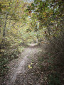
Circular walk in the Merey Forest starting from Épieds

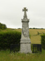
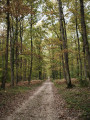
This easy walk will take you on a journey of discovery through a varied woodland area, with a mix of paths and vegetation. On your return, you can stop at the Obelisk; the spot where the ‘Vert Galant’ is said to have fallen asleep under a pear tree after the Battle of Ivry in 1590.

Details

n°110586956
Creation:
Last update:
Last review:
–
  • Walking
    Activity: Walking
  • ↔
    Distance: 6.01 mi
  • ◔
    Average duration: 3h 00 
  • ▲
    Difficulty: Easy

  • ⚐
    Back to start: Yes
  • ↗
    Ascent: + 243 ft
  • ↘
    Descent: - 243 ft

  • ▲
    Highest point: 440 ft
  • ▼
    Lowest point: 187 ft

Photos

Description of the walk

Starting point: Épieds Town Hall car park, Place Henri IV.

(S/E) On leaving the car park, head right, then immediately left at the hairpin bend heading north. Then take the first right. At the T-junction, turn right onto Rue de Merey. Continue along Rue du 8 mai 1945 (yellow and red signposting).

(1) Turn left onto the GRP®. Follow the trail through the forest until you reach a crossroads.

(2) Leave the GRP® and turn left. Carry on straight ahead until you reach a road.

(3) Cross it carefully. Continue straight ahead and pass through a gate. Then leave the paths to one side and, further on, walk alongside a fence on your right. Head downhill, come out onto a railway line and walk alongside it, keeping to the left for about a hundred metres.

(4) At the junction (with a signpost), take the first path on the left. Follow it for 2.5 km until you reach a crossroads.

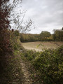
(5) Carry on straight ahead along a GRP® path (field on your right) until you emerge further on onto Rue Creuse in Épieds. Continue to a crossroads.

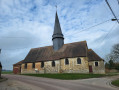
(6) Turn right towards the church. Ignore Rue des Graviers on your right. Enter the cemetery to view the church.

(7) Retrace your steps to leave the cemetery and head straight on along Rue Grande. After about a hundred metres, go through a small gap in the fence on the left to return to the starting point (S/E).

Waypoints

  1. S/E : mi 0 - alt. 430 ft - Town hall car park
  2. 1 : mi 0.38 - alt. 440 ft - Junction
  3. 2 : mi 0.83 - alt. 436 ft - Crossroads
  4. 3 : mi 1.66 - alt. 407 ft - Road crossings
  5. 4 : mi 3.22 - alt. 187 ft - Path on the left / GSM-R antenna
  6. 5 : mi 4.86 - alt. 348 ft - Crossroads
  7. 6 : mi 5.63 - alt. 430 ft - Crossroads in Épieds
  8. 7 : mi 5.87 - alt. 423 ft - Église Saint-Martin (Épieds)
  9. S/E : mi 6.01 - alt. 430 ft - Town hall car park

Notes

The Suricate portal
As users of footpaths and natural environments, you can play an active part in this scheme from today by reporting any issues you encounter whilst out walking Nature Sports Watch

Signposting: a quick reminder

Hunting season: generally from October to February inclusive, but exemptions may apply.
Information on this website:
National Federation of Hunters

Worth a visit

Other walks in the area

For more walks, use our search engine .

The GPS track and description are the property of this route's author. Please do not copy them without permission.